The Phins and Lushbaugh Trail Loop at Elk State Forest are within Cameron County in the Brooks Run District near Sinnemahoning, Pennsylvania and is a difficult 4.7-mile loop hike. Mostly moderate trails, sections are considered hard due to steep and scrambling grades based on two factors: how difficult to hike, and what the consequences will be if you fall. This hike includes open and seasonal views of the surrounding mountains, and the George B Stevenson Dam at the Sinnemahoning State Park. Some scrambling was needed on the upper parts of these trails requiring the use of both of the trekking poles and feet.
Trails
The Phins Trail is an one-way hike that starts along PA State Route 872 on the southeast trailhead near the Sinnemahoning State Park, and tracks to the northwest on a switchback trail that ascends and follows the rocky ridgeline to the northwest toward the Joe King Trail. The Lushbaugh Trail is a connector that follows a steep unnamed hollow from the junction with the Phins Trail on the ridgeline before reaching the Joe King Trail and comes out behind the Brooks Run Ranger House on the Brooks Run Road. Both trails are marked in yellow blazes (Hiking Only Trails).
Hike Description
This hike did not follow the entire Phins trail. Instead, this trek begins along PA State Route 872 and climbs the switchback to the ridgeline, follows the ridgeline trail to the junction with the Lushbaugh Trail. The hike then follows the Lushbaugh Trail to the Brooks Run Road.
For this hike, the hikers will then need to walk east on the Brooks Run Road for about 0.75-miles to PA State Route 872, and then turn left on State Route 872 and walk an additional one-quarter mile on State Route 872 to return back to the starting point at the Phins trail PA-872 trailhead.
A two-vehicle shuttle would eliminate the need to walk back on the roadways.
Switchbacks to Mountain Top on the Phins Trail - Trailhead to Mile 2.2
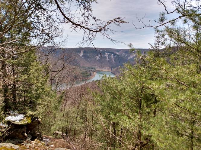
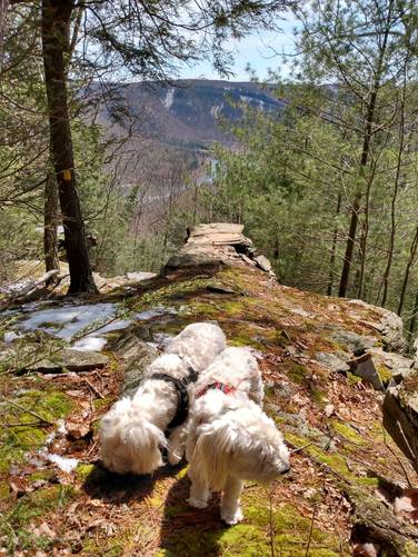
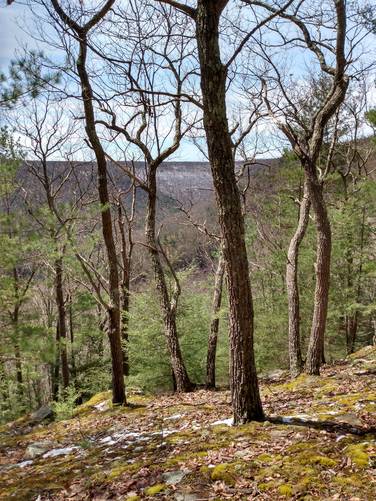
The Phins Trail begins on an easy-walking treadway to the northwest through state forest land for about a half-of-a-mile. On the switchback section of this trail, which has the steepness terrain and narrowness of path, the hiker starts to get a sense of the height. On the top most of this section of switchbacks, the pathway seems to hang on the edge of a cliff face. Around Mile 1 a series of Rock Outcroppings begin and the first reveal of a partly obstructed Vista comes into view. At the very top of these rock outcroppings, around Mile 1.2, sits a "perch rock" or ledge that provides the best and most open vista of the the George B Stevenson Dam at the Sinnemahoning State Park. This vista when combined with the narrowness of the ridgeline beyond, certainly makes the climb worthwhile by giving the hiker a nearly 360 degree aerial view. This lookout point garners that "the highest point attained or attainable" sense of achievement.
Vistas of the surrounding mountains continue along on the narrow ridgeline for a ways beyond the lookout point.
Doing the hike during early spring or late fall gives the best view.
Mountain Top Hiking - Mile 1.2 to 2.2
Once on the mountain ridge, the hiking becomes a bit easier due to to less steep terrain. Hikers will follow the yellow blazes of the Phins Trail as it meanders its way west toward the Joe King Trail watching for the junction with the Lushbaugh Trail at about Mile 2.2. Along the way are sections of overgrown mountain laurel and maybe some rhododendrons that require a bit of bushwhacking, since the pathway on the trail is not open and is partly covered in by these evergreen bushes. This section of elevation grade is by far the "least steep" along the Mountain Top trail, but it's not easy and since the yellow blaze markers aren't always easy to follow because of the overgrowth. At about Mile 2.2, hikers will find the Lushbaugh Trail sign along the Phins Trail, where this hike turns left and heads south following the Lushbaugh Trail. The overgrown mountain laurel section continues on the Lushbaugh Trail until the trail begins the steep downhill descent down the unnamed hollow heading toward Brooks Run Road.
Scramble Hiking the Lushbaugh Trail - Mile 2.7 to 3.3
Once off of the mountain top, the hiking becomes the most difficult section of this hike due to the most steep terrain combined with loose debris (natural materials such as rocks, leaves and branches) on the trail. For about one-half mile on the upper end of the descent down the unnamed hollow, there is a need to use both trekking poles to successfully hike without falling. The method used was to plant one trekking pole and then the other trekking on the firmness ground within a comfort reach forward, before moving feet and to decent only one or two small steps at a time, before repositioning the poles, with the goal to maintain three points of contact at all times on this steep terrain. If you don't have trekking poles, the hiker will need to use their hands for the descent.
Dangerously steep terrain: There was only a little snow but no ice on the trail for this hike, but a thick carpet of wet leaves and some loose stones and branches lay on the pathway, which can make for slippery footing on the steep terrain never the less. Trekking poles are highly recommended.
Hiking Out
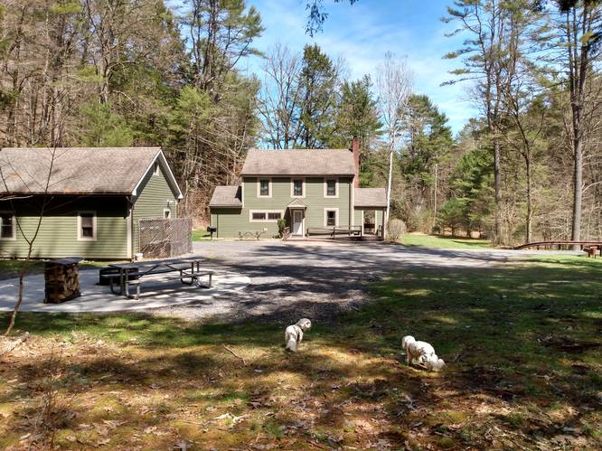
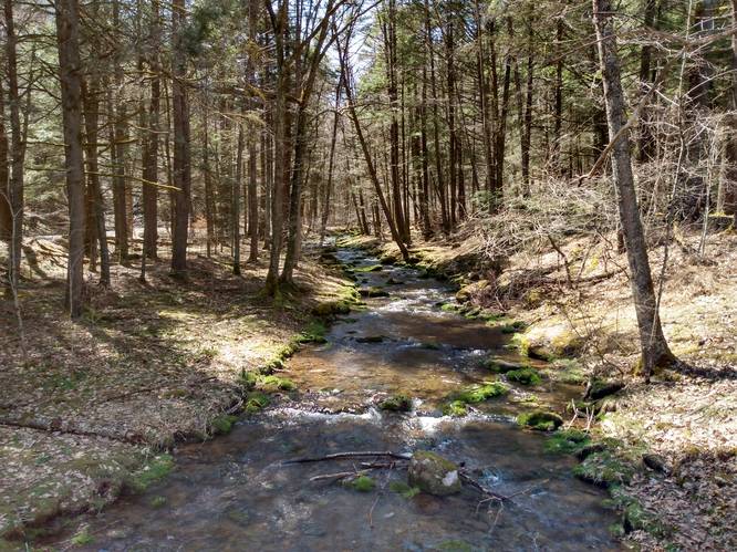
On remaining section of this hike on Lushbaugh Trail along the lower end of the unnamed hollow, the terrain is less steep and easier to hike. However, using the trekking poles is still recommended. After passing through the unnamed hollow on the Lushbaugh Trail, the hiker will come to Brooks Run and head downstream, where it ends at the Brooks Run Ranger House on the Brooks Run Road. A driveway bridge for the Brooks Run Ranger House crosses-over Brooks Run and leads to the Lushbaugh Trailhead sign along Brooks Run Road; so there is no need to do a creek crossing on this hike.
To Get back to the parking area, the hiker will then need to walk east on the Brooks Run Road for about 0.75-miles to PA State Route 872, and then turn left on State Route 872 and walk an additional one-quarter mile on State Route 872 to return back to the starting point at the Phins trail PA-872 trailhead.
Parking
Hikers will find a large parking area along the highway by the coordinates provided. The turnout is large enough for several vehicles.
The parking area is in close proximity to the state highway PA-872.
Pets
While dogs are allowed, these trails are not dog-friendly, mainly because dogs can be a distraction on this difficult trek. This hike includes the need for carefulness, especially on the switchback and scramble portions, and walking along the state highway.
Biking and Horses
Neither Biking or horseback riding is allowed on Hiking Only trails.
Camping and Backpacking
Although camping is allowed along trails in the Elk State Forest, PA where state forest rules permit backcountry / dispersed / primitive camping. This marked trail is not suitable for camping and backpacking due to the terrain and overgrowth. A backpacker may find suitable hammock camping spots, but it may be difficult to setup camp.
The Bucktail Path Trail is by far the best place to camp in this area; and it would be best for the camper to park at another designation parking area for any extended hikes or overnight camping trips. A good parking spot for extended hikes is the nearby Pepper Hill trailhead located at: 41.39971, -78.115492 along Ridge Road.