The Parnell Tower Trail at Kettle Moraine State Forest near Plymouth, Wisconsin is a moderate 0.4-mile out-and-back hike that leads to the top of Parnell Tower and features panoramic views of the surrounding area including glacial hills known as the Moulin Kames.
Trails
This hike follows a very small portion of the officially-named Parnell Tower Trail (purple blazes). The entire length of the Parnell Tower Trail is about 3.5-miles as a loop.
Hike Description
This hike begins at the main parking lot for Parnell Tower at the coordinates provided and leads up the moderately-steep trail toward the tower. Hikers will notice the trail starts off on stairs and this essentially doesn't end until you get back to the parking lot as there are very few places without stairs. Once hikers reach the tower, around mile 0.17, they'll reach flat ground before climbing the tower stairs to reach the observation platform.
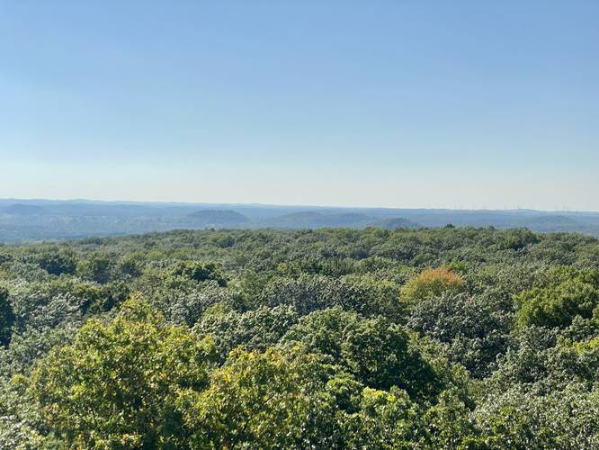
Once hikers are at the top of the tower, they'll get a panoramic view of the surrounding area including Holy Hill - which includes a massive church atop a large hill, Dundee Mountain - the highest moulin kame (glacial till mound) in the area, and the Moulin Kames - the series of hill to the west.
What are the Moulin Kames?
Moulin, a French term, refers to a vertical shaft or hole in the glacial ice through which water poured carrying debris that piled up and built the cone-shaped hills. And a Kame is a glacial landform, usually a knob or hill. The Moulin Kames, located to the west of the tower, are the most impressive groups of moulin kames to be found anywhere in the world.
Parking & Fees
Parking can be found at the large parking lot at the coordinates provided. The lot is large enough to fit several dozen vehicles. There's a day-use fee of about $10 for out-of-state plates as of September, 2022. Please check the state forest's main website for up-to-date information on all fees.
Parnell Tower Map PDF
Please find the official Parnell Tower Trail Map PDF for more route details.
Pets
Dogs are allowed if leashed and their waste must be carried out by the hiker. Dogs are not allowed on the tower.
Trails
This hike follows a very small portion of the officially-named Parnell Tower Trail (purple blazes). The entire length of the Parnell Tower Trail is about 3.5-miles as a loop.
Hike Description
This hike begins at the main parking lot for Parnell Tower at the coordinates provided and leads up the moderately-steep trail toward the tower. Hikers will notice the trail starts off on stairs and this essentially doesn't end until you get back to the parking lot as there are very few places without stairs. Once hikers reach the tower, around mile 0.17, they'll reach flat ground before climbing the tower stairs to reach the observation platform.
Once hikers are at the top of the tower, they'll get a panoramic view of the surrounding area including Holy Hill - which includes a massive church atop a large hill, Dundee Mountain - the highest moulin kame (glacial till mound) in the area, and the Moulin Kames - the series of hill to the west.
What are the Moulin Kames?
Moulin, a French term, refers to a vertical shaft or hole in the glacial ice through which water poured carrying debris that piled up and built the cone-shaped hills. And a Kame is a glacial landform, usually a knob or hill. The Moulin Kames, located to the west of the tower, are the most impressive groups of moulin kames to be found anywhere in the world.
Parking & Fees
Parking can be found at the large parking lot at the coordinates provided. The lot is large enough to fit several dozen vehicles. There's a day-use fee of about $10 for out-of-state plates as of September, 2022. Please check the state forest's main website for up-to-date information on all fees.
Parnell Tower Map PDF
Please find the official Parnell Tower Trail Map PDF for more route details.
Pets
Dogs are allowed if leashed and their waste must be carried out by the hiker. Dogs are not allowed on the tower.