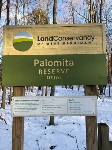
The Palomita Nature Reserve Trail at the Palomita Nature Reserve in West Olive, Michigan is an easy 0.6-mile out-and-back trail that features a beautiful hike through the woods that runs adjacent to Little Pigeon Creek.
The Palomita Nature Reserve, maintained by Consumer's Energy and the Land Conservancy of Michgan, is a microcosmic representation of the Great Lake Region marsh ecosystem.
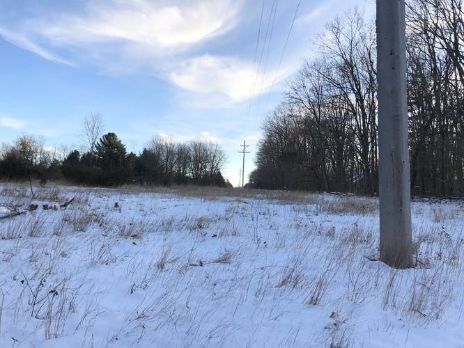
Situated near the Campbell Power Generation Plant on Lakeshore Drive in Ottawa County, Michigan, the preserve has a boardwalk/marsh overlook (not part of this particular trail log), and extends both East and West of Lakeshore Drive.
From the trailhead, proceed East, paying careful attention to the limited signage so as not to disturb private property to the South, sensitive environment areas throughout, or to trespass on Consumer's Energy land where there are high-tension electrical wires.
Parking:
Roadside parking at the trailhead is available on Lakeshore Drive to the south of the preserve - at the coordinates provided.
Pets
Dogs are allowed if leashed and their waste must be carried out by the hiker.
Features and Amenities:
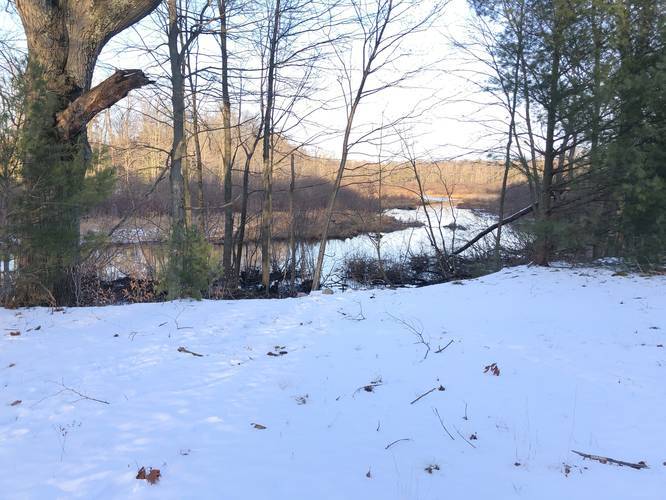
– Marsh overlook with seating
– Abundant opportunities to view wildlife
– Rustic trail
– Leashed dogs allowed
– No alcohol permitted
– No hunting of any kind permitted
– No trash receptacles; pack in, pack out!
– No camping, no fires
– No horses
The Palomita Nature Reserve, maintained by Consumer's Energy and the Land Conservancy of Michgan, is a microcosmic representation of the Great Lake Region marsh ecosystem.
Situated near the Campbell Power Generation Plant on Lakeshore Drive in Ottawa County, Michigan, the preserve has a boardwalk/marsh overlook (not part of this particular trail log), and extends both East and West of Lakeshore Drive.
From the trailhead, proceed East, paying careful attention to the limited signage so as not to disturb private property to the South, sensitive environment areas throughout, or to trespass on Consumer's Energy land where there are high-tension electrical wires.
Parking:
Roadside parking at the trailhead is available on Lakeshore Drive to the south of the preserve - at the coordinates provided.
Pets
Dogs are allowed if leashed and their waste must be carried out by the hiker.
Features and Amenities:
– Marsh overlook with seating
– Abundant opportunities to view wildlife
– Rustic trail
– Leashed dogs allowed
– No alcohol permitted
– No hunting of any kind permitted
– No trash receptacles; pack in, pack out!
– No camping, no fires
– No horses