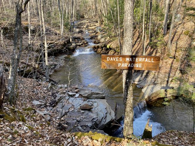
Paint Run Falls & Dave's Waterfall Paradise at State Game Lands 268 near Morris, Pennsylvania is a difficult 2.6-mile loop bushwhack and creek hike that follows Paint Run creek, passing 20 waterfalls along the way. Hikers will see Double Decker Split Falls, Little Gorge Falls, Fantail Falls, Jax Falls (a hidden of a gem gorge waterfall), and finally reaches the hard-to-reach Paint Run Falls (aka Paint Falls). Paint Run, while difficult to follow, has some of the widest-varieties of waterfalls in Tioga County and Dave's Waterfall Paradise trek leads past 20 cascades before reaching the last large waterfall, Paint Run Falls (approx. 30-feet tall); however, requires bushwhacking, creek hiking, and some rock scrambling on shale ledges which can be dangerous.
Hike Description
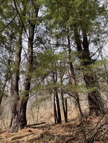
This hike begins along Stony Fork Rd at the coordinates provided where Paint Run spills into Stony Fork creek. The "trailhead" can be found on the north side of Paint Run, technically within Tioga State Forest, but the majority of this trail sits within SGL 268. Since this hike is a bushwhack, so there's no maintained trail, or noted trailhead, and the hiker must know how to read topographical maps and understand how to navigate steep terrain. It's easiest to navigate these woods in cooler months when the leaves are not on the trees. Upon entering the woods, the hiker can easily follow an old logging grade where many small trees have grown in along its path. Soon after, the hiker will want to head down the slopes from this grade and back to Paint Run where small waterfalls can be found - here is where Dave's Waterfall Paradise begins.
Dave's Waterfall Paradise - Miles 0.1 to 1.45
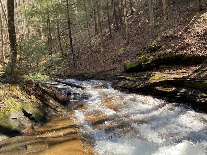
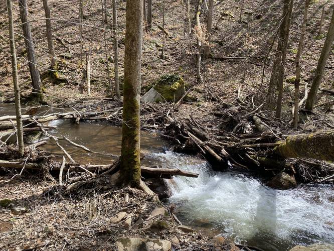
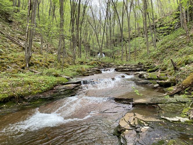
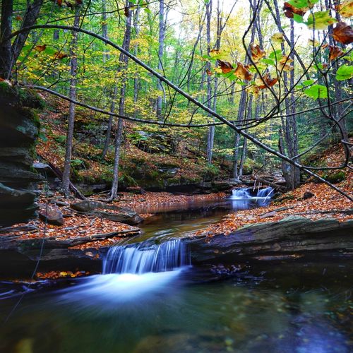
When I (Admin) attempted this hike, I expected little-to-nothing in return of decent waterfalls due to the lack of elevation granularity on topographical maps, but I quickly found that Paint Run is littered with small (1-3 foot) to medium-sized (~10-foot) waterfalls that spill down the creek's beautiful bedrock. Additionally, the terrain is far steeper here than topographical maps lead on which means that following the creek is not easy in many places - mostly further upstream. Despite the potential for using waders here - it's recommended to hike along the creek banks and up around steep terrain to stay safe since some cascade pools spill into deep holes in the creek. Regardless, I attempted to photograph every scenic waterfall that I could along the way - which meant I backtracked to certain spots after hiking up and around steep ledges on my first trip here - trying to keep my feet dry since I was hiking with Jax. This section of the hike took quite a while and was more difficult than expected having to navigate the steep terrain littered with shale ledges along the way. Note that the photos don't do much justice and that experiencing these smaller waterfalls up-close is far more enjoyable than poking through the photos. The "Waterfall Paradise" ends around mile 1.45, just after passing a small waterfall upstream from the large 30-foot tall Paint Run Falls (aka Paint Falls). Just after the last waterfall above Paint Run Falls, hikers will bushwhack uphill to an old logging grade which heads almost directly back to parking - which is yet another bushwhack.
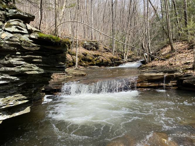
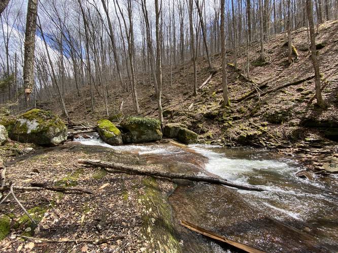
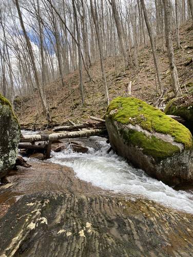
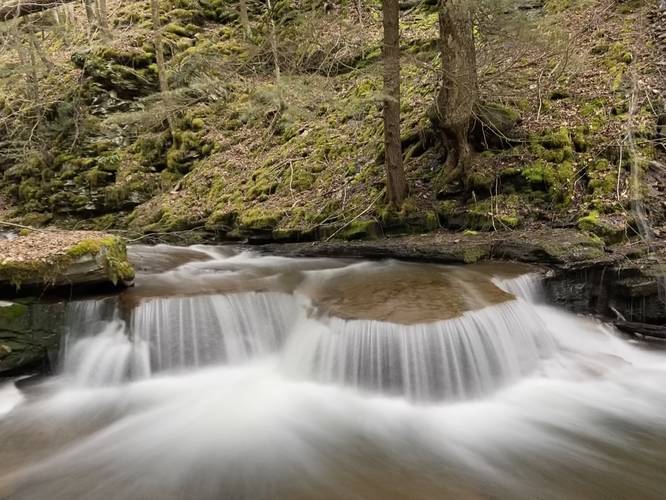
Double Decker Split Falls - Mile 0.26
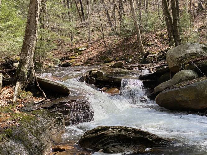
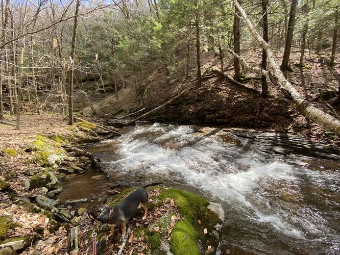
One of the most scenic waterfalls along Paint Run is Double Decker Split Falls, which sits around mile 0.26 in the hike. This waterfall cascades down a red-tinted bedrock where the water splits in two directions at the top before cascading as one fall below. Double Decker Split Falls is about 10-feet tall, 30-feet wide, and 30-feet long. Waterfall name influenced by Firetruck Record's Triple Decker Split featuring various artists. Later in the Spring, upon my second trip here, I noticed the water was a bit lower - causing the "split" to disappear to become simply "Double Decker Falls".
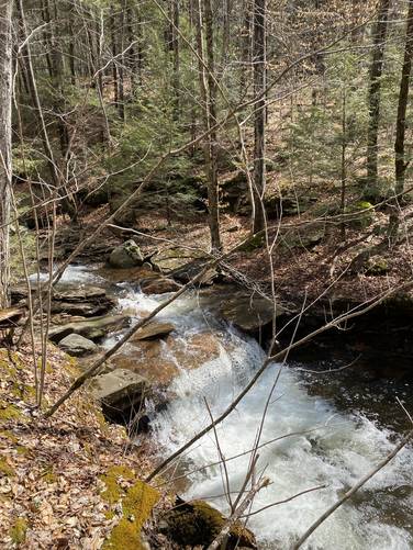
Little Gorge Falls - Mile 0.3
After visiting Double Decker Split Falls, hikers will want to stop at Little Gorge Falls around mile 0.3. This waterfall is about 6-feet tall with another small (1-foot tall) cascade behind it. Little Gorge Falls cascades down into a small gorge with what appears to be a very-deep pool below. This pool might be good for backcountry swimming during the Summer or at the very least, fishing during the Spring.
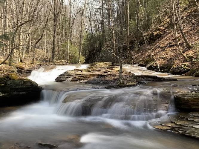
Fantail Falls - Mile 0.6
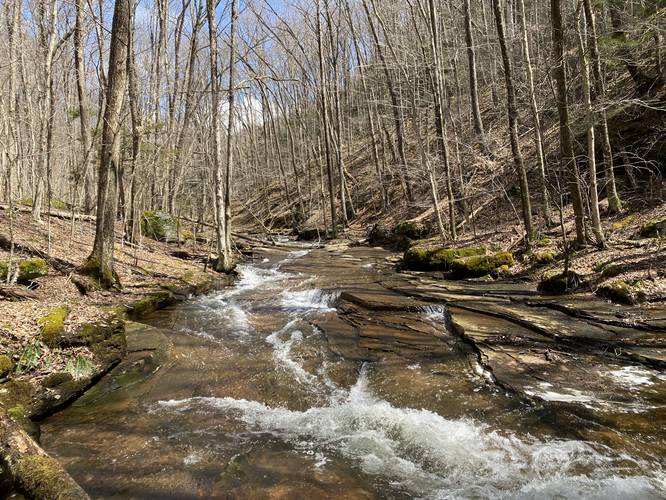
After passing Little Gorge Falls, the hike will pass one more waterfall worth noting for its fantail shape - Fantail Falls around mile 0.6. This waterfall is about 30-feet wide (including the curved contour of the rock at its base) and 30-feet long as it fans the water across red-tinted bedrock.
After Fantail Falls, if hikers want to explore some additional small waterfalls without getting their feet wet, they can follow the track to hike up to the logging grade and then back down to the creek to explore some small waterfalls. Otherwise, just hike along the creek, while getting your feet wet, to continue up Paint Run.
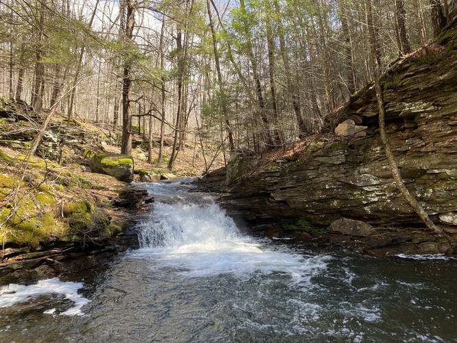
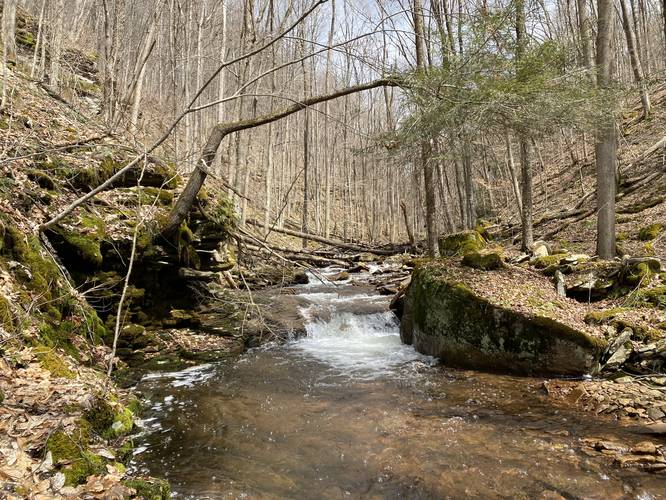
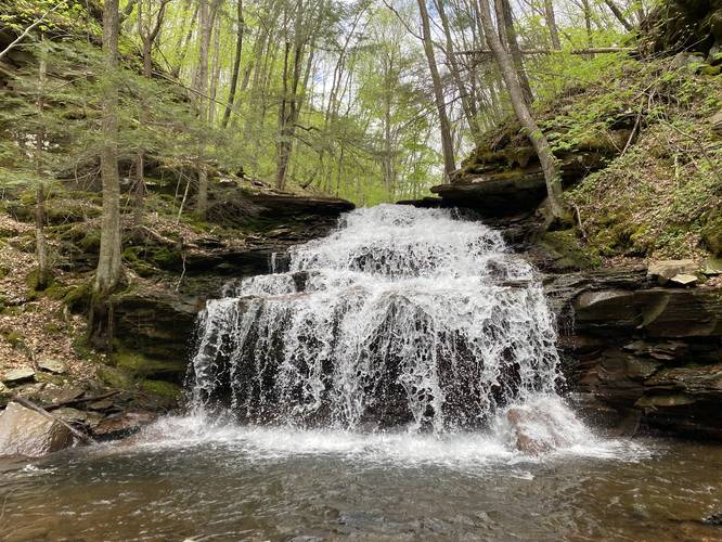
Jax Falls - Mile 1.25
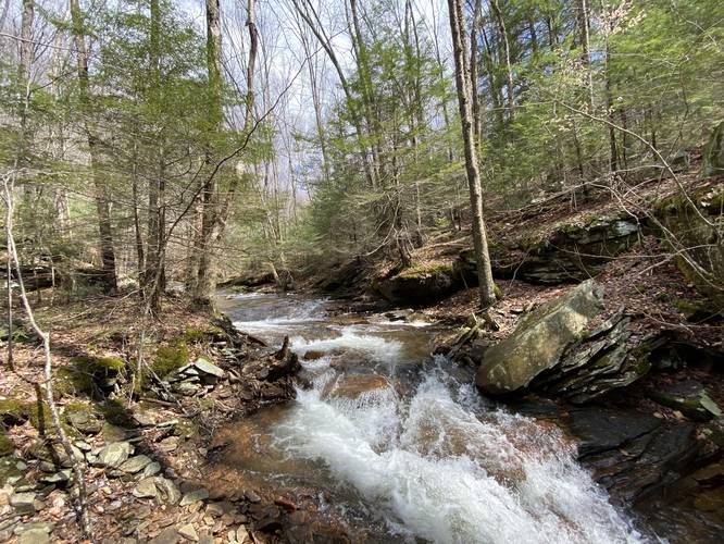
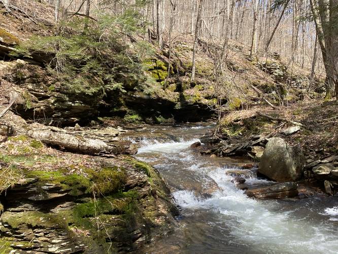
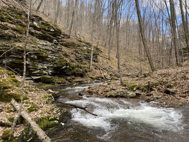
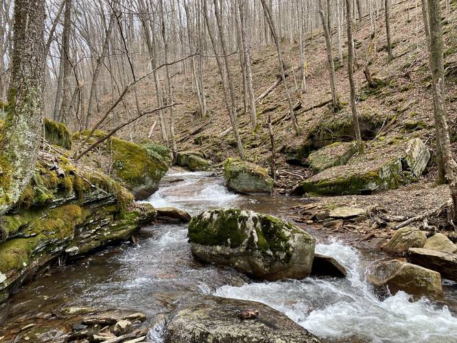
Around mile 1.25, hikers will approach a 20-foot tall shale rock gorge where Paint Run bends around the corner. Here, hikers have no choice but to wade into the creek - which can be thigh-high - to continue making their way upstream. Just around the bend in the creek is a beautiful two-tiered waterfall, approximately 10-feet tall, named Jax Falls that spills down this hidden shale gorge. To continue hiking beyond Jax Falls, hikers will have to scramble up a sketchy shale rock ledge located to the right-hand side of the waterfall. The rock ledge is about 5-feet tall, but the shale "feels" as if it could slide down and out at any moment - be aware of the dangers here.
Red Slab Falls - Mile 1.3
Just beyond Jax Falls is a beautiful small, but noticeable waterfall named Red Slab Falls. The name is obvious - the water cascades over and spills down a red slab of bedrock in two different types of waterfalls including a slide waterfall at the bottom and a tiny free-fall cascade at the top.
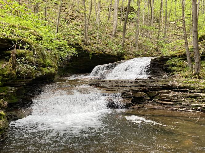
Paint Run Falls - Mile 1.4
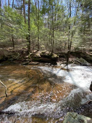
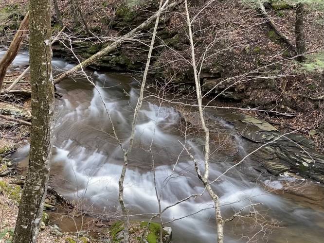
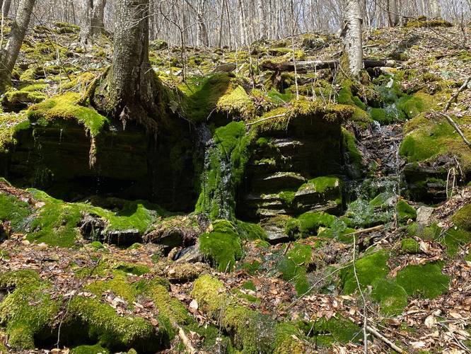
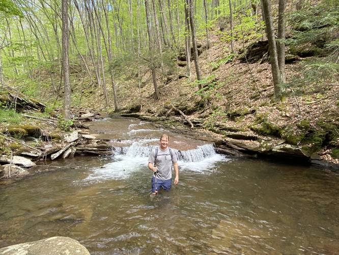
Finally, hikers will reach the largest waterfall along Dave's Waterfall Paradise - Paint Run Falls / Paint Falls, which is approximately 30-feet tall with a 3-foot deep pool at its base. This waterfall sits in another rock gorge, surrounded by extremely steep mountainsides, and is only accessible by hiking directly in the creek. Paint Run Falls roars down the creek and is a nice place to take a short swim, eat lunch, or simply chill out after hiking the difficult creek upstream. To leave, hikers will have to hike up the left-hand side of Paint Run Falls which follows a very steep and sketchy shale mountainside before hikers are forced to scramble up another 5-foot tall shale rock ledge. This rock ledge is similar to the one along Jax Falls - it could breakaway at any time, especially if given too much weight and pressure. Just above Paint Run Falls is yet another waterfall with a swimming hole - the waterfall is not much taller than 1 or 2-feet, but the swimming hole is another place to take a dip. Around this area is where hikers may find a moss-covered shale rock ledge that looks like something out of the Pacific Northwest.
Hiking Out - Old Logging Grade
After scrambling up Paint Run Falls and visiting the small waterfall and swimming hole just upstream, hikers will have to bushwhack their way up to the old logging grade. It's not too difficult if you follow a diagonal path to the steep mountainside - we found a deer trail to follow on my second trip here. Once on the logging grade, hikers will have to slowly bushwhack their way through small trees to reach parking, which can take another ~30 minutes to walk back.
Bail-Out Option at Mile 1.2
Around mile 1.2 the creek forces the hiker to get their feet wet and thus follow a multitude of creek crossings to reach Jax Falls, Red Slab Falls, and eventually Paint Run Falls. Upon my first trip here, I ended up scaling the mountainside up to the old logging grade to reach an obstructed viewpoint above Paint Run Falls safely (with no good photo opportunities). This was because I reached a point in the creek where I either needed waders (and ditch my dog, Jax) or risk our lives to scale the mountain slopes, above the loose shale ledges, to see if I could continue up the creek - so I opt'ed for the the logging grade, climbing back up from the creek along a steep loose-rock terrain. Once on the logging grade, it was easy to find the 50-foot tall Paint Run Falls - just look for the milky-white stream of water pouring down through the trees into the creek below between the trees; however, it's far too steep and dangerous to attempt a hike-down unless you follow the opposite "hike-up" in the GPS data provided, assuming you can scramble down Paint Run Falls.
Parking
Hikers will find a small parking turnout near the coordinates provided. It's large enough for a couple of vehicles.
Warnings
Hunting: Hunting is allowed here, so wearing blaze orange is smart.
Rock ledges: Note that there are several sections where the hiker must either choose to walk under tall, sketchy, and loose shale ledges, or go up and around - this hike mostly stuck to going up and around, despite one section that went below a very tall sketchy shale ledge. Some parts of the hike (including next to Jax Falls and Paint Run Falls) require the hiker to scramble up shale rock ledges, which can be sketchy and may collapse.
Steep terrain & rockfalls: Also note that there's super-steep terrain with barely-noticeable rocky terrain that hikers can easily trigger a mini "rock avalanche" or rock slide - I (Admin) did this, almost injuring my small dog below (he was fine, no harm done, rock stopped moving thankfully); however, this was a wake-up call to scrambling along this type of mountain terrain where large flat boulders can easily break away, sending the hiker down the hill with them.
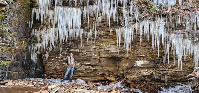
Rattlesnakes: This bushwhack follows some very rocky terrain in certain areas. Due to this, it's possible there are Timber Rattlesnake dens along these mountainous hillside rocks. Rattlesnakes can usually be found out between the end of April and early October - generally sunning themselves in along rocky outcroppings, or hunting and drinking along creek banks.
Hike Description
This hike begins along Stony Fork Rd at the coordinates provided where Paint Run spills into Stony Fork creek. The "trailhead" can be found on the north side of Paint Run, technically within Tioga State Forest, but the majority of this trail sits within SGL 268. Since this hike is a bushwhack, so there's no maintained trail, or noted trailhead, and the hiker must know how to read topographical maps and understand how to navigate steep terrain. It's easiest to navigate these woods in cooler months when the leaves are not on the trees. Upon entering the woods, the hiker can easily follow an old logging grade where many small trees have grown in along its path. Soon after, the hiker will want to head down the slopes from this grade and back to Paint Run where small waterfalls can be found - here is where Dave's Waterfall Paradise begins.
Dave's Waterfall Paradise - Miles 0.1 to 1.45
When I (Admin) attempted this hike, I expected little-to-nothing in return of decent waterfalls due to the lack of elevation granularity on topographical maps, but I quickly found that Paint Run is littered with small (1-3 foot) to medium-sized (~10-foot) waterfalls that spill down the creek's beautiful bedrock. Additionally, the terrain is far steeper here than topographical maps lead on which means that following the creek is not easy in many places - mostly further upstream. Despite the potential for using waders here - it's recommended to hike along the creek banks and up around steep terrain to stay safe since some cascade pools spill into deep holes in the creek. Regardless, I attempted to photograph every scenic waterfall that I could along the way - which meant I backtracked to certain spots after hiking up and around steep ledges on my first trip here - trying to keep my feet dry since I was hiking with Jax. This section of the hike took quite a while and was more difficult than expected having to navigate the steep terrain littered with shale ledges along the way. Note that the photos don't do much justice and that experiencing these smaller waterfalls up-close is far more enjoyable than poking through the photos. The "Waterfall Paradise" ends around mile 1.45, just after passing a small waterfall upstream from the large 30-foot tall Paint Run Falls (aka Paint Falls). Just after the last waterfall above Paint Run Falls, hikers will bushwhack uphill to an old logging grade which heads almost directly back to parking - which is yet another bushwhack.
Double Decker Split Falls - Mile 0.26
One of the most scenic waterfalls along Paint Run is Double Decker Split Falls, which sits around mile 0.26 in the hike. This waterfall cascades down a red-tinted bedrock where the water splits in two directions at the top before cascading as one fall below. Double Decker Split Falls is about 10-feet tall, 30-feet wide, and 30-feet long. Waterfall name influenced by Firetruck Record's Triple Decker Split featuring various artists. Later in the Spring, upon my second trip here, I noticed the water was a bit lower - causing the "split" to disappear to become simply "Double Decker Falls".
Little Gorge Falls - Mile 0.3
After visiting Double Decker Split Falls, hikers will want to stop at Little Gorge Falls around mile 0.3. This waterfall is about 6-feet tall with another small (1-foot tall) cascade behind it. Little Gorge Falls cascades down into a small gorge with what appears to be a very-deep pool below. This pool might be good for backcountry swimming during the Summer or at the very least, fishing during the Spring.
Fantail Falls - Mile 0.6
After passing Little Gorge Falls, the hike will pass one more waterfall worth noting for its fantail shape - Fantail Falls around mile 0.6. This waterfall is about 30-feet wide (including the curved contour of the rock at its base) and 30-feet long as it fans the water across red-tinted bedrock.
After Fantail Falls, if hikers want to explore some additional small waterfalls without getting their feet wet, they can follow the track to hike up to the logging grade and then back down to the creek to explore some small waterfalls. Otherwise, just hike along the creek, while getting your feet wet, to continue up Paint Run.
Jax Falls - Mile 1.25
Around mile 1.25, hikers will approach a 20-foot tall shale rock gorge where Paint Run bends around the corner. Here, hikers have no choice but to wade into the creek - which can be thigh-high - to continue making their way upstream. Just around the bend in the creek is a beautiful two-tiered waterfall, approximately 10-feet tall, named Jax Falls that spills down this hidden shale gorge. To continue hiking beyond Jax Falls, hikers will have to scramble up a sketchy shale rock ledge located to the right-hand side of the waterfall. The rock ledge is about 5-feet tall, but the shale "feels" as if it could slide down and out at any moment - be aware of the dangers here.
Red Slab Falls - Mile 1.3
Just beyond Jax Falls is a beautiful small, but noticeable waterfall named Red Slab Falls. The name is obvious - the water cascades over and spills down a red slab of bedrock in two different types of waterfalls including a slide waterfall at the bottom and a tiny free-fall cascade at the top.
Paint Run Falls - Mile 1.4
Finally, hikers will reach the largest waterfall along Dave's Waterfall Paradise - Paint Run Falls / Paint Falls, which is approximately 30-feet tall with a 3-foot deep pool at its base. This waterfall sits in another rock gorge, surrounded by extremely steep mountainsides, and is only accessible by hiking directly in the creek. Paint Run Falls roars down the creek and is a nice place to take a short swim, eat lunch, or simply chill out after hiking the difficult creek upstream. To leave, hikers will have to hike up the left-hand side of Paint Run Falls which follows a very steep and sketchy shale mountainside before hikers are forced to scramble up another 5-foot tall shale rock ledge. This rock ledge is similar to the one along Jax Falls - it could breakaway at any time, especially if given too much weight and pressure. Just above Paint Run Falls is yet another waterfall with a swimming hole - the waterfall is not much taller than 1 or 2-feet, but the swimming hole is another place to take a dip. Around this area is where hikers may find a moss-covered shale rock ledge that looks like something out of the Pacific Northwest.
Hiking Out - Old Logging Grade
After scrambling up Paint Run Falls and visiting the small waterfall and swimming hole just upstream, hikers will have to bushwhack their way up to the old logging grade. It's not too difficult if you follow a diagonal path to the steep mountainside - we found a deer trail to follow on my second trip here. Once on the logging grade, hikers will have to slowly bushwhack their way through small trees to reach parking, which can take another ~30 minutes to walk back.
Bail-Out Option at Mile 1.2
Around mile 1.2 the creek forces the hiker to get their feet wet and thus follow a multitude of creek crossings to reach Jax Falls, Red Slab Falls, and eventually Paint Run Falls. Upon my first trip here, I ended up scaling the mountainside up to the old logging grade to reach an obstructed viewpoint above Paint Run Falls safely (with no good photo opportunities). This was because I reached a point in the creek where I either needed waders (and ditch my dog, Jax) or risk our lives to scale the mountain slopes, above the loose shale ledges, to see if I could continue up the creek - so I opt'ed for the the logging grade, climbing back up from the creek along a steep loose-rock terrain. Once on the logging grade, it was easy to find the 50-foot tall Paint Run Falls - just look for the milky-white stream of water pouring down through the trees into the creek below between the trees; however, it's far too steep and dangerous to attempt a hike-down unless you follow the opposite "hike-up" in the GPS data provided, assuming you can scramble down Paint Run Falls.
Parking
Hikers will find a small parking turnout near the coordinates provided. It's large enough for a couple of vehicles.
Warnings
Hunting: Hunting is allowed here, so wearing blaze orange is smart.
Rock ledges: Note that there are several sections where the hiker must either choose to walk under tall, sketchy, and loose shale ledges, or go up and around - this hike mostly stuck to going up and around, despite one section that went below a very tall sketchy shale ledge. Some parts of the hike (including next to Jax Falls and Paint Run Falls) require the hiker to scramble up shale rock ledges, which can be sketchy and may collapse.
Steep terrain & rockfalls: Also note that there's super-steep terrain with barely-noticeable rocky terrain that hikers can easily trigger a mini "rock avalanche" or rock slide - I (Admin) did this, almost injuring my small dog below (he was fine, no harm done, rock stopped moving thankfully); however, this was a wake-up call to scrambling along this type of mountain terrain where large flat boulders can easily break away, sending the hiker down the hill with them.
Rattlesnakes: This bushwhack follows some very rocky terrain in certain areas. Due to this, it's possible there are Timber Rattlesnake dens along these mountainous hillside rocks. Rattlesnakes can usually be found out between the end of April and early October - generally sunning themselves in along rocky outcroppings, or hunting and drinking along creek banks.