This is just a tiny fraction of the PCT at Crater Lake National Park which leads out to Grouse Hill, but is a decent backpacking trail for an overnight at the park. The trail starts about 1.5 miles north of Crater Lake's Rim Drive northern junction and has parking across the street and free dispersed camping. The trail leads over to Grouse Hill, which lies east off of the trail at about mile 0.5 where the trail takes a hairpin-turn going west. The total mileage out to the Grouse Hill campsite is about 1 mile out-and-back.
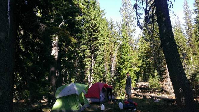
Camping: To camp off of the trail, you first need to register at the park's headquarters to get your backpacking permit, which is free. Fires are prohibited unless you find a preexisting fire pit since fire risks are usually very high in this area. We found a campsite and fire pit at the end of this GPS track (before the turn around point in the data). To find it, you need to hike off of the trail, heading southeast, for about 200 to 300 feet. If you need to pin-point it on an offline device, make sure to write down the coordinates of where the data turns around on the map. There also appears to be a campsite at the hairpin turn near Grouse Hill, but we did not look for it.
Camping: To camp off of the trail, you first need to register at the park's headquarters to get your backpacking permit, which is free. Fires are prohibited unless you find a preexisting fire pit since fire risks are usually very high in this area. We found a campsite and fire pit at the end of this GPS track (before the turn around point in the data). To find it, you need to hike off of the trail, heading southeast, for about 200 to 300 feet. If you need to pin-point it on an offline device, make sure to write down the coordinates of where the data turns around on the map. There also appears to be a campsite at the hairpin turn near Grouse Hill, but we did not look for it.