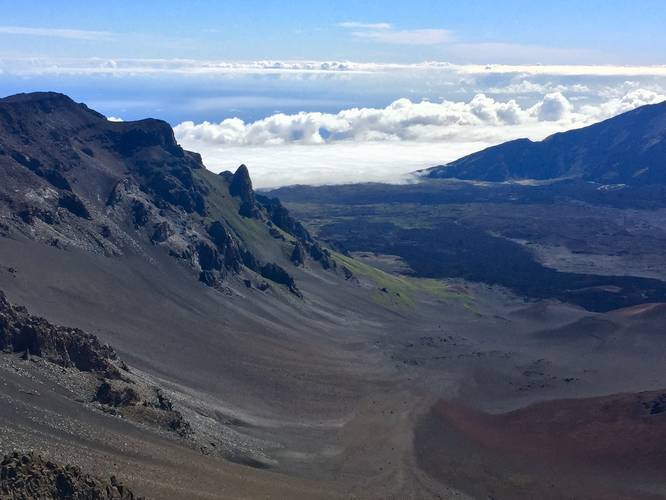
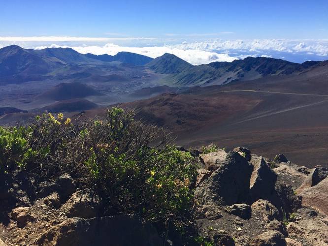
The Pa Ka'oao Trail at Haleakala National Park in Kula, Hawaii is a moderate 0.4-mile out-and-back hike to the top of Pa Ka'oao - a cinder cone at the summit of Haleakala Crater with stunning views into the crater, Big Island, and West Maui.
Pa Ka'oao is a cinder cone, also known in Hawaiian as a pu‘u, but the majority of the cinder cone is not made of fine cinder, it's mostly larger rock. The trailhead can be found directly next to the visitor center at the summit (just below the actual summit, Red Hill) and follows a rocky path to the top. From the top of Pa Ka'oao are amazing views of the Haleakala Crater, Red Hill Summit, and the Haleakala Observatory. For night sky, astrophysics, and astrophotography lovers, the sight of the Haleakala Observatory is extra special.
Views: From the top of Pa Ka'oao are views of the crater, the West Maui Mountains, Big Island (on clear days), Haleakala Observatory, and sometimes views of Lanai and Kaho'olawe on clear days.
Elevation and Difficulty: This hike is rated as moderate for one main reason - the elevation. This trail sits at about 9,900-feet above sea level and most people drive up the summit from sea level and do not acclimate to the thin air before hiking. The trail's actual elevation gain is not even 100-feet, but the hike is moderate for those who do not acclimate well or have a hard time breathing. Make sure to spend about 30 minutes walking around near the visitors center before attempting any difficult hikes. This hike can be done after spending a bit of time near the summit; however, you may find it more difficult to breathe while exerting more energy.
Fees: There's a $25 entry fee for Haleakala National Park. The ticket you receive is good for 7-days (make sure to check the Haleakala National Park's site), but I highly encourage you to purchase the $50 annual pass if you plan to visit more national parks within the next 365 days.
Respecting the Land
Hawaiian land is considered sacred to native Hawaiians and many locals, so please stay on-trail, take nothing but photos, and leave nothing but footprints. Respect the locals - don't stay for long and have a backup hike planned in case the parking lot is full.