The Oxbow Falls & Overlooks Hike at Oxbow Falls Park in Lincoln, New York is an easy 0.7-mile out-and-back hike that leads to waterfalls and overlook in the park.
Hike Description
This very short hike begins at the main parking lot for Oxbow Falls Park and heads into the park. The main trail system can be a bit difficult to find despite the trailhead map for orientation - if you hike toward the baseball diamond and picnic area, the trail will be between both of these structures. The trail itself is a bit skinny, but beaten down.
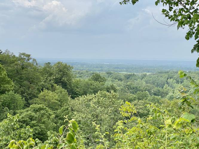
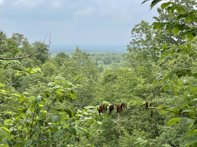
1st Overlook (Yellow Blazes) - Mile 0.1
Around mile 0.1, hikers will find a yellow blazed trail on the right-hand side of the path. Take this trail (out-and-back) to reach the 1st overlook / vista. This overlook faces north and includes views across the Oneida Lake Plain and onto Lake Ontario.
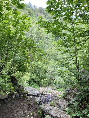
After reaching the orange blazed trail once more, the hike heads west to reach two waterfalls. The first waterfall is a free falling cascade that spills down the steep gorge; however, this waterfall is dried-up during early Summer.
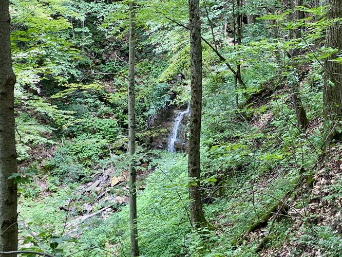
Annual Waterfall (20-feet tall) - Mile 0.35
Continuing onward is an annual creek that flows with at least one waterfall that can be seen from the trail. Around mile 0.35, after hiking down the hill a bit, hikers will find a view of the waterfall that cascades down the creek's bedrock. Here, the hike ends and turns-around; however, there are more waterfalls to explore in the park if you wish to keep hiking further.
Parking
Hikers will find a medium-sized parking lot at the coordinates provided, located on Oxbow Road in Lincoln, NY.
Pets
Dogs are allowed only if leashed and must be cleaned up after.
Warnings
Steep ledges: This trail follows some very steep ledges - hikers should keep back at all times despite the interesting views of waterfalls surrounding you.
Poison ivy: There's plenty of poison ivy just on the side of the trail along this hike, watch out.
Hike Description
This very short hike begins at the main parking lot for Oxbow Falls Park and heads into the park. The main trail system can be a bit difficult to find despite the trailhead map for orientation - if you hike toward the baseball diamond and picnic area, the trail will be between both of these structures. The trail itself is a bit skinny, but beaten down.
1st Overlook (Yellow Blazes) - Mile 0.1
Around mile 0.1, hikers will find a yellow blazed trail on the right-hand side of the path. Take this trail (out-and-back) to reach the 1st overlook / vista. This overlook faces north and includes views across the Oneida Lake Plain and onto Lake Ontario.
After reaching the orange blazed trail once more, the hike heads west to reach two waterfalls. The first waterfall is a free falling cascade that spills down the steep gorge; however, this waterfall is dried-up during early Summer.
Annual Waterfall (20-feet tall) - Mile 0.35
Continuing onward is an annual creek that flows with at least one waterfall that can be seen from the trail. Around mile 0.35, after hiking down the hill a bit, hikers will find a view of the waterfall that cascades down the creek's bedrock. Here, the hike ends and turns-around; however, there are more waterfalls to explore in the park if you wish to keep hiking further.
Parking
Hikers will find a medium-sized parking lot at the coordinates provided, located on Oxbow Road in Lincoln, NY.
Pets
Dogs are allowed only if leashed and must be cleaned up after.
Warnings
Steep ledges: This trail follows some very steep ledges - hikers should keep back at all times despite the interesting views of waterfalls surrounding you.
Poison ivy: There's plenty of poison ivy just on the side of the trail along this hike, watch out.