The Orange Loop at Robert V. Riddle State Park near Oneonta, New York is an easy 1.2-mile loop hike that features views of Shenevus Creek, open meadows, and surrounding hills and mountains.
Hike Description
This hike begins at the main trailhead system for Robert V. Riddle State Park located off of Gersoni Road just north of the I-88 junction. The Orange Loop heads in along an old railroad grade where hikers will find flat and easy hiking.
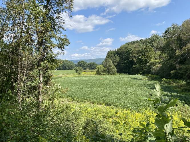
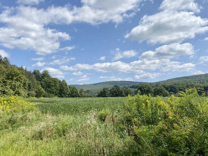
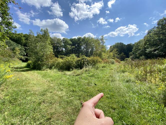
Meadow and Mountain Views - Mile 0.2 to 0.3
Eventually this old railroad grade will come into an open field with steep banks on each side. The trail will be surrounded by trees, but every now and then the trees part ways so you'll get views of the open meadows and surrounding mountains.
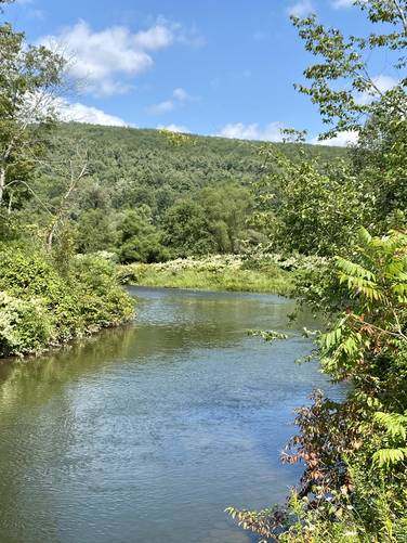
Shenevus Creek Views - Mile 0.35
Around mile 0.35, hikers will find a left-hand turn that's worth exploring quickly as you'll get views of Shenevus Creek if you take a left-hand turn. To continue on the Orange Loop, head back from Shenevus Creek to reach the trail once more.
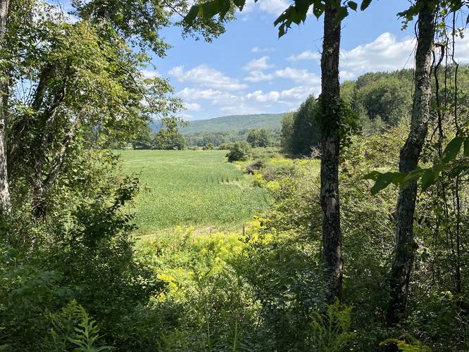
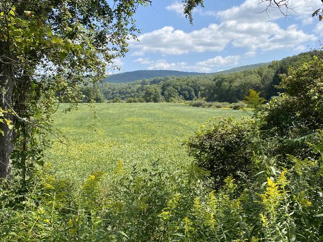
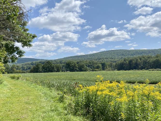
More Meadow Views - Mile 0.4 to 0.6
From miles 0.4 to 0.6, hikers will get to take in more meadow views as the Orange Loop skirts the outer edge of the open meadow.
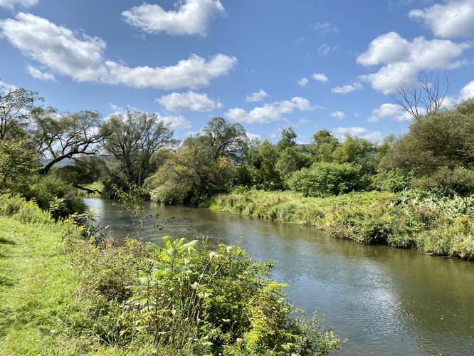
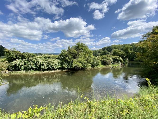
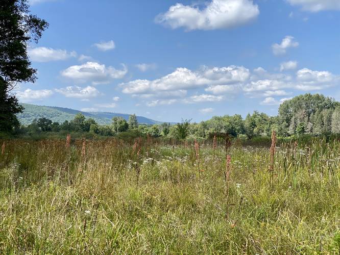
Shenevus Creek - Mile 0.6 to 0.8
From mile 0.6 to 0.8, hikers will walk along Shenevus Creek once more. Here, you'll get views of the creek, wildflowers during warm months, and the surrounding hills and mountains.
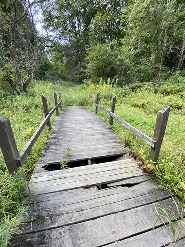
Right-hand Turn to Wetlands - Mile 0.8 to 0.9
Around mile 0.8, if you wish to take a short-cut, hikers can take a right-hand turn to head into the wetter / slightly-muddy cut-off trail that leads through a bit of wetlands. Here, hikers will find different species of grass like reeds and boardleaf cattail. Look for the sketchy wooden bridge, cross that but watch your steps, to continue following the Orange Loop.
Hiking Out - Mile 0.9 to 1.2
After crossing the wooden bridge and hopping back onto the Orange Loop, hikers will head west once more to reach the parking lot to complete the hike for a 1.2-mile loop.
Parking
Hikers will find parking at the coordinates provided, located off of Gersoni Road just north of the I-88 junction. The lot is large enough to fit about a dozen vehicles as of September 2023.
Pets
Dogs are allowed if leashed and must be cleaned up after.
Hike Description
This hike begins at the main trailhead system for Robert V. Riddle State Park located off of Gersoni Road just north of the I-88 junction. The Orange Loop heads in along an old railroad grade where hikers will find flat and easy hiking.
Meadow and Mountain Views - Mile 0.2 to 0.3
Eventually this old railroad grade will come into an open field with steep banks on each side. The trail will be surrounded by trees, but every now and then the trees part ways so you'll get views of the open meadows and surrounding mountains.
Shenevus Creek Views - Mile 0.35
Around mile 0.35, hikers will find a left-hand turn that's worth exploring quickly as you'll get views of Shenevus Creek if you take a left-hand turn. To continue on the Orange Loop, head back from Shenevus Creek to reach the trail once more.
More Meadow Views - Mile 0.4 to 0.6
From miles 0.4 to 0.6, hikers will get to take in more meadow views as the Orange Loop skirts the outer edge of the open meadow.
Shenevus Creek - Mile 0.6 to 0.8
From mile 0.6 to 0.8, hikers will walk along Shenevus Creek once more. Here, you'll get views of the creek, wildflowers during warm months, and the surrounding hills and mountains.
Right-hand Turn to Wetlands - Mile 0.8 to 0.9
Around mile 0.8, if you wish to take a short-cut, hikers can take a right-hand turn to head into the wetter / slightly-muddy cut-off trail that leads through a bit of wetlands. Here, hikers will find different species of grass like reeds and boardleaf cattail. Look for the sketchy wooden bridge, cross that but watch your steps, to continue following the Orange Loop.
Hiking Out - Mile 0.9 to 1.2
After crossing the wooden bridge and hopping back onto the Orange Loop, hikers will head west once more to reach the parking lot to complete the hike for a 1.2-mile loop.
Parking
Hikers will find parking at the coordinates provided, located off of Gersoni Road just north of the I-88 junction. The lot is large enough to fit about a dozen vehicles as of September 2023.
Pets
Dogs are allowed if leashed and must be cleaned up after.