Oliver Phineas' Forest Oasis is an easy 0.2-mile out-and-back stream walk near Austin, Pennsylvania at Elk State Forest that leads to a little-known creek swimming hole.
Oliver Phineas (with his finger in front of his lips): Shhh....be quiet about this. We don't want word to get out, but I discovered a forest spa near Sizerville, PA on my last hike. Sometimes, we all need a little incentive when hiking. Despite the fact that hikers and us backpackers find ourselves surrounded by natural beauty on the trails, sometimes we need an additional reward at the end of our efforts, especially in those hot summer months. Which is why this Forest Oasis hike is the best answer. Not only will the hiker, and more importantly the backpacker, get to enjoy an quality outdoor experience but on this hike also a refreshing dip in the cool spring waters of this local (hidden) swimming hole.
Trails
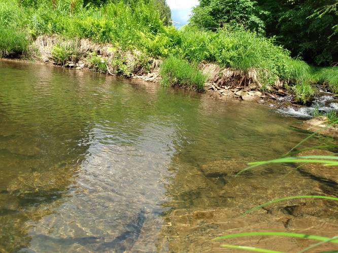
This great swimming hole has a cascade of natural spring water, plus a cool pool of water with rock ledges to just sit and relax in the warming sunshine. It is within easy walking distance for the East Cowley Run Road. The hiker may opt to walk along on the stream bank or wade in the shallow stream to and from the swimming hole.
Length and Difficulty
The path should still be considered short and easy but unmarked with uneven terrain.
Parking
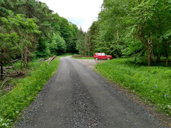
Hikers can find parking at the coordinates provided; next to the unmarked path, along East Cowley Run Road.
Pets
Dogs are allowed if leashed.
Camping and Backpacking
Backpackers are allowed to camp off-trail within the Elk State Forest near this site. Backpackers need to follow the state forest rules and regulations for dispersed / primitive / backcountry camping.
Water Source
Hikers can use water filters along the adjacent creeks.
.Warnings
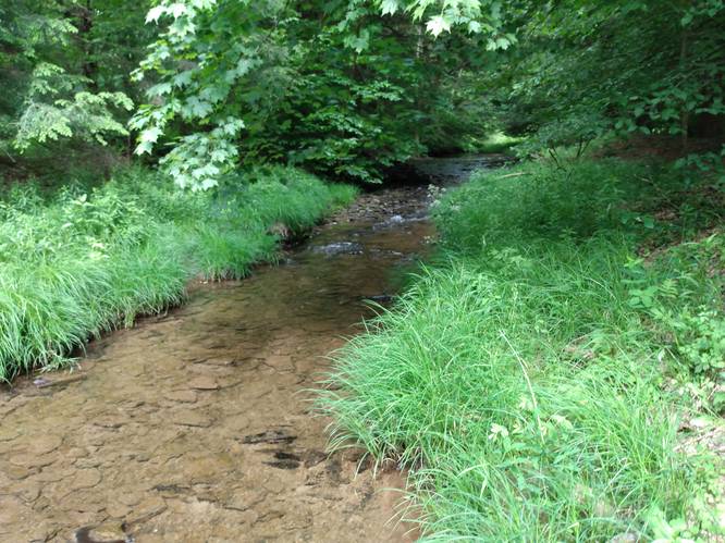
Unmarked Trails: The path to this swimming area is unmarked. The swimming hole is hidden from sight.
Swimming or Wading in Creeks: Swimming and wading in the stream is allowed. Come prepared with the proper footwear. When wading or swimming in the stream always wear shoes for protection from sharp glass and metal objects that might be along the stream or on the stream bottom. Diving/jumping into unfamiliar waters is never a good idea.
Waterfalls
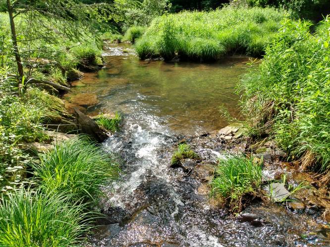
While there are no large waterfalls along this creek, there are several small cascades that tumble down the creek.
Oliver Phineas (with his finger in front of his lips): Shhh....be quiet about this. We don't want word to get out, but I discovered a forest spa near Sizerville, PA on my last hike. Sometimes, we all need a little incentive when hiking. Despite the fact that hikers and us backpackers find ourselves surrounded by natural beauty on the trails, sometimes we need an additional reward at the end of our efforts, especially in those hot summer months. Which is why this Forest Oasis hike is the best answer. Not only will the hiker, and more importantly the backpacker, get to enjoy an quality outdoor experience but on this hike also a refreshing dip in the cool spring waters of this local (hidden) swimming hole.
Trails
This great swimming hole has a cascade of natural spring water, plus a cool pool of water with rock ledges to just sit and relax in the warming sunshine. It is within easy walking distance for the East Cowley Run Road. The hiker may opt to walk along on the stream bank or wade in the shallow stream to and from the swimming hole.
Length and Difficulty
The path should still be considered short and easy but unmarked with uneven terrain.
Parking
Hikers can find parking at the coordinates provided; next to the unmarked path, along East Cowley Run Road.
Pets
Dogs are allowed if leashed.
Camping and Backpacking
Backpackers are allowed to camp off-trail within the Elk State Forest near this site. Backpackers need to follow the state forest rules and regulations for dispersed / primitive / backcountry camping.
Water Source
Hikers can use water filters along the adjacent creeks.
.Warnings
Unmarked Trails: The path to this swimming area is unmarked. The swimming hole is hidden from sight.
Swimming or Wading in Creeks: Swimming and wading in the stream is allowed. Come prepared with the proper footwear. When wading or swimming in the stream always wear shoes for protection from sharp glass and metal objects that might be along the stream or on the stream bottom. Diving/jumping into unfamiliar waters is never a good idea.
Waterfalls
While there are no large waterfalls along this creek, there are several small cascades that tumble down the creek.