Loading...

🎉 Enjoy a Free 7-Day Supporter Trial and Unlock Exclusive Perks — No Credit Card Required. Learn more.

Old Wire Road Trail

Directions
Map
Pictures
Send to App
Distance:
1.7 Miles / 2.7 km
Type:
One-Way
Difficulty:
Moderate
Time to Hike:
~51 minutes
Features:
Surface Type:
Dirt
Park:
Wilson's Creek National Battlefield
Town:
Brookline Township, Missouri
Directions:
37.108023, -93.398386
Added:
November 21, 2024
Updated:
December 01, 2024
Copy Trail Link Hiking this trail? Send a friend or family member a link to this trail guide for your own safety. Hike at your own risk (disclaimer)
Loading...
Loading...
158'

Total Change
163'

Ascent
166'

Descent

Download the Trail Route for Offline Use

Supporters get exclusive access to download trail routes to the MyHikes app for offline use. Stay prepared on your adventure, even without an internet connection! Become a Supporter today to unlock this feature and hike with confidence.

Send to App

Old Wire Road Trail

The Old Wire Road Trail at Wilson's Creek National Battlefield in Brookline Township, Missouri is a moderate 1.7-mile one-way hike that leads through a historic civil war battlefield.

Explore the Trail

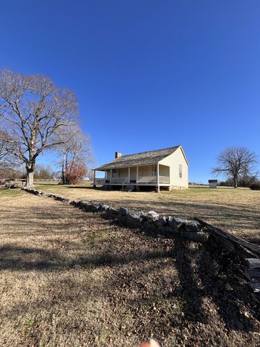
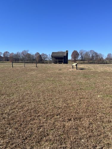
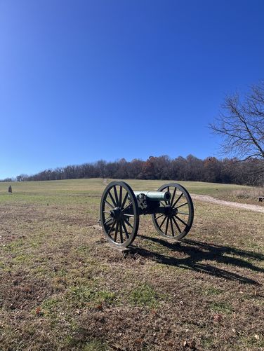
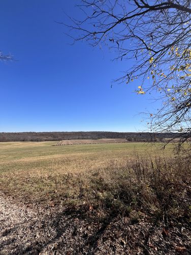
The Old Wire Road Trail starts at the historic Ray House at the northern trailhead, which is the only original structure that remains from the August 10, 1861 Battle of Wilson’s Creek. The historic Ray House is where General Nathaniel Lyon's body, who was the first General to die in battle during the Civil War, was brought to. After proceeding south along the trail, you will pass several canon batteries, cross a bridge over Wilson’s Creek, pass General Price's headquarters, General Segel’s final position, and beautiful open fields and forested woodlands.
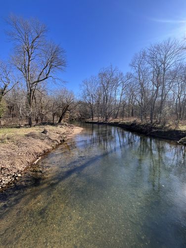
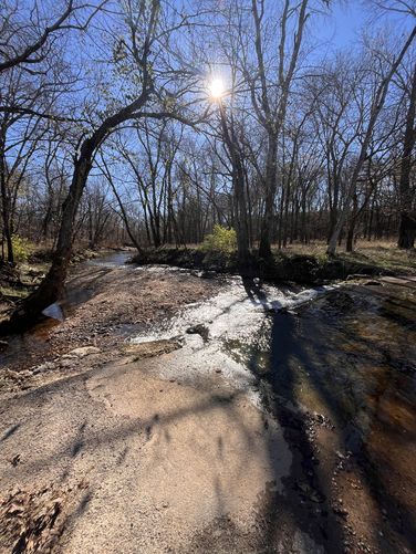
This trail is a well Maintained gravel trail that only hiking and equestrian usage is allowed. About 0.15 north of Segel’s Final Position there is a paved, low water crossing that can be impassable or at the minimum can get your wet during the rainy season or after a period of consistent rainfall.

The National Park Service recommends that you do not drink from the creeks on the park since there is run off from agricultural farming along with Springfield Missouri and Springfield Southwest treatment plants located up stream.

Parking

Hikers will find a large parking lot at the coordinates provided, located along the Tour Road. The lot is large enough to fit several dozen vehicles as of November 2024.

Pets

Dogs are allowed only if leashed and must be cleaned up after. Pets are not allowed inside of historic buildings.
Explore 2 trails near Brookline Township, MO
  1. Parking

    37.108023, -93.398386
  2. Main Trailhead

    37.107999, -93.398431
  3. Ray House

    37.106833, -93.398378
    Ray House
  4. Wilson Creek

    37.101683, -93.406822
    Wilson Creek
  5. Edward cabin and Price HQ

    37.100011, -93.406717
    Edward cabin and Price  HQ
  6. Low Water crossing at Shuyler Creek

    37.097008, -93.408447
    Low Water crossing at Shuyler Creek
  7. Sigel Last Position

    37.095658, -93.410356
    Sigel  Last Position
  8. Sharp Corn Field

    37.093917, -93.412583
    Sharp Corn Field
No community routes found. To add your own hike as a Community Route for this Trail guide, leave a Trip Report with an attached GPX file.

Hazards

Snakes
Poison Ivy/Oak

Seasons

All

Photo Albums

Trip Reports

Trail Guide By:
MoHiker user profile picture
1.7 miles / 2.7 km

Weather Forecast

In Brookline Township, MO

Explore Hiking Trails

You May Also Like

Colorado's Million Dollar Highway - Plan a day's drive adventure along the iconic Million Dollar Highway in Colorado. Explore the best short trails, roadside stops, waterfalls, vistas, ghost towns, and hot springs within a ~6 hour road trip.
Explore

Colorado's Million Dollar Highway

Plan a day's drive adventure along the iconic Million Dollar Highway in Colorado. Explore the best short trails, roadside stops, waterfalls, vistas, ghost towns, and hot springs within a ~6 hour road trip.

Read
Glacier's Going-to-the-Sun Road - Discover the breathtaking beauty of Glacier National Park along the iconic Going-to-the-Sun Road. From stunning roadside stops to picturesque waterfalls and vistas, this engineering marvel offers endless opportunities for exploration.
Explore

Glacier's Going-to-the-Sun Road

Discover the breathtaking beauty of Glacier National Park along the iconic Going-to-the-Sun Road. From stunning roadside stops to picturesque waterfalls and vistas, this engineering marvel offers endless opportunities for exploration.

Read
New York's Best Waterfalls - Whether you're planning a day hike, roadside stop, or a leisurely short walk, this guide provides hikers, travelers, and locals alike with 63 different locations to over 100 scenic waterfalls to help plan your next adventure!
Explore

New York's Best Waterfalls

Whether you're planning a day hike, roadside stop, or a leisurely short walk, this guide provides hikers, travelers, and locals alike with 63 different locations to over 100 scenic waterfalls to help plan your next adventure!

Read

Before you boogie...

Find our trail guides useful? Consider becoming a Supporter to unlock perks!

MyHikes is an indie platform that makes exploring public trails easier for everyone. The platform has no investors, no ads, and is owned and operated by one person, Dave Miller. Dave has personally mapped and written over 1,800 trail guides on MyHikes for the public to explore. MyHikes has helped millions outdoor enthusiasts plan their next adventure.

But it takes a lot of time 🕦, money 💰, work, and espresso shots ☕ to run MyHikes, including hiking , mapping , writing , and publishing new trails with high-quality (accurate) information... along with software engineering (coding) the platform like building new features, website and mobile app development (iOS and Android), site maintainance . and much much more.

Supporters unlock website and mobile app perks with an annual one-time payment of $25 (you renew) 😎👍. Or you can simply make a Donation of your choice. Otherwise, you can support us by telling your friends about MyHikes - both quick and free 🎉

Admin user profile picture

Dave Miller
MyHikes Founder