North Sugarloaf Mountain at the Mount Sugarloaf State Reservation in Deerfield, Massachusetts is a moderate 3.6-mile loop hike that summits North Sugarloaf Mountain and features stunning views of the Connecticut River Valley from two vista points.
Trails
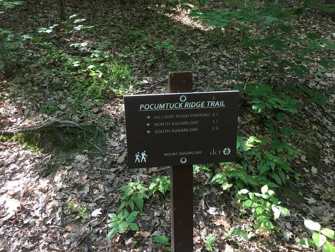
This hike follows the Pocumtuck Ridge Trail from the parking lot along blue blazes.
Trail Description
The trail should be rated as easy for the vast majority of the loop, however, the ascent can be moderate for some hikers. The trail is wide enough for off road vehicles and is not full of roots or rocks, unlike neighboring peak trails.
The trail takes its time ascending to the summit with relative ease. The first trail junction is roughly 0.4 miles up the trail. From here you can go right up the Pocumtuck Ridge Trail to the summit, straight up the Zig Zag Trails, or left along the Hemlock Trail.
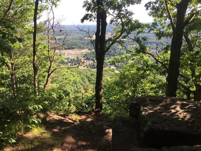
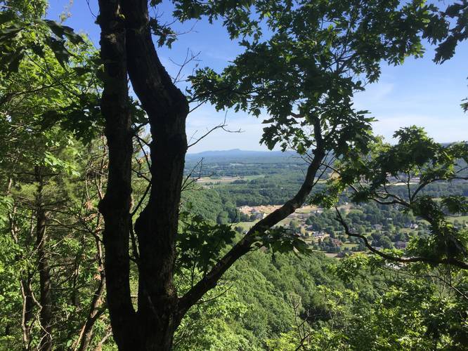
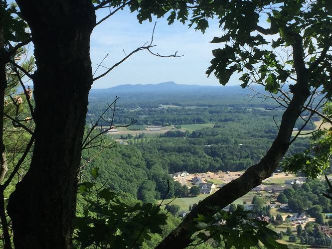
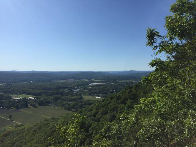
After the first overlook the trail flattens more as it rounds the southern face of the mountain for the next half mile providing two more clear overlooks facing west/southwest. The Pocumtuck Ridge Trail turns south towards Mt Sugarloaf. About 0.3 miles beyond the turn towards Mt. Sugarloaf, there is a left turn heading back north towards the yellow blazed Zig Zag Trail back down to Pocumtuck Ridge Trail. The Zig Zag trail is named that way for a reason, you can the trail following switchbacks down the hill. Early on there is one confusing corner -- either hikers have tried to blaze new trails and were confused or there is an old trail that was lost under overgrowth. After a half-mile of hiking down the switchbacks along a gentle slope, you will reach the the first junction of the hike. From here, the hike back to parking follows the same trail as the way in.
Parking
Parking is limited to about 6 cars in the lot, street parking is not advised. No permit required.
Pets
Dogs are allowed if leashed.
Trails
This hike follows the Pocumtuck Ridge Trail from the parking lot along blue blazes.
Trail Description
The trail should be rated as easy for the vast majority of the loop, however, the ascent can be moderate for some hikers. The trail is wide enough for off road vehicles and is not full of roots or rocks, unlike neighboring peak trails.
The trail takes its time ascending to the summit with relative ease. The first trail junction is roughly 0.4 miles up the trail. From here you can go right up the Pocumtuck Ridge Trail to the summit, straight up the Zig Zag Trails, or left along the Hemlock Trail.
After the first overlook the trail flattens more as it rounds the southern face of the mountain for the next half mile providing two more clear overlooks facing west/southwest. The Pocumtuck Ridge Trail turns south towards Mt Sugarloaf. About 0.3 miles beyond the turn towards Mt. Sugarloaf, there is a left turn heading back north towards the yellow blazed Zig Zag Trail back down to Pocumtuck Ridge Trail. The Zig Zag trail is named that way for a reason, you can the trail following switchbacks down the hill. Early on there is one confusing corner -- either hikers have tried to blaze new trails and were confused or there is an old trail that was lost under overgrowth. After a half-mile of hiking down the switchbacks along a gentle slope, you will reach the the first junction of the hike. From here, the hike back to parking follows the same trail as the way in.
Parking
Parking is limited to about 6 cars in the lot, street parking is not advised. No permit required.
Pets
Dogs are allowed if leashed.