White & Tan Blaze Trail
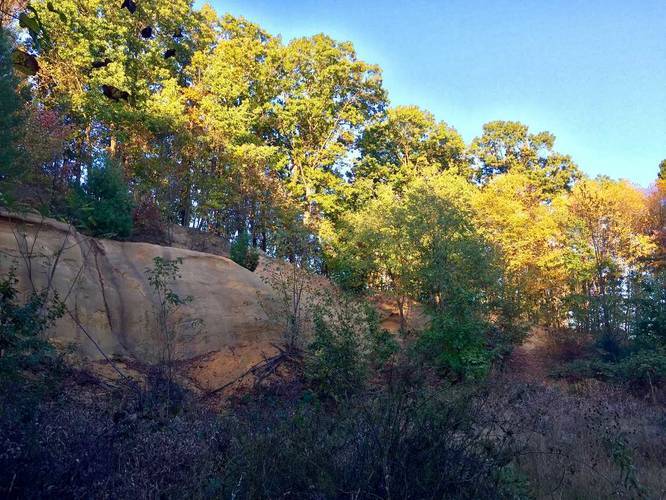
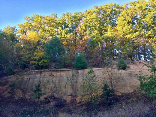
When the trail starts to curve back around, you'll find a unique cliff feature with pine trees and sandy soil. This is definitely a different sight to see on trails near Pittsburgh. This trail is short, but definitely one of the best trails at North Park.
Know Before You Go
Interactive topographic map for White & Tan Blaze Trail located in Hampton Township, PA. Click the "View Map" button to load GPS coordinates and trail markers.
View map
Get directions
- Distance
- 0.5 mi
- Difficulty
- Easy
- Type
- Loop
- Est. Time
- 15 min
- Elev. Gain
- 85'
- Rating
- 0.0
- Added
- October 21, 2017
- Updated
- June 06, 2018
Weather Forecast
Today
High
85°F
Mostly Cloudy
Tonight
Low
68°F
Scattered Showers And Thunderstorms
Sunday
High
80°F
Chance Showers And Thunderstorms
Sunday Night
Low
66°F
Chance Showers And Thunderstorms then Showers And Thunderstorms
Monday
High
82°F
Scattered Showers And Thunderstorms
Monday Night
Low
65°F
Scattered Showers And Thunderstorms then Partly Cloudy
Tuesday
High
83°F
Partly Sunny then Chance Showers And Thunderstorms
Tuesday Night
Low
67°F
Chance Showers And Thunderstorms
Wednesday
High
83°F
Showers And Thunderstorms Likely
Wednesday Night
Low
68°F
Showers And Thunderstorms Likely
Thursday
High
84°F
Slight Chance Rain Showers then Chance Showers And Thunderstorms
Thursday Night
Low
67°F
Chance Showers And Thunderstorms
Friday
High
85°F
Chance Showers And Thunderstorms
Friday Night
Low
67°F
Chance Showers And Thunderstorms
Don't let Google decide who you trust.


Loading...
<strong>Trail map and elevation chart not rendering in print mode?</strong> Simply scroll to the trail map section, then try printing again!
Total Change
86 ft.
26 m
26 m
Ascent
85 ft.
26 m
26 m
Descent
82 ft.
25 m
25 m
Loading...
Features
- Dogs
- Biking
Points of interest
-
Parking
40.587222, -79.98333 -
Main Trailhead
40.586525, -79.982762 -
Rock cliffs along the trail about 15 feet tall
40.584317, -79.98095 -
Rock cliffs along the trail about 15 feet tall
40.584256, -79.980744
Safety information
For your own safety: plan ahead, let someone know where you'll be, and hike at your own risk.
Markers
Blaze Color
White
fff
Blaze Dot Color
Tan
d2b48c
Availability
All seasons
Surface type
Dirt
Trip Reports (Reviews)
Ready to help fellow hikers? Add a trip report to share your experience!
No community routes found. To add your own hike as a Community Route for this Trail guide, leave a Trip Report with an attached GPX file.


You may also like

Explore
Pennsylvania's Grand Canyon
Explore Pennsylvania's Grand Canyon, officially named Pine Creek Gorge, including hiking trails, vistas, overlooks, waterfalls, backcountry campsites, backpacking trails.

Explore
New York's Best Waterfalls
Whether you're planning a day hike, roadside stop, or a leisurely short walk, this guide provides hikers, travelers, and locals alike with 63 different locations to over 100 scenic waterfalls to help plan your next adventure!

Explore
25 Best Day Hikes in West Virginia
Discover 25 of the best day hikes in West Virginia, from scenic overlooks to wilderness trails—perfect for every level of hiker.

Explore
Best of the Alps: Hiking, Adventure & Scenery
Plan your ultimate European Alps adventure! Discover the best hiking trails, epic scenery, and villages in the Swiss Alps, Dolomites, Chamonix, and Lake Como.
north park

