Loading...

North Mountain Trail Hike

Directions
Map
Pictures
Send to App
Distance:
11.3 Miles / 18.2 km
Type:
One-Way
Difficulty:
Hard
Time to Hike:
5 hours, ~39 minutes
Features:
Surface Type:
Dirt
Park:
Jefferson National Forest
Town:
Troutville, Virginia
Directions:
37.457438, -80.017467
Added:
February 28, 2025
Updated:
April 05, 2025
Copy Trail Link Hiking this trail? Send a friend or family member a link to this trail guide for your own safety. Hike at your own risk (disclaimer)
Loading...
Loading...
1,566'

Total Change
2,796'

Ascent
2,516'

Descent

Download the Trail Route for Offline Use

Supporters get exclusive access to download trail routes to the MyHikes app for offline use. Stay prepared on your adventure, even without an internet connection! Become a Supporter today to unlock this feature and hike with confidence.

Send to App

North Mountain Trail Hike

The North Mountain Trail was once an alignment of the Appalachian Trail, back when landowners did not give permission for the trail to approach McAfee Knob and before the National Park Service purchased land for the present route. The North Mountain Trail remains in use today, close to three of the top hiking destinations in Virginia (McAfee Knob, Dragon’s Tooth, and Tinker Cliffs) and allows a backpacker to connect all three in a loop of about 37 miles. The North Mountain Trail has nothing of note along its distance when compared to its nearby superstar destinations with few if any summer views, and there is usually no water to be found along its length. However, it does offer solitude and multiple campsites. And if you are backpacking the entire Triple Crown, this trail completes your loop.

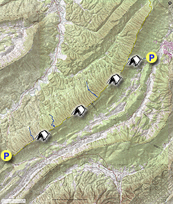
  • Mile 0.0 – This trail description goes north to south. Use the parking lot on Route 779 (Catawba Road) that also serves as the starting point for the Tinker Cliffs hike.  There is room for about ten vehicles here. Cross Catawba Road and look for the sign for the Catawba Valley Trail and a trail kiosk.
  • Mile 0.5 – The Catawba Valley Trail crosses a stream bed with seasonal water. Shortly after is a flat spot that has clearly been used as a campsite, on the left.
  • Mile 1.0 – Cross a seasonal stream. This is your last water source for the entire hike. Stock up if you did not bring enough!
  • Mile 1.8 – The trail passes a dry campsite and continues to ascend. Winter views of Tinker Cliffs are possible along the way.
  • Mile 2.3 – The Catawba Valley Trail ends at the North Mountain Trail. Take a left here, towards the Turkey Trail. Follow the North Mountain ridgeline for the rest of this hike.
  • Mile 3.8 – Pass a small campsite on the left.
  • Mile 5.1 – The route drops into a small wind gap where the Turkey Trail comes up from the right and ends at the North Mountain Trail at a point marked by Forest Service signs. Continue straight on the North Mountain Trail
  • Mile 5.4 – Pass a small campsite on the right, and another on the left shortly afterward. Winter views of McAfee Knob can be seen on the left.
  • Mile 6.5 – Small Campsite on the left. Winter views, though a gap, to downtown Roanoke.
  • Mile 7.3 – Pass small campsite. Trail continues along ridge, climbing occasionally steeply for short sections.
  • Mile 8.1 – The blue blazed Grouse Trail comes up from the right and ends at the North Mountain Trail.
  • Mile 8.2 – Pass a campsite that is larger than most others along this trail.
  • Mile 9.6 – The blue blazed Deer Trail comes up steeply from the right and ends at its intersection here with the North Mountain Trail.
  • Mile 9.8 – Pass another campsite.
  • Mile 10.3 – Pass the final campsite before descending to the Dragon’s Tooth Parking Lot. Over the next 1.5 miles, the trail drops 1200 feet at a 15 percent grade.
  • Mile 11.8 – The trail switchbacks next to a signpost containing a map before coming out at Virginia State Route 311. There is a sign marking the trail for hikers starting from the south. Walk along the side of Route 311 for a short distance in the same direction as the trail took you, before crossing the road with care and entering the Dragon’s Tooth Parking Lot.
  • Mile 12.2 – Return to your vehicle in the parking lot. There are privies next to this parking lot, and it is likely crowded with vehicles that brought folks to hike Dragon’s Tooth.
By HikingUpward Contributor: Jeff Monroe
Explore 17 trails near Troutville, VA
  1. Parking

    37.457438, -80.017467
  2. Main Trailhead

    37.457438, -80.017467
No community routes found. To add your own hike as a Community Route for this Trail guide, leave a Trip Report with an attached GPX file.

Hazards

Ticks - Lyme Disease More Info (CDC)
Snakes
Poison Ivy/Oak

Seasons

All

Blaze Color

Yellow

Trip Reports

Trail Guide By:
HikingUpward user profile picture
11.3 miles / 18.2 km

Weather Forecast

In Troutville, VA

Explore Hiking Trails

You May Also Like

New York's Best Waterfalls - Whether you're planning a day hike, roadside stop, or a leisurely short walk, this guide provides hikers, travelers, and locals alike with 63 different locations to over 100 scenic waterfalls to help plan your next adventure!
Explore

New York's Best Waterfalls

Whether you're planning a day hike, roadside stop, or a leisurely short walk, this guide provides hikers, travelers, and locals alike with 63 different locations to over 100 scenic waterfalls to help plan your next adventure!

Read
25 Best Day Hikes in North Carolina - Discover the top 25 best day hikes in North Carolina, from breathtaking waterfalls to mountain peaks. Explore hidden gems, scenic views, and trails suitable for all skill levels, perfect for your next outdoor adventure.
Explore

25 Best Day Hikes in North Carolina

Discover the top 25 best day hikes in North Carolina, from breathtaking waterfalls to mountain peaks. Explore hidden gems, scenic views, and trails suitable for all skill levels, perfect for your next outdoor adventure.

Read

Before you boogie...

Find our trail guides useful? Consider becoming a Supporter to unlock perks!

MyHikes is an indie platform that makes exploring public trails easier for everyone. The platform has no investors, no ads, and is owned and operated by one person, Dave Miller. Dave has personally mapped and written over 1,800 trail guides on MyHikes for the public to explore. MyHikes has helped millions outdoor enthusiasts plan their next adventure.

But it takes a lot of time 🕦, money 💰, work, and espresso shots ☕ to run MyHikes, including hiking , mapping , writing , and publishing new trails with high-quality (accurate) information... along with software engineering (coding) the platform like building new features, website and mobile app development (iOS and Android), site maintainance . and much much more.

Supporters unlock website and mobile app perks with an annual one-time payment of $25 (you renew) 😎👍. Or you can simply make a Donation of your choice. Otherwise, you can support us by telling your friends about MyHikes - both quick and free 🎉

Admin user profile picture

Dave Miller
MyHikes Founder