Loading...

🎉 Enjoy a Free 7-Day Supporter Trial and Unlock Exclusive Perks — No Credit Card Required. Learn more.

North Fork Dam Hike

Directions
Map
Pictures
Send to App
Distance:
1.0 Mile / 1.6 km
Type:
Out-and-Back
Difficulty:
Easy
Time to Hike:
~30 minutes
Features:
PA Wilds
Surface Type:
Dirt
Town:
Harrison Valley, Pennsylvania
Directions:
41.994559, -77.649669
Added:
March 31, 2025
Updated:
April 02, 2025
Copy Trail Link Hiking this trail? Send a friend or family member a link to this trail guide for your own safety. Hike at your own risk (disclaimer)
Loading...
Loading...
76'

Total Change
101'

Ascent
108'

Descent

Download the Trail Route for Offline Use

Supporters get exclusive access to download trail routes to the MyHikes app for offline use. Stay prepared on your adventure, even without an internet connection! Become a Supporter today to unlock this feature and hike with confidence.

Send to App

North Fork Dam Hike

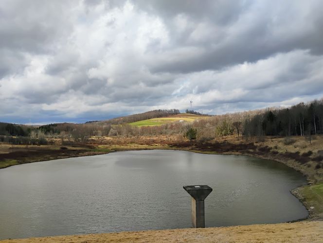
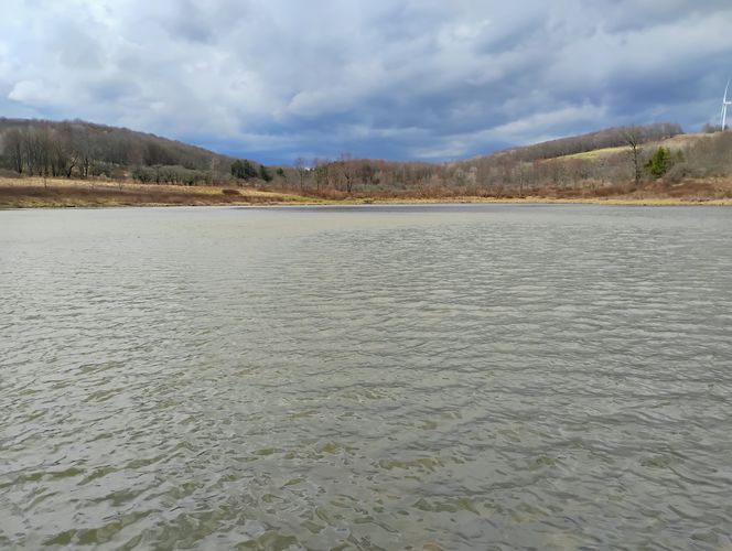
The North Fork Dam on the Cowanesque River in Harrison Valley, Pennsylvania has an easy 1.0-mile out-and-back walk that leads along the dam embankment for a panoramic view of the surrounding farmlands and features views of the reservoir.

Exploring the North Fork Dam

This 
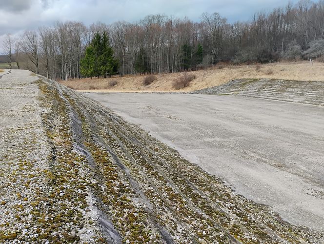
vista hike has short trail that hikers can follow along the crest of the dam's embankment. Visitors can also meander around grassy fields, to take pictures from the different vantage points or make use of the picnic pavilion located near the parking area. This recording is about 1.0-mile long, but visitors will not need to walk far to get a great view.

On the sky-line to the north, appeared three tall windmills rotating in the wind, and were located just across the border in New York State less than a mile away. A herd of cattle was grazing in a nearby pasture, all of which added to the scenery making this park a pleasantly captivating place to visit.

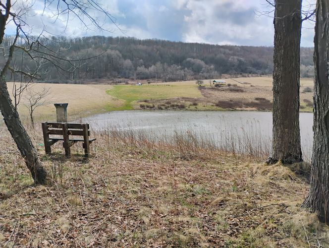
Some of additional hiking was done on this walk by crossing the grassy channel that leads to the dam high-water spillway to explore the elevated bluff across the reservoir from the Picnic Pavilion. Although this area of the park is not maintained, it did give an very nice vista looking back across the reservoir. There was a nice wood lot of old-growth Maple trees on the bluff to explore. Other areas beyond the woods appeared to be primarily wetlands and bushy thickets, which are not suitable for hiking without trail footbridges and blaze marks to guide hikers. This part of the park features excellent wildlife habitat, making wildlife watching from blinds and sitting benches along the trails a great opportunity..

Parking

Hikers will find parking at the coordinates provided along the North Fork Road in the northeast corner of Potter County, Pennsylvania.

The lot is large enough to hold a dozen vehicles with some amenities including a fishing lake and picnic pavilion. When fishing in Pennsylvania, anglers must obtain a valid fishing license if 16 years of age or older, be aware of seasons, size, and creel limits for various fish species, and familiarize themselves with the general regulations, tackle, and bait rules

Restrictions

Swimming and Camping are not permitted at the North Fork Dam Recreational Area which is a day use only park.

Facilities

No restroom was available on-site at the time of this hike (early-spring), however it appears that a portable toilet might be provided seasonal, but might not have been delivered here yet.

Pets

Dogs are allowed if leashed and cleaned up after.
Explore 165 trails near Harrison Valley, PA
  1. Parking

    41.994559, -77.649669
  2. Main Trailhead

    41.994665, -77.649629
  3. Sitting Bench near Pavilion

    41.994985, -77.650143
    Sitting Bench near Pavilion
  4. View From Embankment North

    41.995418, -77.64798
    View From Embankment North
  5. Dam Spillway

    41.995779, -77.647245
    Dam Spillway
  6. Sitting Bench of Bluff across Reservoir

    41.996632, -77.648137
    Sitting Bench of Bluff across Reservoir
  7. Reservoir Lake Side

    41.995949, -77.648336
    Reservoir Lake Side
No community routes found. To add your own hike as a Community Route for this Trail guide, leave a Trip Report with an attached GPX file.

Hazards

Ticks - Lyme Disease More Info (CDC)

Seasons

All

Weather Forecast

In Harrison Valley, PA

Explore Hiking Trails

You May Also Like

Colorado's Million Dollar Highway - Plan a day's drive adventure along the iconic Million Dollar Highway in Colorado. Explore the best short trails, roadside stops, waterfalls, vistas, ghost towns, and hot springs within a ~6 hour road trip.
Explore

Colorado's Million Dollar Highway

Plan a day's drive adventure along the iconic Million Dollar Highway in Colorado. Explore the best short trails, roadside stops, waterfalls, vistas, ghost towns, and hot springs within a ~6 hour road trip.

Read
New York's Best Waterfalls - Whether you're planning a day hike, roadside stop, or a leisurely short walk, this guide provides hikers, travelers, and locals alike with 63 different locations to over 100 scenic waterfalls to help plan your next adventure!
Explore

New York's Best Waterfalls

Whether you're planning a day hike, roadside stop, or a leisurely short walk, this guide provides hikers, travelers, and locals alike with 63 different locations to over 100 scenic waterfalls to help plan your next adventure!

Read

Before you boogie...

Find our trail guides useful? Consider becoming a Supporter to unlock perks!

MyHikes is an indie platform that makes exploring public trails easier for everyone. The platform has no investors, no ads, and is owned and operated by one person, Dave Miller. Dave has personally mapped and written over 1,800 trail guides on MyHikes for the public to explore. MyHikes has helped millions outdoor enthusiasts plan their next adventure.

But it takes a lot of time 🕦, money 💰, work, and espresso shots ☕ to run MyHikes, including hiking , mapping , writing , and publishing new trails with high-quality (accurate) information... along with software engineering (coding) the platform like building new features, website and mobile app development (iOS and Android), site maintainance . and much much more.

Supporters unlock website and mobile app perks with an annual one-time payment of $25 (you renew) 😎👍. Or you can simply make a Donation of your choice. Otherwise, you can support us by telling your friends about MyHikes - both quick and free 🎉

Admin user profile picture

Dave Miller
MyHikes Founder