Loading...

WINTER SALE! 50% OFF Supporter Accounts — now through January 31st. Learn More.

Nine Mile Run Trail

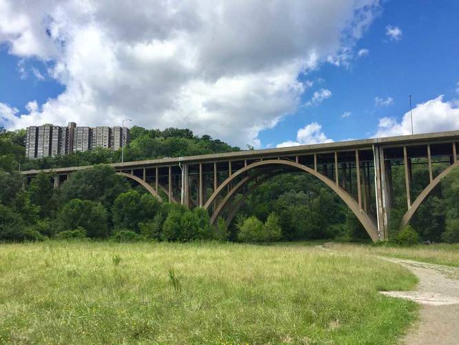
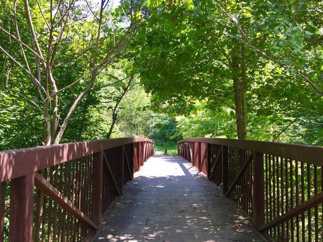
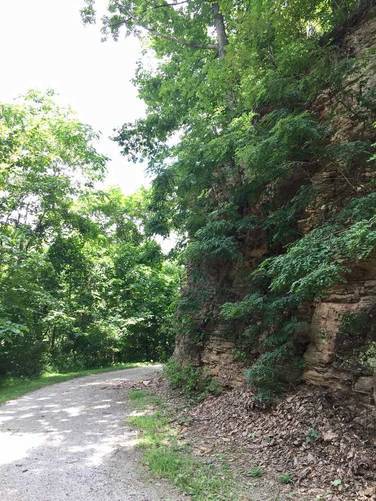
The Nine Mile Run Trail at Frick Park in Pittsburgh, PA, is an easy 3.6 mile out-and-back hike that leads from Duck Hollow up Nine Mile Run and over to the eastern side of the park.

Parking can be found in Duck Hollow at the Duck Hollow Trail Parking area. This parking lot serves Frick Park, the Three Rivers Heritage Trail, the Steel Valley Heritage Trail, and the Duck Hollow Trail.

History: In 1922, the Duquesne Slag Company bought land along Nine Mile Run and dumped slag into the valley for 50 years via a railroad track above the creek. About 200 million tons were dumped alongside the banks, which reached ten stories deep.

Starting in 2006, with the help of the US Army Corps of Engineers and the Nine Mile Run Watershed Association, the restoration of Nine Mile Run began and continues to this day. It's the largest restoration of its kind in an urban area in the country.

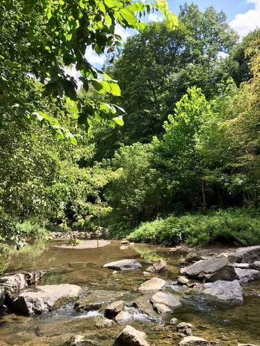
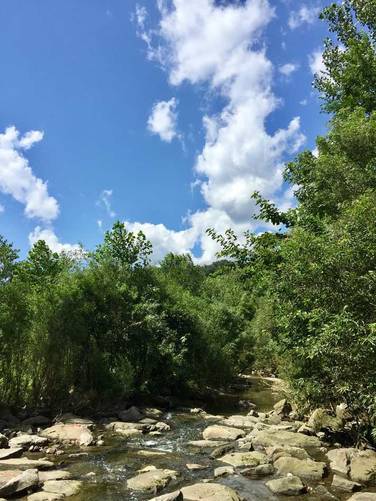
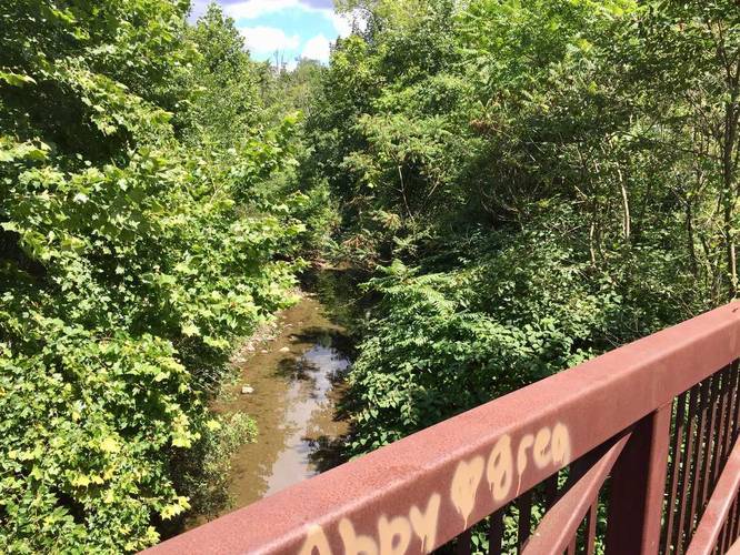
Nine Mile Run's wetlands naturally filter runoff and the surrounding trees are as vibrant as anywhere else in the city. Walking along Nine Mile Run, without previously knowing its history, you'd have no idea the area used to be a slag dump. You can hike the Nine Mile Run Trail all the way to where the run meets the Monongahela River and the trailhead for the Duck Hollow Trail.

Explore 223 trails near Pittsburgh, PA

Know Before You Go

  • Nine Mile Run Trail is a 3.6-mile, easy out-and-back trail in Frick Park, Pittsburgh, accessible via the Duck Hollow Trail Parking area.
  • The area was historically a slag dump for 50 years, but since 2006 it has been undergoing a large-scale urban restoration project.
  • The restored Nine Mile Run now features wetlands and vibrant trees, effectively masking its industrial past, and the trail extends to the Monongahela River.
Interactive topographic map for Nine Mile Run Trail located in Pittsburgh, PA. Click the "View Map" button to load GPS coordinates and trail markers.
Get directions
Distance
3.6 mi
Difficulty
Easy
Type
Out-and-Back
Est. Time
1.8 hrs
Elev. Gain
313'
Rating
0.0
Added
August 05, 2017
Updated
December 18, 2018

Weather Forecast

Tonight
Low 14°F
Partly Cloudy
Friday
High 36°F
Scattered Snow Showers
Friday Night
Low 30°F
Chance Snow Showers
Saturday
High 39°F
Snow Showers
Saturday Night
Low 16°F
Chance Snow Showers
Sunday
High 24°F
Isolated Snow Showers then Partly Sunny
Sunday Night
Low 15°F
Mostly Cloudy
M.L. King Jr. Day
High 24°F
Scattered Snow Showers
Monday Night
Low 4°F
Scattered Snow Showers then Partly Cloudy
Tuesday
High 15°F
Partly Sunny
Tuesday Night
Low 8°F
Partly Cloudy
Wednesday
High 31°F
Scattered Snow Showers
Wednesday Night
Low 19°F
Scattered Snow Showers
Thursday
High 31°F
Scattered Snow Showers
Loading...
Total Change
77'
Ascent
313'
Descent
316'
Loading...

Download the GPX Data for Offline Use

Supporters get exclusive access to download trail routes to the MyHikes app for offline use. Stay prepared on your adventure, even without an internet connection! Become a Supporter today to unlock this feature and hike with confidence.

Download Nine Mile Run Trail GPX Data to the MyHikes Mobile App

Features

Dogs
Biking

Points of interest

  1. Parking

    40.414614, -79.916271
  2. Main Trailhead

    40.415525, -79.917214
  3. Just before the I-376 PA-22 bridge

    40.424656, -79.905708
    Just before the I-376 PA-22 bridge
  4. View of Nine Mile Run

    40.426375, -79.905158
    View of Nine Mile Run

Safety information

For your own safety: plan ahead, let someone know where you'll be, and hike at your own risk.

Availability

Summer

Surface type

Dirt

Trip Reports (Reviews)

Your opinion matters! Be the first to rate this trail.

Ready to help fellow hikers? Add a trip report to share your experience and provide valuable insights for other hikers!

Hhm avatar
Hhm
1.26 miles / 2.0 km
July 25, 2019
Hhm avatar
Hhm
1.4 miles / 2.3 km
July 25, 2019
3.6 miles / 5.8 km
August 05, 2017
Hiking

Explore other routes for this Trail guide, added by the MyHikes' community via Trip Reports (Reviews). To add your own hike as a Community Route for this Trail guide, leave a Trip Report and attached your GPX file!

Popular categories

Scenic mountain view representing vista trails
Vista trails
Scenic gorge of cascades representing waterfall trails
Waterfall hikes
Rugged mountain terrain representing summit trails
Summit trails
Scenic mountain view representing dog-friendly trails
Dog-friendly
Scenic campsite with a view representing camping trails
Camping trails
Appalachian Trail logo representing A.T. hikes
A.T. hikes

You May Also Like

New York's Best Waterfalls - Whether you're planning a day hike, roadside stop, or a leisurely short walk, this guide provides hikers, travelers, and locals alike with 63 different locations to over 100 scenic waterfalls to help plan your next adventure!
Explore

New York's Best Waterfalls

Whether you're planning a day hike, roadside stop, or a leisurely short walk, this guide provides hikers, travelers, and locals alike with 63 different locations to over 100 scenic waterfalls to help plan your next adventure!

Read
🍪 We use cookies to learn about site usage and to serve map tiles. You may block cookies manually in the browser. By continuing you agree. Learn more