Loading...

Distance:
0.3 Miles / 0.5 km
Type:
Loop
Difficulty:
Easy
Time to Hike:
~9 minutes
Features:
Surface Type:
Dirt
Park:
Mt. Rainier National Park
Town:
Ashford, Washington
Directions:
46.994952, -121.915517
Added:
March 17, 2017
Updated:
June 12, 2018
Loading...
Loading...
107 '

Total Change
100 '

Ascent
196 '

Descent

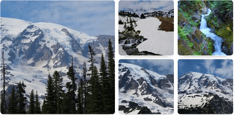
The Rain Forest Trail at Mt. Rainier National Park, WA, is an easy 0.3 mile loop hike located on the northwest boundary of Mt. Rainier National Park.

It's extremely short, but it's a really nice loop trail that gives you a quick peek into Rainier's rain forests.

You'll find that most of the trail is made up of large wooden planks to keep you off the wet ground.

Along the east side of the trail you may find a waterfall hidden in the back; however, I'm not sure if it exists throughout the entire year or if it only exists during the spring or after a heavy rainfall.

Also beware that there's a parking fee for the park and dogs are not allowed on any of the trails within the park's boundaries.

Explore 3 trails near Ashford, WA
  1. Parking

    46.994952, -121.915517
  2. Main Trailhead

    46.994891, -121.915381
No community routes found. To add your own hike as a Community Route for this Trail guide, leave a Trip Report with an attached GPX file.

Seasons

All

Photo Albums

1 Trip Report

No Star-Ratings
Write-up by:
Admin user profile picture
0.3 miles / 0.5 km
Trail added
March 17, 2017
Hiked on
March 17, 2017
Updated on
June 12, 2018

Weather Forecast

In Ashford, WA

Explore Hiking Trails

New Hikes

Sugar Hill Pond and Twin Lean-Tos Hike
2.3 Miles
3.7 km
Moderate
Out-and-Back
Almond Lake Overlook
0.1 Miles
0.2 km
Easy
Out-and-Back
Weston Lake Loop
3.2 Miles
5.1 km
Easy
Loop
Eternal Flame Falls via Eternal Flame Trail
1.2 Miles
1.9 km
Moderate
Out-and-Back

Before you leave...

MyHikes is an indie web platform aimed to make exploring public trails easier for everyone. The site has no investors and is owned and operated by one person, Dave Miller (Founder & Admin). As the Founder, main contributor, and doer-of-all-things for MyHikes, I share my trips with over-detailed write-ups for fun on a volunteer basis and I believe that public trail information should be available to everyone.

It takes a lot of time 🕦, money 💰, and effort (including espresso shots ☕) to run MyHikes, including hiking , mapping , writing , and publishing new trails with high-quality content... along with building new features, moderating, site maintainance, and app development for iOS and Android . I simply ask that if you find MyHikes' trail guides helpful to please consider becoming a Supporter to help keep the site, iOS, and Android apps available to everyone.

Supporters unlock website and in-app perks with a one-time payment of $25 (you renew) 😎👍. Or you can simply make a Donation of your choice without a MyHikes user account. Otherwise, telling your friends about MyHikes is the next-best thing - both quick and free 🎉

Thanks for visiting MyHikes and have a great hike!️

Admin user profile picture

Dave Miller
MyHikes Founder & Admin