The Mount Osceola Trail at the White Mountain National Forest near Lincoln, New Hampshire is a moderate-to-difficult 6-mile out-and-back trail up to a beautiful vista point atop Mount Osceola's summit.
In my experience, this is probably one of the easiest 4,000-foot peaks in the White Mountains; however, inexperienced hikers may find this mountain a challenge due to the 2,000-foot elevation change. Experienced hikers may find this trail to be moderate instead of difficult. The trail is fairly steady going up with a consistent elevation grade and it's easy to follow.
The summit offers great views, with the option to continue on to East Osceola if you want to cross another 4,000-foot peak off your list. I saw lots of dogs and older children on the trail, and I would say this hike is suitable for both - unlike some of the other trails in the White Mountains.
Vista
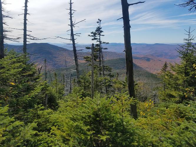
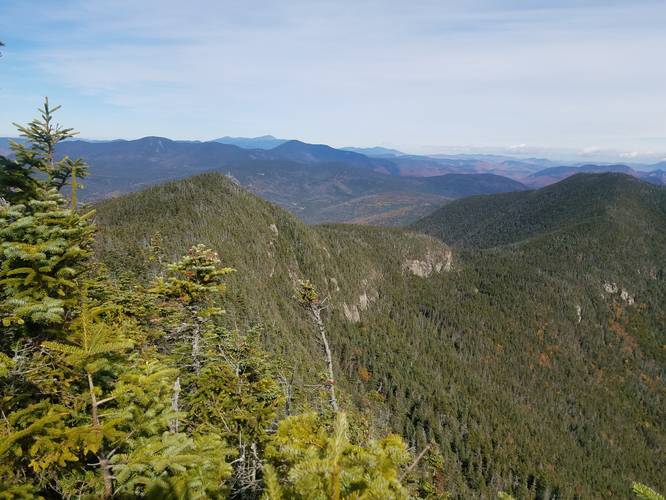
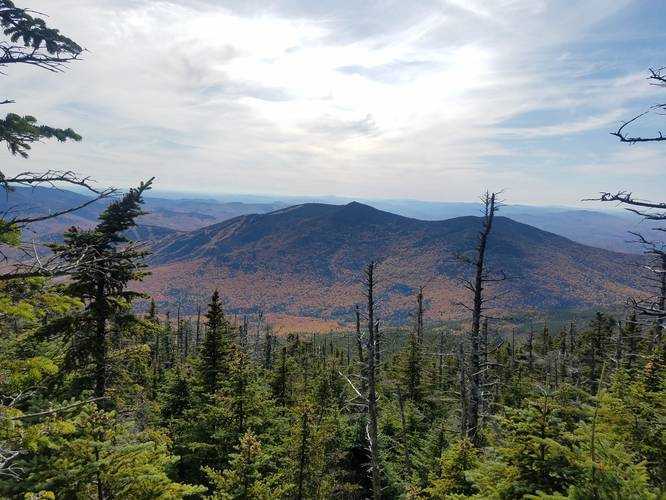
Once at the top of Mount Osceola, hikers have a view of Mount Tripyramid (north, middle, south peaks), The Sleepers, Scaur Peak, and Waterville Valley below. There are several other vista points along the trail that give hikers stunning views of the White Mountains and neighboring valleys.
Parking
There is a moderate-sized parking lot at the coordinates provided; however, hikers will find the parking lot is generally full during the busy seasons - Summer and Autumn. Hikers should plan to show up early if they want a space in the parking lot, otherwise, plan to park along the street. Parking along the street may add an additional 0.5-miles to your hike, depending on how many hikers are on the trail.
Fees
There is a $5 fee at the parking area.
Road Closed for Winter
The road to access this trailhead is closed during the winter months due to snow.
In my experience, this is probably one of the easiest 4,000-foot peaks in the White Mountains; however, inexperienced hikers may find this mountain a challenge due to the 2,000-foot elevation change. Experienced hikers may find this trail to be moderate instead of difficult. The trail is fairly steady going up with a consistent elevation grade and it's easy to follow.
The summit offers great views, with the option to continue on to East Osceola if you want to cross another 4,000-foot peak off your list. I saw lots of dogs and older children on the trail, and I would say this hike is suitable for both - unlike some of the other trails in the White Mountains.
Vista
Once at the top of Mount Osceola, hikers have a view of Mount Tripyramid (north, middle, south peaks), The Sleepers, Scaur Peak, and Waterville Valley below. There are several other vista points along the trail that give hikers stunning views of the White Mountains and neighboring valleys.
Parking
There is a moderate-sized parking lot at the coordinates provided; however, hikers will find the parking lot is generally full during the busy seasons - Summer and Autumn. Hikers should plan to show up early if they want a space in the parking lot, otherwise, plan to park along the street. Parking along the street may add an additional 0.5-miles to your hike, depending on how many hikers are on the trail.
Fees
There is a $5 fee at the parking area.
Road Closed for Winter
The road to access this trailhead is closed during the winter months due to snow.