Loading...

WINTER SALE! 50% OFF Supporter Accounts — now through January 31st. Learn More.

Little Badger Creek-Ball Point-School Canyon Loop Trail

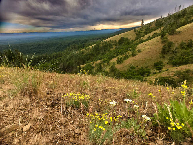
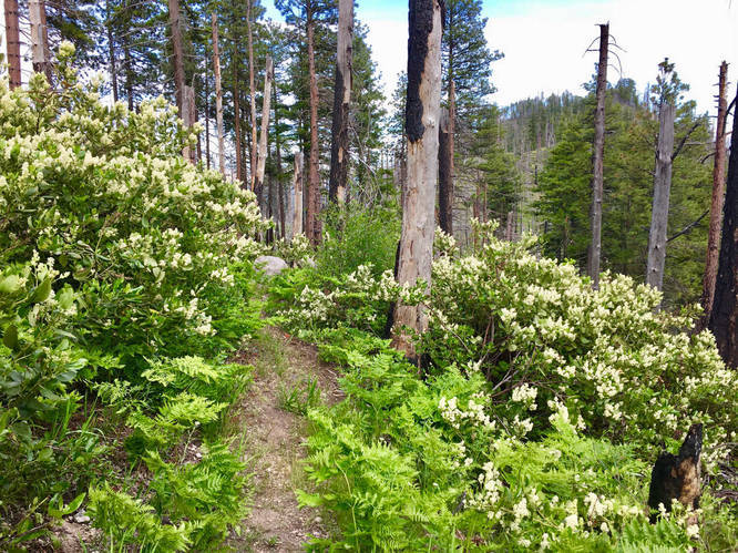
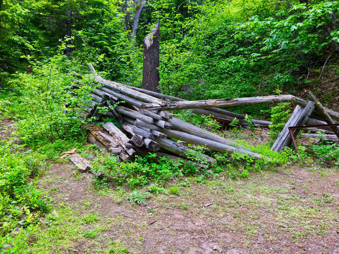
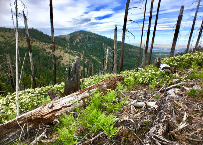
The loop hike is a great early season hike, melting out sooner than many other areas in the Mount Hood National Forest. Because it is so far east, it is much more likely to be sunny on a cloudy day in the Willamette Valley or the western Cascades. There are a few views along this hike. The first part of the hike follows Little Badger Creek. At the middle of the hike is an extremely steep section of trail climbing out of the Little Badger Creek valley. The trail starts climbing steeply past the old mine and collapsed cabin. Once at the top, take the School Canyon Trail to the right. This will lead down to the School Canyon Trailhead, where a cross country route is required to keep the loop under 10 miles.

To complete this loop in under 10 miles, you will need to do some cross-country (off-trail) hiking down a steep grassy slope to rejoin the Little Badger Creek Trail near the trailhead. You will need to hike down the road from the School Canyon trailhead along FR-27 to a point that you can head downhill. Use a GPS or a map and compass. 
If you do not want to do this option, you can hike down the road from the School Canyon Trailhead and take Road 2710 (on your right coming down from the School Canyon Trailhead). FR-27 to FR-2710 will take you back to the Little Badger Creek Trailhead. It will add a few miles.  
Explore 13 trails near Tygh Valley, OR

Know Before You Go

  • The Little Badger Creek-Ball Point-School Canyon Loop Trail is a 9.4-mile early-season hike near Tygh Valley, Oregon, known for its sunnier weather compared to the western Cascades.
  • The trail features diverse terrain, including a section along Little Badger Creek, a very steep climb past an old mine and collapsed cabin, and views at the top.
  • Completing the loop under 10 miles requires a challenging, off-trail descent using GPS or map/compass skills; an alternative, longer route follows forest roads.
Interactive topographic map for Little Badger Creek-Ball Point-School Canyon Loop Trail located in Tygh Valley, OR. Click the "View Map" button to load GPS coordinates and trail markers.
Get directions
Distance
9.4 mi
Difficulty
Hard
Type
Loop
Est. Time
4.7 hrs
Elev. Gain
1,941'
Rating
0.0
Added
September 15, 2017
Updated
June 16, 2018

Weather Forecast

Loading...
Total Change
1,925'
Ascent
1,941'
Descent
1,585'
Loading...

Download the GPX Data for Offline Use

Supporters get exclusive access to download trail routes to the MyHikes app for offline use. Stay prepared on your adventure, even without an internet connection! Become a Supporter today to unlock this feature and hike with confidence.

Download Little Badger Creek-Ball Point-School Canyon Loop Trail GPX Data to the MyHikes Mobile App

Features

Vista / Lookout Point
Dogs
Camping
Water Source

Points of interest

  1. Parking

    45.287478, -121.361242
  2. Main Trailhead

    45.287647, -121.361361
  3. Beautiful vista

    45.306964, -121.379394
    Beautiful vista
  4. Dead standing trees from past forest fires

    45.311486, -121.399911
    Dead standing trees from past forest fires

Safety information

For your own safety: plan ahead, let someone know where you'll be, and hike at your own risk.

Hazards

Snakes (Rattlesnakes, Copperheads, others)

Availability

Spring, Summer, Fall

Surface type

Dirt

Trip Reports (Reviews)

Your opinion matters! Be the first to rate this trail.

Ready to help fellow hikers? Add a trip report to share your experience and provide valuable insights for other hikers!

No community routes found. To add your own hike as a Community Route for this Trail guide, leave a Trip Report with an attached GPX file.

Popular categories

Scenic mountain view representing vista trails
Vista trails
Scenic gorge of cascades representing waterfall trails
Waterfall hikes
Rugged mountain terrain representing summit trails
Summit trails
Scenic mountain view representing dog-friendly trails
Dog-friendly
Scenic campsite with a view representing camping trails
Camping trails
Appalachian Trail logo representing A.T. hikes
A.T. hikes

You May Also Like

Glacier's Going-to-the-Sun Road - Discover the breathtaking beauty of Glacier National Park along the iconic Going-to-the-Sun Road. From stunning roadside stops to picturesque waterfalls and vistas, this engineering marvel offers endless opportunities for exploration.
Explore

Glacier's Going-to-the-Sun Road

Discover the breathtaking beauty of Glacier National Park along the iconic Going-to-the-Sun Road. From stunning roadside stops to picturesque waterfalls and vistas, this engineering marvel offers endless opportunities for exploration.

Read
Colorado's Million Dollar Highway - Plan a day's drive adventure along the iconic Million Dollar Highway in Colorado. Explore the best short trails, roadside stops, waterfalls, vistas, ghost towns, and hot springs within a ~6 hour road trip.
Explore

Colorado's Million Dollar Highway

Plan a day's drive adventure along the iconic Million Dollar Highway in Colorado. Explore the best short trails, roadside stops, waterfalls, vistas, ghost towns, and hot springs within a ~6 hour road trip.

Read
🍪 We use cookies to learn about site usage and to serve map tiles. You may block cookies manually in the browser. By continuing you agree. Learn more