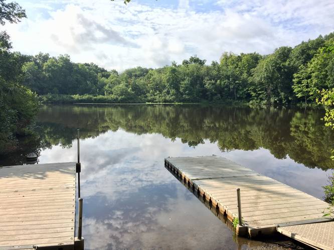
Mount Holyoke College Upper Lake Loop Trail
The trail is easy to follow as you just need to stay right or stay left to continue following the water, depending on which direction you walk it.
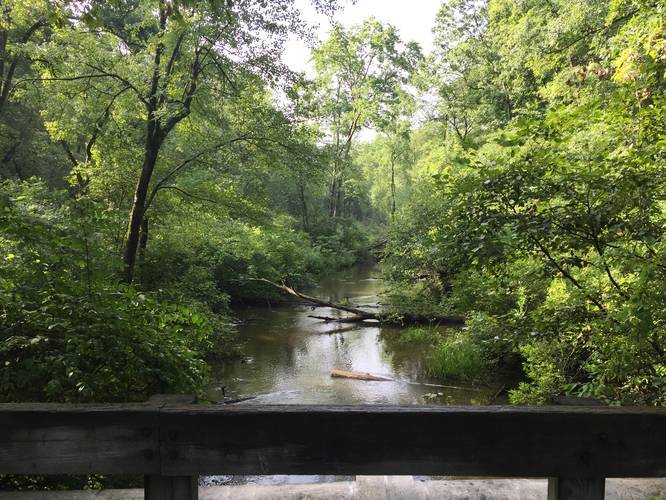
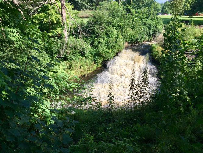
Waterfall: Along the western side of the lake is a dam with the Stony Brook waterfall cascading down, about 12 feet tall, that feeds into Stony Brook.
Dogs are allowed. No biking.
Know Before You Go
Interactive topographic map for Mount Holyoke College Upper Lake Loop Trail located in South Hadley, MA. Click the "View Map" button to load GPS coordinates and trail markers.
View map
Get directions
- Distance
- 1.0 mi
- Difficulty
- Easy
- Type
- Loop
- Est. Time
- 30 min
- Elev. Gain
- 51'
- Rating
- 0.0
- Added
- August 09, 2018
- Updated
- January 23, 2020
Weather Forecast
This Afternoon
High
84°F
Sunny
Tonight
Low
52°F
Mostly Clear
Saturday
High
85°F
Sunny
Saturday Night
Low
56°F
Mostly Clear
Sunday
High
85°F
Sunny
Sunday Night
Low
58°F
Partly Cloudy
Monday
High
85°F
Mostly Sunny then Slight Chance Showers And Thunderstorms
Monday Night
Low
61°F
Slight Chance Showers And Thunderstorms then Chance Showers And Thunderstorms
Tuesday
High
79°F
Showers And Thunderstorms
Tuesday Night
Low
62°F
Showers And Thunderstorms Likely
Wednesday
High
80°F
Chance Rain Showers
Wednesday Night
Low
60°F
Chance Showers And Thunderstorms then Mostly Cloudy
Thursday
High
80°F
Mostly Sunny then Slight Chance Rain Showers
Thursday Night
Low
60°F
Slight Chance Rain Showers then Partly Cloudy
Don't let Google decide who you trust.


Loading...
<strong>Trail map and elevation chart not rendering in print mode?</strong> Simply scroll to the trail map section, then try printing again!
Total Change
33 ft.
10 m
10 m
Ascent
51 ft.
16 m
16 m
Descent
40 ft.
12 m
12 m
Loading...
Features
- Dogs
- Water Source
Points of interest
-
Parking
42.259112, -72.571472 -
Main Trailhead
42.258492, -72.571745 -
View / Overlook / Vista
42.258872, -72.568297 -
Eastern Stony Brook
42.257733, -72.564431
-
Parking
42.259112, -72.571472 -
Main Trailhead
42.258492, -72.571745
Safety information
For your own safety: plan ahead, let someone know where you'll be, and hike at your own risk.
Availability
All seasons
Surface type
Semi-Paved
Trip Reports (Reviews)
Ready to help fellow hikers? Add a trip report to share your experience!
No community routes found. To add your own hike as a Community Route for this Trail guide, leave a Trip Report with an attached GPX file.


You may also like

Explore
Best of the Alps: Hiking, Adventure & Scenery
Plan your ultimate European Alps adventure! Discover the best hiking trails, epic scenery, and villages in the Swiss Alps, Dolomites, Chamonix, and Lake Como.

Explore
Colorado's Million Dollar Highway
Plan a day's drive adventure along the iconic Million Dollar Highway in Colorado. Explore the best short trails, roadside stops, waterfalls, vistas, ghost towns, and hot springs within a ~6 hour road trip.

Explore
Glacier's Going-to-the-Sun Road
Discover the breathtaking beauty of Glacier National Park along the iconic Going-to-the-Sun Road. From stunning roadside stops to picturesque waterfalls and vistas, this engineering marvel offers endless opportunities for exploration.

Explore
Hike Washington's National Parks & Forests
Find the best day hikes in Washington's National Parks and Forests. Explore panoramic alpine vistas, turquoise lakes, and stunning waterfalls.
a park

