The Mother's Bog Loop in Brewster, Massachusetts is an easy 0.5-mile loop hike that encompasses a old cranberry bog and features colorful natural scenery.
Hike Description
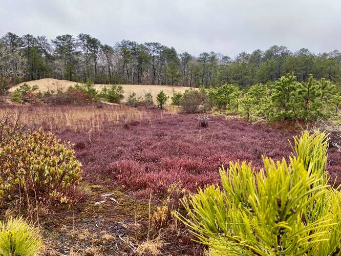
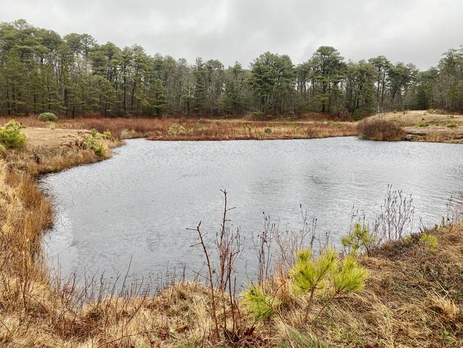
This hike begins at the end of the entrance road for Mother's Bog where the large road gate sits. Hikers can choose either direction to walk around the bog, but this GPS track follow a clockwise direction by heading along the southern half first. Along the way, hikers get views essentially the entire time, but depending on where you're standing, the views and colors of the red-tinted cranberry bog plants and pine trees will vary. The most colorful section, during early April 2023 that-is, were closer to the western end of the bog where you get views of the sandy hills, pine trees, and red cranberry plants.
Eventually the sandy trail will make its way back to parking for an easy 0.5-mile hike.
History
As found on the Brewster Conservation Trust's site: "In 2006 & 2007, the Town of Brewster purchased an assemblage of properties totaling 59 acres straddling Slough Road in SW Brewster for conservation. Included was an 8-acre working cranberry bog called Mother’s Bog, named after “Mother” Louise Crowell, whose family ran the bogs for many years.". To find out more history, please check out the Brewster Conservation Trust's website.
Parking
Hikers will find parking at the coordinates provided, located at the end of the service road that leads to Mother's Bog. The parking lot is large enough to fit about 10 vehicles.
Pets
Dogs are allowed if leashed and must be cleaned up after.
Hike Description
This hike begins at the end of the entrance road for Mother's Bog where the large road gate sits. Hikers can choose either direction to walk around the bog, but this GPS track follow a clockwise direction by heading along the southern half first. Along the way, hikers get views essentially the entire time, but depending on where you're standing, the views and colors of the red-tinted cranberry bog plants and pine trees will vary. The most colorful section, during early April 2023 that-is, were closer to the western end of the bog where you get views of the sandy hills, pine trees, and red cranberry plants.
Eventually the sandy trail will make its way back to parking for an easy 0.5-mile hike.
History
As found on the Brewster Conservation Trust's site: "In 2006 & 2007, the Town of Brewster purchased an assemblage of properties totaling 59 acres straddling Slough Road in SW Brewster for conservation. Included was an 8-acre working cranberry bog called Mother’s Bog, named after “Mother” Louise Crowell, whose family ran the bogs for many years.". To find out more history, please check out the Brewster Conservation Trust's website.
Parking
Hikers will find parking at the coordinates provided, located at the end of the service road that leads to Mother's Bog. The parking lot is large enough to fit about 10 vehicles.
Pets
Dogs are allowed if leashed and must be cleaned up after.