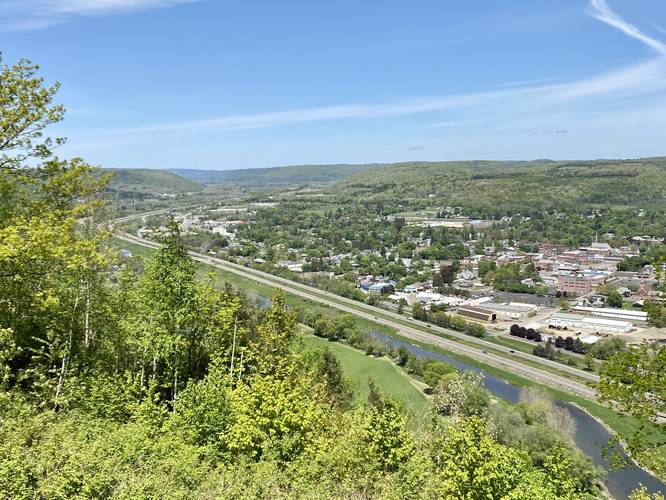
Mossy Bank Park Overlook at Mossy Bank Park in Bath, New York is an easy 0.2-mile walk to explore the views of Bath, the Cohocton River, and the surrounding hills.
This is not a hike but rather a short walk that leads to a drive-up overlook pavilion. Visitors, if they wish, can walk down the steep hillside (as depicted in this trail) to the Green Trail at the park which provides a similar, but slightly different view of the Cohocton River, the town of Bath, and the surrounding hills. The hillside walk down is quite steep.
Parking
Visitors will find several parking turnouts near the coordinates provided, located on the skinny driveable dirt road labeled Overlook Road.
Pets
Dogs are allowed if leashed and cleaned up after.
Warning
Garter snakes: During warm months, the Green Trail's overlook section is a popular spot for Garter snakes to sunbathe. While not an issue, they might not be favorable for folks who don't like snakes, thus you can stay up top at the overlook pavilion.