The Morris Trail at Tioga State Forest in Elk Township near Blackwell and Leetonia, Pennsylvania is an easy 2.8-mile out-and-back trail that leads to two vista points at the end of the trail with views of Pennsylvania Wilds' mountains above Slate Run creek.
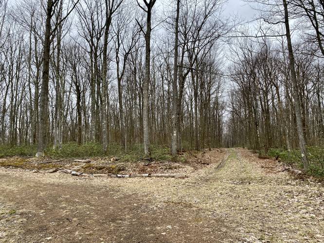
This trail begins at the yellow service road gate and follows the main service road all the way out to the lookout point. Shortly after hiking in, there will be a right-hand turn that leads down an overgrown trail - skip this offshoot loop and stay left along the main service road.
The trail undulates slightly but is mostly flat. Recent rainfalls can make the trail muddy in certain areas, but the worst sections of mud are closest to the trailhead and the first 0.5-miles of the hike.
About 0.5-miles from reaching the vista point is a trail junction where the wildlife conservation fence takes a left-hand turn. Skip this left-hand turn and continue straight - this will lead to the vista point.
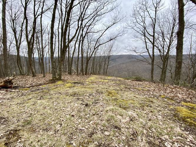
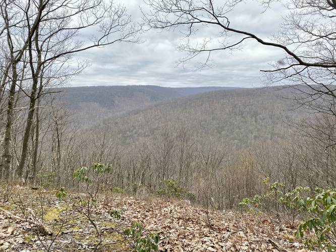
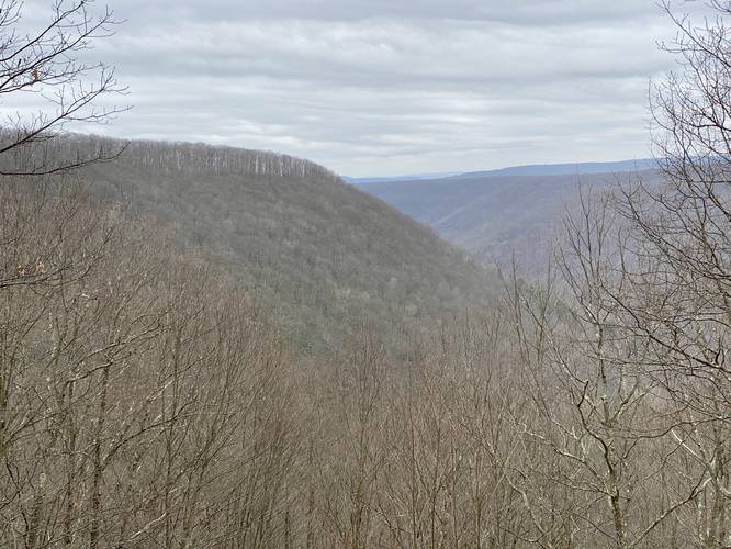
Once at the vista point, take in the views from the obvious vista at the end of the trail, but also the vista point to the left of the end of the trail, about 50-feet away.
The hike back is generally easy except for the initial climb from the vista point back up to the ridge of the mountain. Regardless, this hike should be considered easy.
Vistas
At the end of the trail are two vista points. The first vista is the obvious lookout point at the end of the trail. The second vista point can be found to the left of the end of the trail, about 50-feet away through the trees. This second vista faces south looking down the mountain ravine that Slate Run creek cuts its way through.
Parking
Hikers will find parking at the coordinates provided. There's parking off of the road next to the gate, but do not block the gate.
Camping and Backpacking
Camping is allowed on this trail per the Tioga State Forest dispersed/primitive/backcountry camping rules. The only pre-built campsites along this trail that we found were next to the vista point.
Pets
Dogs are allowed if leashed.
Buggy
Please note that the trail becomes extremely buggy at the vista point. We hiked this trail in late April, 2020 and the black flies were swarming so much we had to take pictures and hike back immediately. Bringing a face net on this hike might improve the lookout point - or hiking this trail in very early Spring (late March) or late Fall if the snow-pack allows for driving down this road.
Winter Road Conditions
Tioga State Forest does not maintain this road during the winter. Do not attempt driving on this road without proper equipment including snow tires and/or chains unless the road is clear. High wind storms may also cause trees to fall across the road, making the road impassible. If you plan to visit during the winter, plan accordingly.
This trail begins at the yellow service road gate and follows the main service road all the way out to the lookout point. Shortly after hiking in, there will be a right-hand turn that leads down an overgrown trail - skip this offshoot loop and stay left along the main service road.
The trail undulates slightly but is mostly flat. Recent rainfalls can make the trail muddy in certain areas, but the worst sections of mud are closest to the trailhead and the first 0.5-miles of the hike.
About 0.5-miles from reaching the vista point is a trail junction where the wildlife conservation fence takes a left-hand turn. Skip this left-hand turn and continue straight - this will lead to the vista point.
Once at the vista point, take in the views from the obvious vista at the end of the trail, but also the vista point to the left of the end of the trail, about 50-feet away.
The hike back is generally easy except for the initial climb from the vista point back up to the ridge of the mountain. Regardless, this hike should be considered easy.
Vistas
At the end of the trail are two vista points. The first vista is the obvious lookout point at the end of the trail. The second vista point can be found to the left of the end of the trail, about 50-feet away through the trees. This second vista faces south looking down the mountain ravine that Slate Run creek cuts its way through.
Parking
Hikers will find parking at the coordinates provided. There's parking off of the road next to the gate, but do not block the gate.
Camping and Backpacking
Camping is allowed on this trail per the Tioga State Forest dispersed/primitive/backcountry camping rules. The only pre-built campsites along this trail that we found were next to the vista point.
Pets
Dogs are allowed if leashed.
Buggy
Please note that the trail becomes extremely buggy at the vista point. We hiked this trail in late April, 2020 and the black flies were swarming so much we had to take pictures and hike back immediately. Bringing a face net on this hike might improve the lookout point - or hiking this trail in very early Spring (late March) or late Fall if the snow-pack allows for driving down this road.
Winter Road Conditions
Tioga State Forest does not maintain this road during the winter. Do not attempt driving on this road without proper equipment including snow tires and/or chains unless the road is clear. High wind storms may also cause trees to fall across the road, making the road impassible. If you plan to visit during the winter, plan accordingly.