Loading...

WINTER SALE! 50% OFF Supporter Accounts — now through January 31st. Learn More.

Meek's Run Trail

Meek's Run Trail at Montour Woods Conservation Area in Moon, Pennsylvania is an easy 1.4 mile one-way trail that runs from 1899 Hassam Rd to the end of Downing Drive.

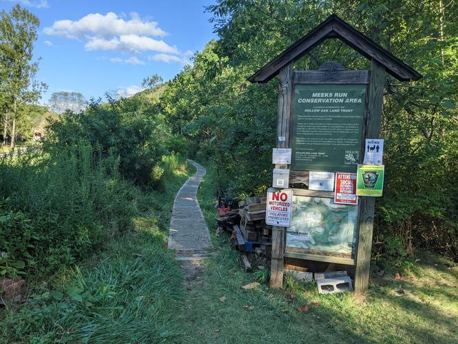
The blue-blazed trail first passes through a marshy field with a boardwalk and then immediately heads into the woods along Meek's Run. The trail crosses the stream a couple of times, so prepare to rock hop or get your feet wet.

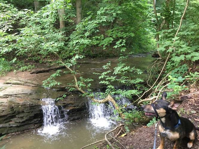
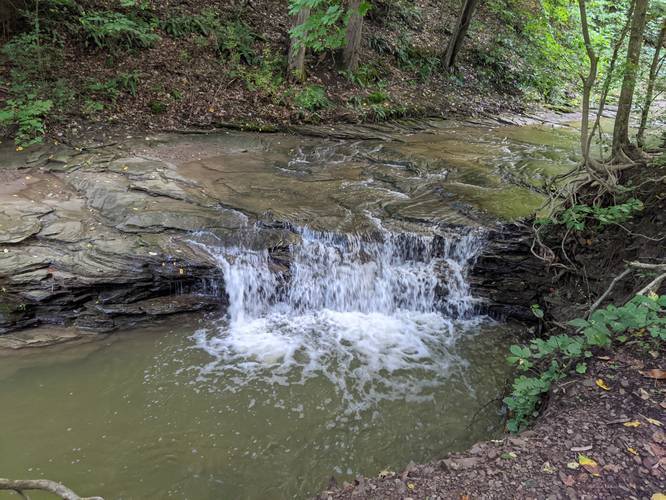
There's a small waterfall just after the sign for parking to Hassam Rd - or just after coming down the hill from parking at Hassam Rd.

For a 2.4 mile loop, try taking the Oil Well Trail back to parking.

Parking
Hikers will find parking at either end of the trail. The coordinates here will bring you to the end of Downing Drive at a circular-parking area near the trailhead.

Pets
Dogs are allowed if leashed and must be cleaned up after.
Explore 213 trails near Moon Township, PA

Know Before You Go

  • Meek's Run Trail is a 1.4-mile, one-way, easy trail in Moon Township, PA, featuring a marshy field, woods, and stream crossings.
  • Be prepared to rock hop or get your feet wet as the trail crosses Meek's Run multiple times, and there's a small waterfall near the Hassam Rd parking sign.
  • Parking is available at both ends of the trail (Hassam Rd and Downing Drive), and leashed dogs are permitted with cleanup.
Interactive topographic map for Meek's Run Trail located in Moon Township, PA. Click the "View Map" button to load GPS coordinates and trail markers.
Get directions
Distance
1.4 mi
Difficulty
Easy
Type
One-Way
Est. Time
42 min
Elev. Gain
110'
Rating
0.0
Added
July 08, 2017
Updated
April 25, 2023

Weather Forecast

Loading...
Total Change
144'
Ascent
110'
Descent
143'
Loading...

Download the GPX Data for Offline Use

Supporters get exclusive access to download trail routes to the MyHikes app for offline use. Stay prepared on your adventure, even without an internet connection! Become a Supporter today to unlock this feature and hike with confidence.

Download Meek's Run Trail GPX Data to the MyHikes Mobile App

Features

Dogs
Waterfalls
Water Source
Biking

Points of interest

  1. Parking

    40.491189, -80.173266
  2. Main Trailhead

    40.49101, -80.173187

Safety information

For your own safety: plan ahead, let someone know where you'll be, and hike at your own risk.

Markers

Blaze Color

Blue

Availability

Summer

Surface type

Dirt

Trip Reports (Reviews)

Your opinion matters! Be the first to rate this trail.

Ready to help fellow hikers? Add a trip report to share your experience and provide valuable insights for other hikers!

1.17 miles / 1.9 km
September 23, 2020
Hiking
1.4 miles / 2.3 km
August 29, 2020
Hiking
1.4 miles / 2.3 km
June 24, 2018
Hiking
No community routes found. To add your own hike as a Community Route for this Trail guide, leave a Trip Report with an attached GPX file.

Popular categories

Scenic mountain view representing vista trails
Vista trails
Scenic gorge of cascades representing waterfall trails
Waterfall hikes
Rugged mountain terrain representing summit trails
Summit trails
Scenic mountain view representing dog-friendly trails
Dog-friendly
Scenic campsite with a view representing camping trails
Camping trails
Appalachian Trail logo representing A.T. hikes
A.T. hikes

You May Also Like

New York's Best Waterfalls - Whether you're planning a day hike, roadside stop, or a leisurely short walk, this guide provides hikers, travelers, and locals alike with 63 different locations to over 100 scenic waterfalls to help plan your next adventure!
Explore

New York's Best Waterfalls

Whether you're planning a day hike, roadside stop, or a leisurely short walk, this guide provides hikers, travelers, and locals alike with 63 different locations to over 100 scenic waterfalls to help plan your next adventure!

Read
🍪 We use cookies to learn about site usage and to serve map tiles. You may block cookies manually in the browser. By continuing you agree. Learn more