The Mokolea Point Trail near Kahakuloa, Hawaii (Maui) is an easy 0.3-mile out-and-back hike that leads to Mokolea Point and features views of Maui's northern coastline including Kahakuloa Head.
Hike Description
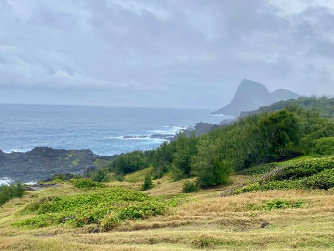
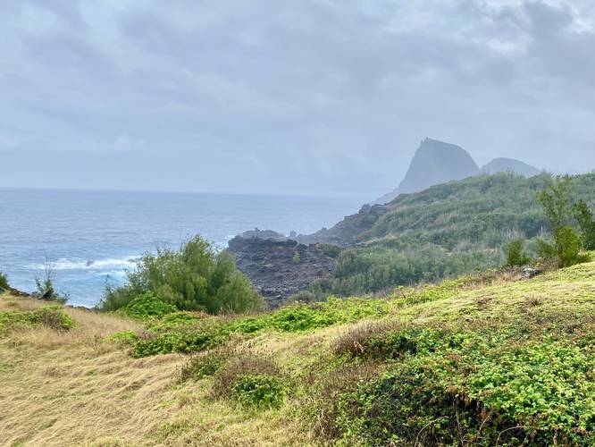
This hike begins along the Kahekili Highway (HI-340) and follows a wide dirt trail as it leads out to Mokolea Point. Along the way are several vista points where hikers can get views of Kahakuloa Head (Pu'u Koa'e and Pu'ukahuli'anapa) and Maui's rugged northern coastline.
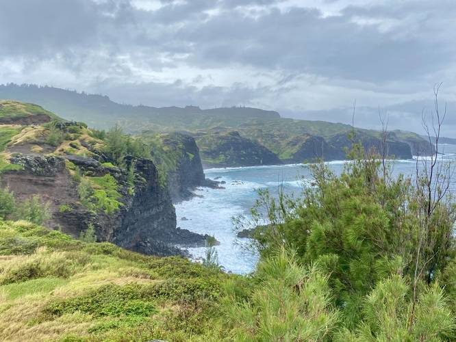
The trail begins to turn west and it seemingly connects back to the highway, but this recording stops just over halfway to the other trailhead. There's a large pile of rocks that I climbed up to take some additional photos, where this GPS track ends. From the large rock pile, you get better views of the coastline; however, it's not necessary to climb it for views.
Parking
Hikers will find small parking turnouts by the coordinates provided - large enough to fit five vehicles. As of February 2023, there were massive potholes at the parking turnouts, so park at your own risk.
Pets
Dogs appear to be allowed if leashed and must be cleaned up after.
Respecting the Land
Hawaiian land is considered sacred to native Hawaiians and many locals, so please stay on-trail, take nothing but photos, and leave nothing but footprints. Respect the locals - don't stay for long and have a backup hike planned in case the parking lot is full.
Hike Description
This hike begins along the Kahekili Highway (HI-340) and follows a wide dirt trail as it leads out to Mokolea Point. Along the way are several vista points where hikers can get views of Kahakuloa Head (Pu'u Koa'e and Pu'ukahuli'anapa) and Maui's rugged northern coastline.
The trail begins to turn west and it seemingly connects back to the highway, but this recording stops just over halfway to the other trailhead. There's a large pile of rocks that I climbed up to take some additional photos, where this GPS track ends. From the large rock pile, you get better views of the coastline; however, it's not necessary to climb it for views.
Parking
Hikers will find small parking turnouts by the coordinates provided - large enough to fit five vehicles. As of February 2023, there were massive potholes at the parking turnouts, so park at your own risk.
Pets
Dogs appear to be allowed if leashed and must be cleaned up after.
Respecting the Land
Hawaiian land is considered sacred to native Hawaiians and many locals, so please stay on-trail, take nothing but photos, and leave nothing but footprints. Respect the locals - don't stay for long and have a backup hike planned in case the parking lot is full.