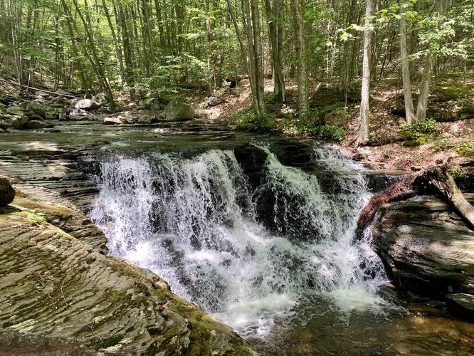
Miners Falls at the McIntyre Wild Area near McIntyre Township, Pennsylvania is a moderate 0.4-mile out-and-back hike up to two waterfalls along Miners Run - Lower and Middle Miners Falls - both about 6 to 8-feet tall and 5 to 10-feet wide. While Middle Miners Falls is difficult to reach, hikers will find Lower Miners Falls right next to the parking lot.
Hike Description
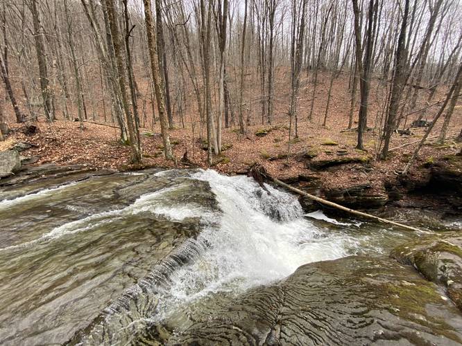
This trail is both a super easy and short walk or a longer bushwhack with some danger and rocky upstream creek hiking. Hikers can choose to enjoy the lower falls section of Miners Falls within the first 100-feet of entering the trail. Heading up the left-hand side of Miners Run, hikers first hit Lower Miners Falls in less than 100-feet. Miners Run creek has two different rock outcroppings that hikers can use to photograph this waterfall.
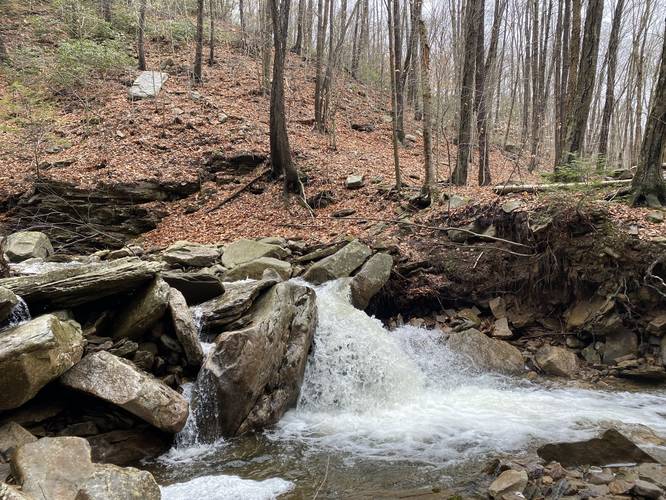
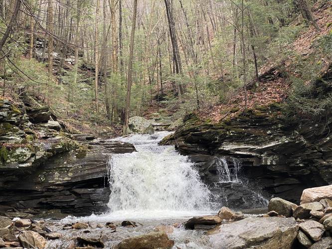
Heading upstream from here, to find Middle Miners Falls, is a bit of a challenge and bushwhack. Hikers will need to cut through the woods, pass rocky creek beds, and eventually hike along a steep incline to reach Middle Falls, which sits within a large rocky gorge. This is where the track ends. There appears to be one more waterfall upstream from Middle Miners Falls; however, reaching that waterfall, by following this route, is extremely dangerous as hikers either need to scale Middle Miners Falls to climb upstream or they need to hike along a very skinny, but very steep (20-foot drop) sketchy section of land that cuts around this large gorge area.
Please note that the trail depicted on the state forest map (Miners Run Trail) heads up the right-hand side of the creek, while this hike follows the left-hand side.
Bouldering
Adjacent to Miners Falls are two large boulders, about 8-feet tall, that can be used for bouldering as well.
Parking
Hikers can find a small parking lot next to the bridge along Miners Run at the coordinates provided. The lot is large enough for about three vehicles.
Pets
Dogs are allowed if leashed and their waste must be carried out by the hiker.
Warning
Rattlesnakes: While rare, the Timber Rattlesnake lives in this area and tends to come down to creeks to cool down or hunt between the end of April through the end of September. Watch your step and give any rattlesnake you see some space.
Hike Description
This trail is both a super easy and short walk or a longer bushwhack with some danger and rocky upstream creek hiking. Hikers can choose to enjoy the lower falls section of Miners Falls within the first 100-feet of entering the trail. Heading up the left-hand side of Miners Run, hikers first hit Lower Miners Falls in less than 100-feet. Miners Run creek has two different rock outcroppings that hikers can use to photograph this waterfall.
Heading upstream from here, to find Middle Miners Falls, is a bit of a challenge and bushwhack. Hikers will need to cut through the woods, pass rocky creek beds, and eventually hike along a steep incline to reach Middle Falls, which sits within a large rocky gorge. This is where the track ends. There appears to be one more waterfall upstream from Middle Miners Falls; however, reaching that waterfall, by following this route, is extremely dangerous as hikers either need to scale Middle Miners Falls to climb upstream or they need to hike along a very skinny, but very steep (20-foot drop) sketchy section of land that cuts around this large gorge area.
Please note that the trail depicted on the state forest map (Miners Run Trail) heads up the right-hand side of the creek, while this hike follows the left-hand side.
Bouldering
Adjacent to Miners Falls are two large boulders, about 8-feet tall, that can be used for bouldering as well.
Parking
Hikers can find a small parking lot next to the bridge along Miners Run at the coordinates provided. The lot is large enough for about three vehicles.
Pets
Dogs are allowed if leashed and their waste must be carried out by the hiker.
Warning
Rattlesnakes: While rare, the Timber Rattlesnake lives in this area and tends to come down to creeks to cool down or hunt between the end of April through the end of September. Watch your step and give any rattlesnake you see some space.