Milton State Park Loop at Milton State Park in Milton, Pennsylvania is an easy 1.7-mile loop hike that features views of the West Branch Susquehanna River.
Universal Access
Only a portion of this loop is universally-accessible. The Mid Trail, which encompasses the soccer fields side of the park, is universally accessible and follows a very-flat crushed gravel pathway. The Mid Trail begins at the parking lot and trailhead provided and loops back to the same spot. The South Trail section of this loop is not universally accessible. The pathway should be obvious to visitors and walkers.
Trails
This hike follows two named trails within the park: Mid Trail, South Trail.
Hike Description
This hike begins at the western-most parking lot, at the parking coordinates provided, located just north of the entrance to Milton State Park. Following this GPS track, hikers will start along the northern trailhead at the parking lot to follow the crushed gravel, universally-accessible pathway as it loops around the fields within the northern section of the park. This part of the trail is open with soccer fields that sit in the middle of the loop.
South Trail - Mile 0.45
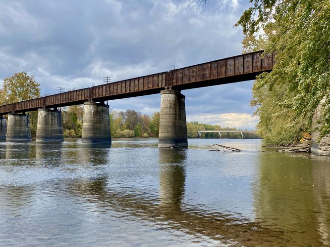
At mile 0.45, the Mid Trail will head westward to complete its own loop; however, to follow this GPS track, hikers will head straight south to walk under the PA-642 bridge to reach the South Trail. Along the way to the South Trail is a short out-and-back walk that leads down a boat ramp to reach a view of the West Branch Susquehanna River.
South Trail to Island Point - Mile 0.55 to 1.1
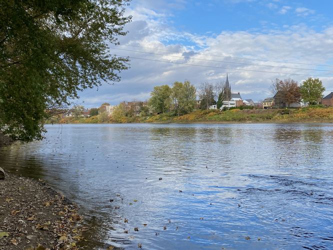
At mile 0.55, hikers will start along the South Trail at the signage provided. The South Trail encompasses the south part of Milton State Park's island and leads to a beautiful viewing point at the end of the island. Along the way, hikers will pass through a more closed-in forest with tall grasses and invasive species of what looked like bamboo. Eventually, around mile 1.1, hikers will reach the very end of the Milton State Park island with a nice view of the West Branch Susquehanna River.
Hiking Back to Parking - Mile 1.1 to 1.7
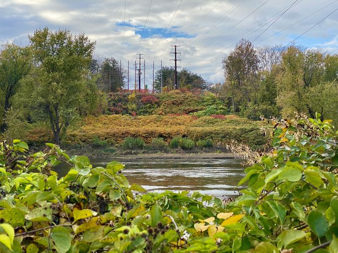
After exploring the south tip of the island, hikers can head up the western side of it by following the rest of the South Trail. Along the way will be more opportunities to view the river. During Autumn, some of the foliage along the banks of the river can really be popping, especially in multi-colored rows near the powerline crossing. There's also a spot to hike off-trail to reach the banks of the river to get another view of the west side of it before leaving. Eventually, the trail will reach the road bridge once more -- hikers will head under the bridge and walk straight to reach the parking lot and complete the 1.7-mile loop.
Parking
Hikers will find a medium-sized parking lot at the coordinates provided, at Milton State Park just north of the entrance road off of the PA-642 bridge. The lot is large enough to fit just under a dozen vehicles as of October 2023.
Pets
Dogs are allowed only if leashed and must be cleaned up after.
Universal Access
Only a portion of this loop is universally-accessible. The Mid Trail, which encompasses the soccer fields side of the park, is universally accessible and follows a very-flat crushed gravel pathway. The Mid Trail begins at the parking lot and trailhead provided and loops back to the same spot. The South Trail section of this loop is not universally accessible. The pathway should be obvious to visitors and walkers.
Trails
This hike follows two named trails within the park: Mid Trail, South Trail.
Hike Description
This hike begins at the western-most parking lot, at the parking coordinates provided, located just north of the entrance to Milton State Park. Following this GPS track, hikers will start along the northern trailhead at the parking lot to follow the crushed gravel, universally-accessible pathway as it loops around the fields within the northern section of the park. This part of the trail is open with soccer fields that sit in the middle of the loop.
South Trail - Mile 0.45
At mile 0.45, the Mid Trail will head westward to complete its own loop; however, to follow this GPS track, hikers will head straight south to walk under the PA-642 bridge to reach the South Trail. Along the way to the South Trail is a short out-and-back walk that leads down a boat ramp to reach a view of the West Branch Susquehanna River.
South Trail to Island Point - Mile 0.55 to 1.1
At mile 0.55, hikers will start along the South Trail at the signage provided. The South Trail encompasses the south part of Milton State Park's island and leads to a beautiful viewing point at the end of the island. Along the way, hikers will pass through a more closed-in forest with tall grasses and invasive species of what looked like bamboo. Eventually, around mile 1.1, hikers will reach the very end of the Milton State Park island with a nice view of the West Branch Susquehanna River.
Hiking Back to Parking - Mile 1.1 to 1.7
After exploring the south tip of the island, hikers can head up the western side of it by following the rest of the South Trail. Along the way will be more opportunities to view the river. During Autumn, some of the foliage along the banks of the river can really be popping, especially in multi-colored rows near the powerline crossing. There's also a spot to hike off-trail to reach the banks of the river to get another view of the west side of it before leaving. Eventually, the trail will reach the road bridge once more -- hikers will head under the bridge and walk straight to reach the parking lot and complete the 1.7-mile loop.
Parking
Hikers will find a medium-sized parking lot at the coordinates provided, at Milton State Park just north of the entrance road off of the PA-642 bridge. The lot is large enough to fit just under a dozen vehicles as of October 2023.
Pets
Dogs are allowed only if leashed and must be cleaned up after.