The Mills Lake - The Loch - Lake Haiyaha - Dream Lake - Nymph Lake Loop at Rocky Mountain National Park near Estes Park, Colorado is a moderate 8.6-mile loop hike that features stunning views of alpine lakes, waterfalls, and the surrounding mountains.
Trails
This hike follows several named trails in order: Glacier Gorge Trail, Sky Pond Trail, Lake Haiyaha Trail, Emerald Lake Trail. Note that you can add the Bear Lake Trail to this list to make a 9.4-mile loop hike as that trail is found at the same trailhead.
Points-of-Interest (What You'll See)
This hike brings visitors to many different points-of-interest along the way including Alberta Falls, Glacier Falls, Mills Lake, The Loch (lake), Icy Brook Falls, backcountry ponds and mountain views, Lake Haiyaha and its turquoise waters, Dream Lake, Tyndall Falls, and Nymph Lake (to name a few).
Hike
This hike begins at the main trailhead at the end of Bear Lake Road in the park and follows the Glacier Gorge Trail as it makes its way up the mountain toward Mills Lake and Alberta Falls. The initial part of the trail heads downhill for a short while before heading back uphill.
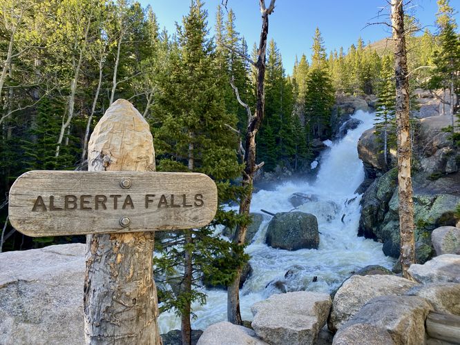
Trailhead to Alberta Falls - Mile 0 to 1
From mile 0 to Alberta Falls (mile 1), the trail follows a curated national park pathway that has minimal tripping hazards and nicely-spaced steps that form a very gradual grade. Hikers will find several off-trail views of waterfalls and cascades that spill down Glacier Creek. At mile 1.1, hikers will reach the stunning Alberta Falls as it roars down Glacier Creek. This spot is a great place to take a short break and to enjoy the waterfall before hiking onward toward Mills Lake.
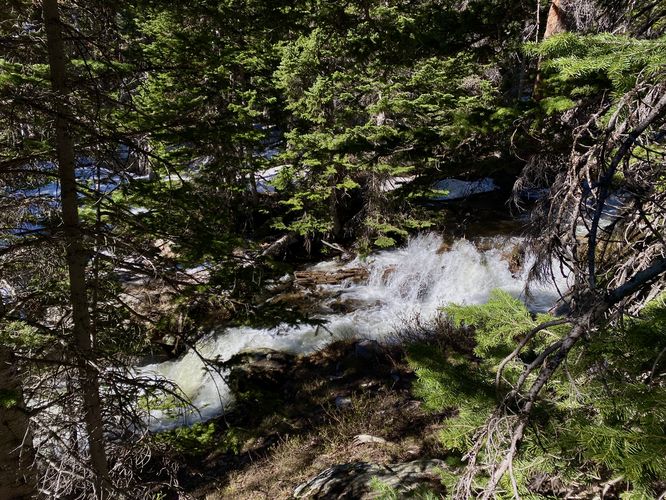
Alberta Falls to Glacier Falls - Mile 1 to 2.6
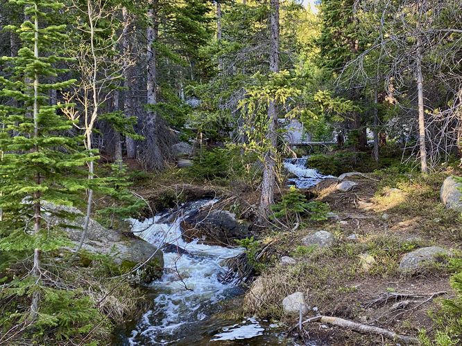
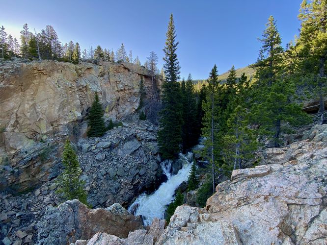
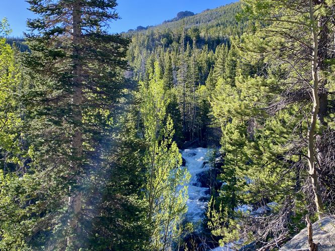
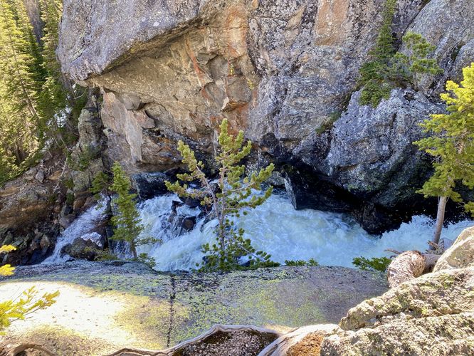
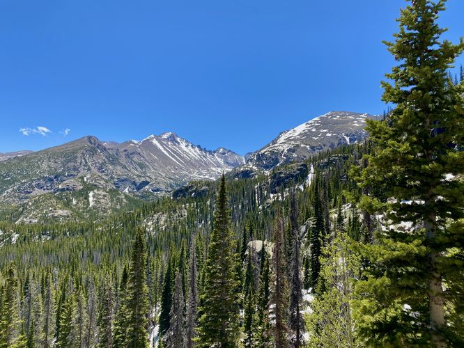
After visiting Alberta Falls, hikers will head toward Mills Lake which has a large waterfall stop along the way - Glacier Falls. Along the way you'll find views starting around mile 1.5. From mile 1.9 to 2.2, hikers will find more sweeping views of the mountains as the trail passes through a more open area - here you can see where you'll hike up the mountain to reach Mills Lake. At mile 2.3, there's a trail junction for Mills Lake, The Loch, and Lake Haiyaha - here you'll want to keep left to hike up toward Mills Lake. Along the way up to the lake, you'll cross a stream via a footbridge before reaching Glacier Falls. Glacier Falls can be found with an off-trail view, located along a rocky outcropping, around mile 2.6. Here you must be super careful to get a decent view of Glacier Falls as the rock outcropping plummets with steep cliffs for dozens of feet to the water below.
Hiking to Mills Lake - Mile 2.9
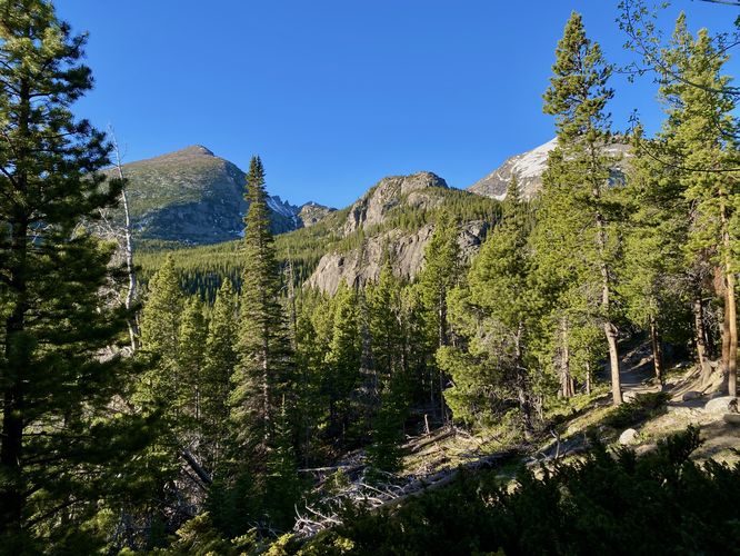
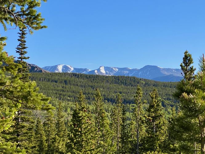
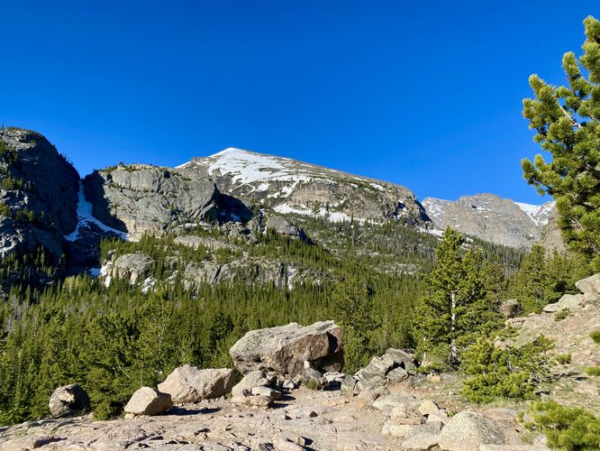
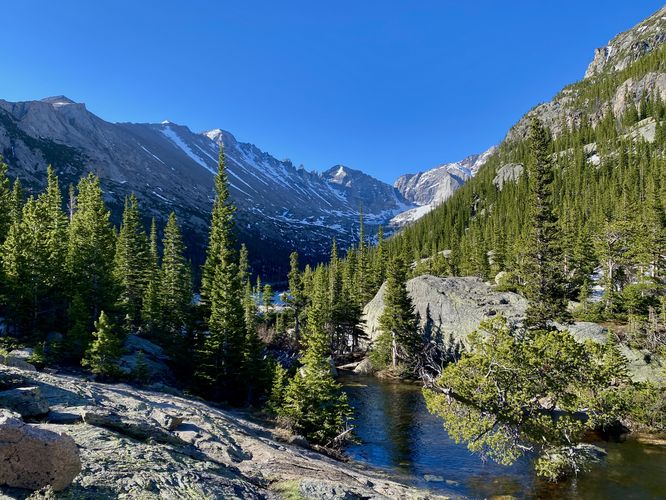
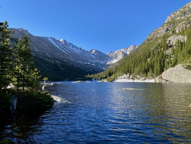
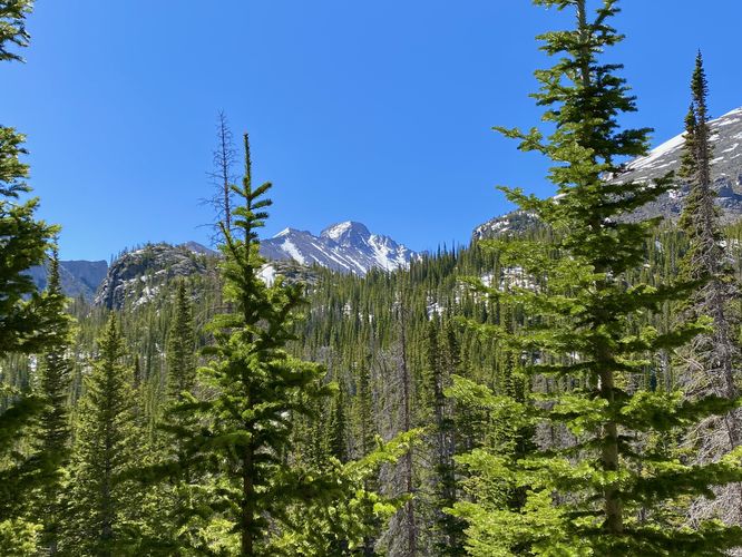
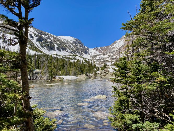
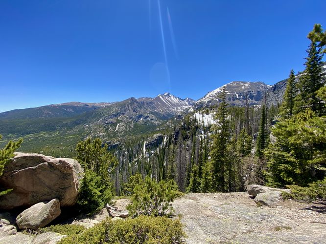
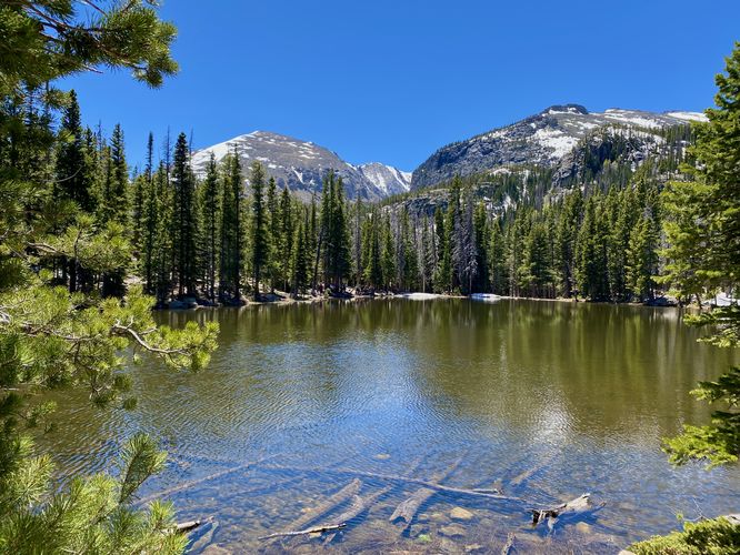
After passing Glacier Falls, hikers will meander through the forest, passing more creek crossings and some mountain views as the trail heads uphill. Finally, around mile 2.8, hikers will find the outflow of Mills Lake (Glacier Creek) as it flows out of the lake and down the mountain. Just beyond is the northern shore of Mills Lake, around mile 2.9. At Mills Lake, hikers can take a break while soaking up the alpine lake views including views of Half Mountain, Storm Peak, Longs Peak, and Pagoda Mountain. The views from Mills Lake are stunning and well-worth the hike if you plan to only hike to Mills.
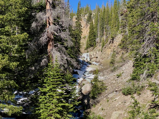
Hiking to The Loch - Mile 2.9 to 4.3
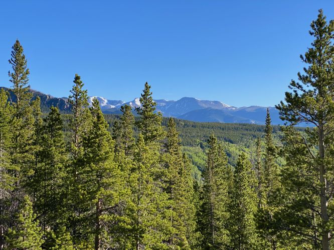
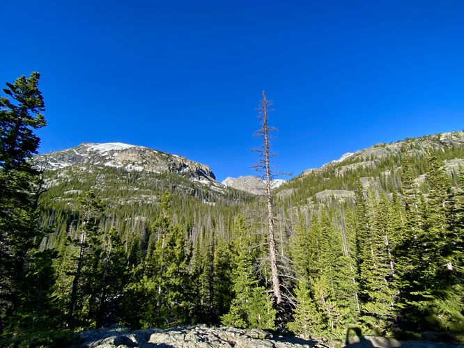
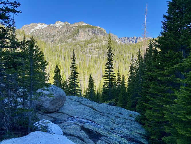
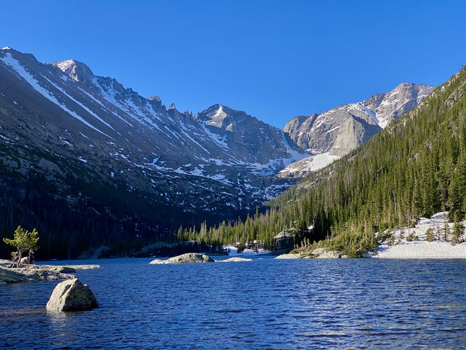
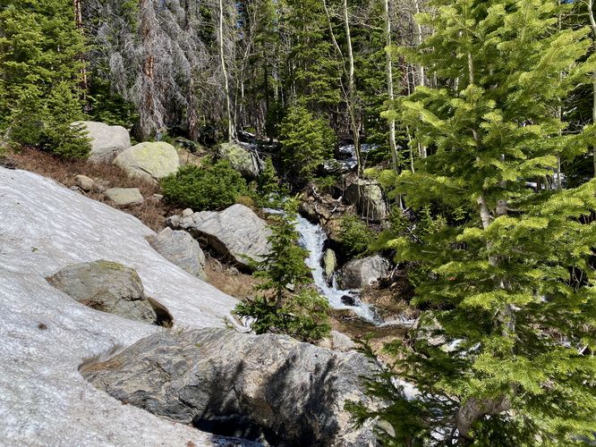
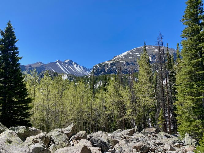
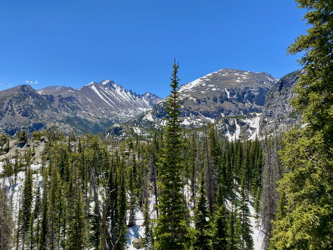
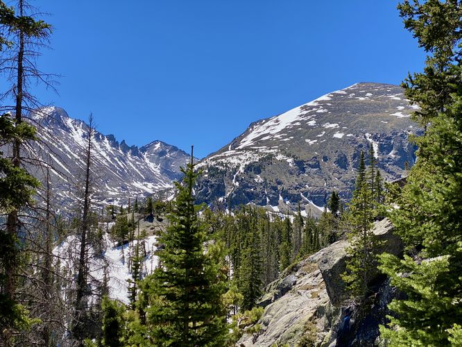
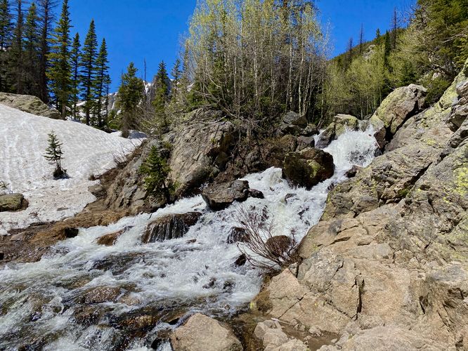
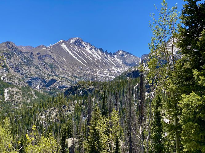
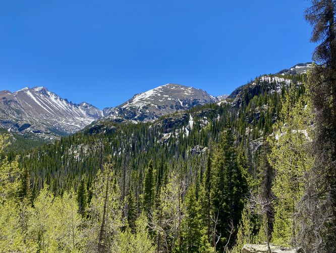
To reach The Loch from Mills Lake, hikers will head back down the trail they hiked up to reach Mills. Once at the junction (mile 3.5), take a left-hand turn to head uphill toward The Loch. Along the way, hikers will find a rocky trail that features a multitude of waterfalls in the creek (Icy Brook) below. The most prominent of the waterfalls is a multi-tiered cascade known as Icy Brook Falls located around mile 4. Just beyond the waterfall is a series of switchbacks that leads up the mountain and provides a nice view. After that, the trail winds around through the woods before popping out into an open space as it ascends to reach The Loch. Hikers will find the eastern shores of The Loch around mile 4.3. Here, you can explore The Loch as you wish or sit down to relax and enjoy the breathtaking alpine views of this lake and its surrounding mountains like Taylor Peak, The Sharkstooth, Otis Peak, and Thatchtop.
Hiking to Lake Haiyaha from The Loch - Mile 4.3 to 6.5
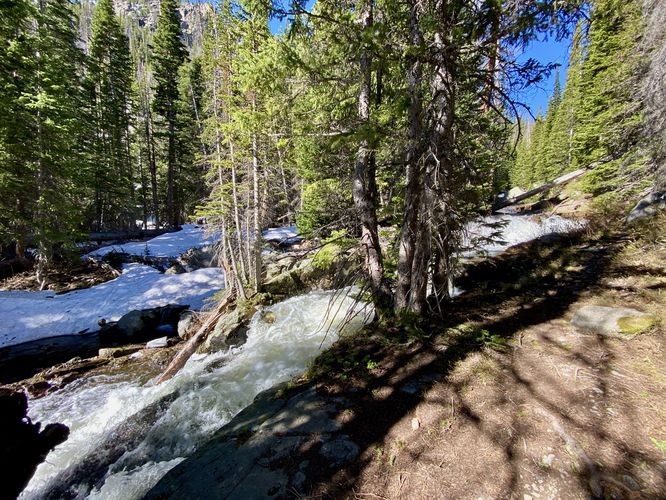
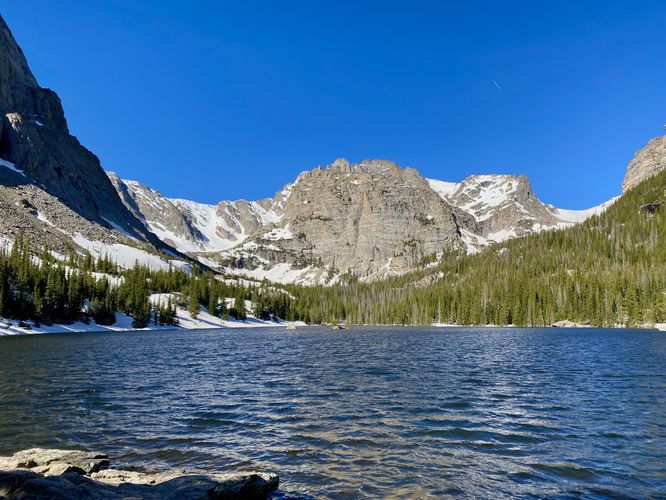
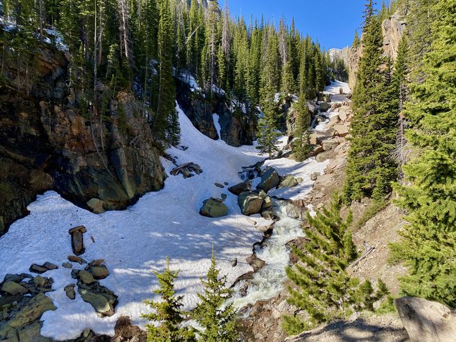
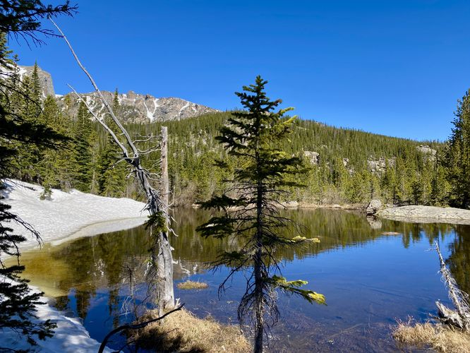
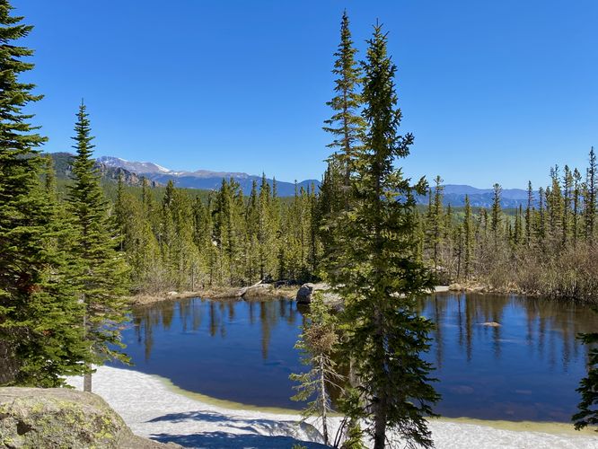
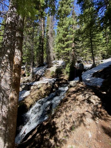
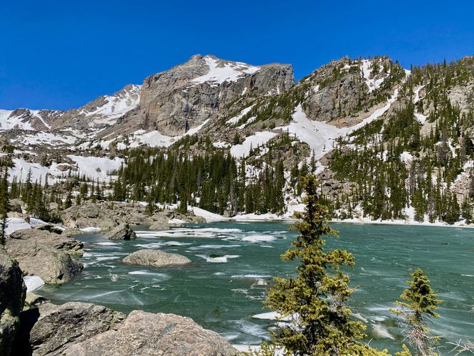
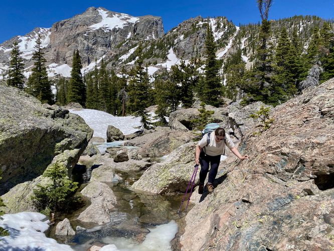
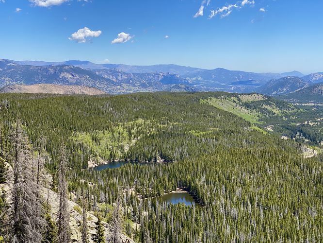
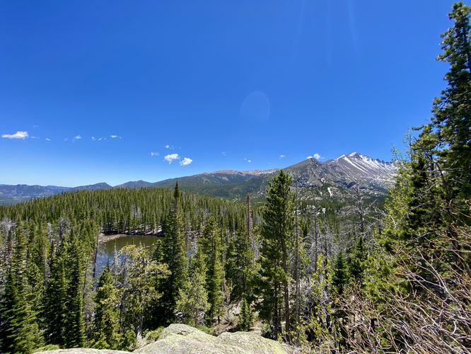
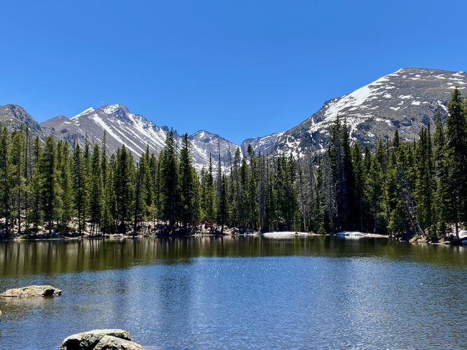
After exploring The Loch, hikers will want to check out Lake Haiyaha. To reach Lake Haiyaha, hike back down to the junction of Mills Lake and The Loch, enjoying the waterfalls and views along the way. At mile 5.15, you'll reach the junction. Here, take a left-hand turn and notice there are three different pathways. Take the pathway on the far-left - this is the Lake Haiyaha Trail. During late Spring and early Fall, this trail may be covered in snow fields - during our hike here in late Spring, the trail had snowfields that covered 80% of the entire trail and caused for annoying undulating hiking and some postholing. Regardless, this trail can be hard to navigate, especially with snow on the ground, as the path is not always obviously defined. It helps to use offline maps here - we used the MyHikes app to ensure we were on the right track. Along the way, you'll find neat points-of-interest like Weeping Rock (mile 5.3), backcountry pond views (mile 5.65), a waterfall at mile 6, views at mile 6.05, and another waterfall around mile 6.1. Hikers will reach a trail junction at mile 6.25 -- take a left-hand turn to hike southwest from here. This trail will lead directly to Lake Haiyaha. At mile 6.45, hikers will encounter a rock scramble that sits between you and the stunning views of Lake Haiyaha. Here, be extra careful as you scramble over large boulders to reach the shoreline of Lake Haiyaha around mile 6.5. Once along the shores of Lake Haiyaha, hikers will find the recent (as of 2022) turquoise waters of the lake, as caused by a recent rock slide, in addition to mountain views of Hallett Peak and Otis Peak.
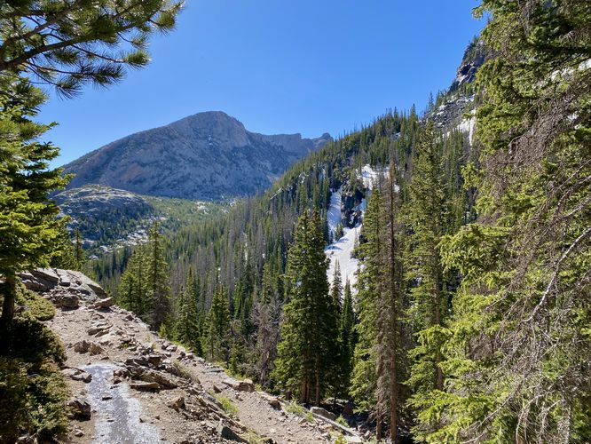
Hiking to Dream Lake from Lake Haiyaha - Mile 6.5 to 7.55
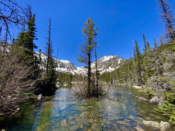
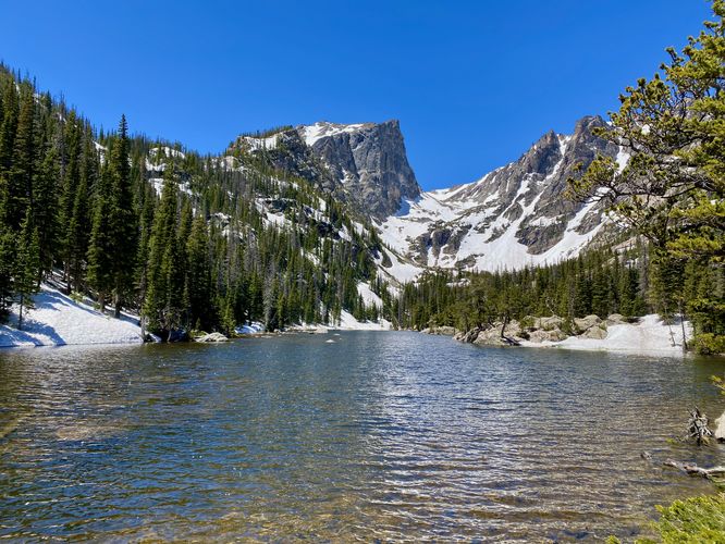
After exploring Lake Haiyaha, hikers will want to head back to parking along the north section of this loop, but will want to stop at Dream Lake first. The hike to Dream Lake is fairly straight forward - hike back to the junction you recently passed, now located at mile 6.8, then continue along the trail as it meanders through the woods before dropping down to reach Dream Lake. Along the way, hikers will find views around mile 6.9, 7, and 7.1. Hikers will encounter steep mountain slopes around mile 7.1 and they don't end until mile 7.45. During late Spring or early Fall, the trail may have super steep snowfields that pose extreme danger to hikers. If there are steep snowfields along the trail here, you'll definitely want to use ice spikes on your shoes or boots to ensure your safety. If you have an ice axe, it's smart to hold it here just in case of a fall. Hikers will end the seasonlly-sketchy steep-sloped terrain around mile 7.45. Once off of the mountain slopes, you can make your way over to the eastern shore of Dream Lake, around mile 7.55. Once on the shores of Dream Lake, you can sit to relax and take in more breathtaking alpine lake views.
Hiking to Nymph Lake from Dream Lake - Mile 7.55 to 8
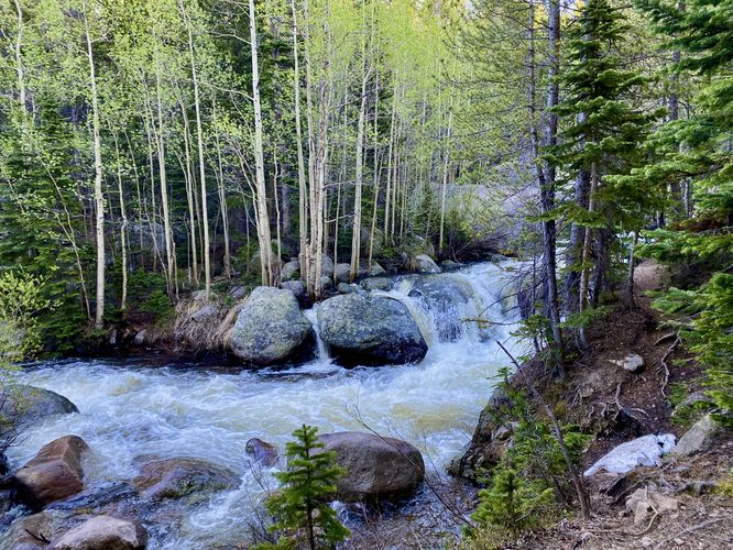
After taking in the views at Dream Lake, hikers will head down the trail toward the parking lot; however, there's still one more lake to explore along the way out - Nymph Lake. While the name doesn't sound as awe-inspiring as Dream Lake, Nymph Lake still has plenty of beautiful views to check out. Along the way down, hikers will pass a waterfall around mile 7.7 called Tyndall Falls - named after the creek and glacier it flows down from. The trail then provides views of Half Mountain and Storm Peak from miles 7.75 to 7.87. Hikers will reach the first shoreline of Nymph Lake around mile 8 - you'll have to hike off of the main trail to reach the views. Just beyond is another stunning view of Nymph Lake at mile 8.05.
Hike Nymph Lake to Parking - mile 8 to 8.6
After exploring Nymph Lake, hikers will head down the trail to reach the parking lot. There are no views, lakes, or waterfalls along the way (assuming you skip Bear Lake). The only noteworthy part of this section of the hike is that the trail is partially made-up of paved sections with random breaks of rock and dirt between. The paved trail can pose a hazard for very-tired hikers as I accidentally rolled my ankle pretty bad here on the hike down. Watch your step and be mindful of the uneven terrain here. You'll wrap-up this hike around mile 8.6 when you reach the parking lot.
Pets
Dogs are not allowed on this trail.
Popularity
This loop hike and most of the lakes that hikers choose for out-and-back hikes listed along this loop are some of the most-popular and heavily-trafficked trails at the park. Expect to see plenty of people along these trails. The quieter trail is by far the middle of the Lake Haiyaha Trail since not everyone hikes to Lake Haiyaha in a loop.
Parking
Hikers will find a massive parking lot at the coordinates provided, located at the end of Bear Lake Road. The lot is large enough to fit many dozens of vehicles as of June 2024.
Wildlife Viewing
This trail is great for viewing wildlife, especially deer, elk, and moose due to the lake's water source for drinking. If you wish to spot wildlife, your best chances are in the early morning or in the early evening. Always keep a safe distance while viewing - approx. 75-feet for elk and longhorn sheep; 120-feet for bear and moose.
Timed-Entry Reservations
Between the months of late May through early October you must purchase a timed-entry pass to visit Rocky Mountain National Park. If you wish to visitor and hike anything off of the Bear Lake Road, you must purchase a dedicated Bear Lake timed-entry pass. You can find more information about timed entry on the park's website.
Warnings
Elevation sickness: This trail leads hikers up to about 10,200 feet above sea level. Around the 7,000-foot mark above sea level, hikers may start to experience symptoms of elevation sickness including headache, muscle aches, shortness of breath, among other warning signs. In order to avoid elevation sickness it's recommended to ascend to higher elevations and take short walks to acclimate over the course of several days before taking a long or physically-demanding hike. At any time you feel elevation sickness kicking in, that's the time to turn back and head for lower altitude or the parking lot.
Wild animals: While rare, hikers may encounter bears or mountain lion along the trail. Again, this is rare due to the insane amount of people who hike these trails each day; however, it's smart to know that these wild animals could be on-trail. Please read-up on how to properly handle a bear or mountain lion encounter before hitting the trails.
Steep terrain: This hike passes several areas where the terrain becomes very steep. Watch your step and always stay away from fast-moving water sources as they pose serious danger to hikers.
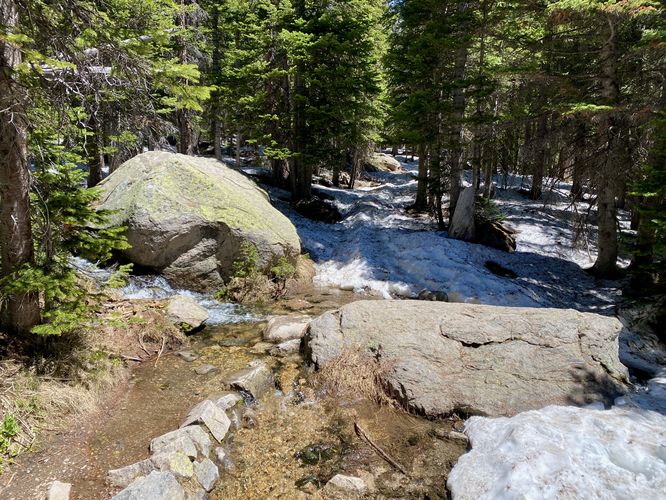
Steep snow fields: During late Spring (late May / early June), the trail may still have large patches of snow, called snow fields. These snow fields slow you down dramatically. The Haiyaha Trail was 80% covered in snow fields which undulated the entire way, causing some postholing too. Along the Haiyaha Trail down to Dream Lake was super sketchy as snow fields, angled at 80-degrees or more, were scattered along the super steep mountain slopes. These snow fields had ~12-inches of foot placement and ran for hundreds of feet. It's recommended to bring ice spikes with you if you plan to hike this loop near the tail end of Spring or in early Fall to ensure you don't slip and get seriously injured or die. An ice axe is also recommended, if you own one.
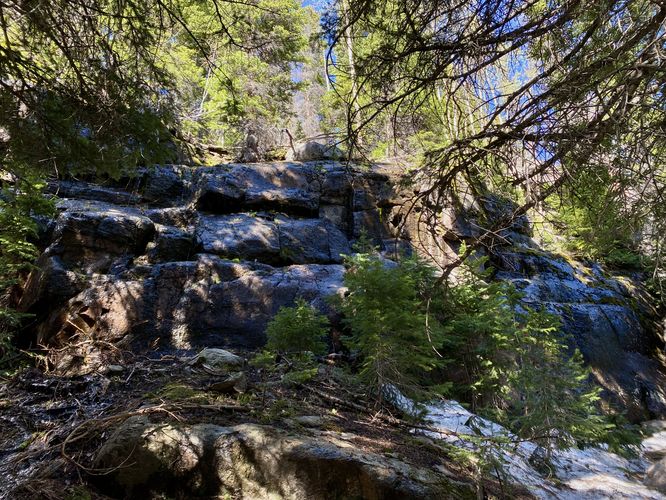
Scrambles to Lake Haiyaha: The spur trail that leads in to Lake Haiyaha is very sketchy at the last 300-feet to reach the shore of the lake. During late Spring, the snow melt cases overflowing water to creep up around the boulders that define the trail. Due to this, we had to scramble over boulders that had 3-foot deep water around them. One false move and you could get seriously injured before falling into the water. Watch your step and plan your scramble properly to ensure your own safety.
Trails
This hike follows several named trails in order: Glacier Gorge Trail, Sky Pond Trail, Lake Haiyaha Trail, Emerald Lake Trail. Note that you can add the Bear Lake Trail to this list to make a 9.4-mile loop hike as that trail is found at the same trailhead.
Points-of-Interest (What You'll See)
This hike brings visitors to many different points-of-interest along the way including Alberta Falls, Glacier Falls, Mills Lake, The Loch (lake), Icy Brook Falls, backcountry ponds and mountain views, Lake Haiyaha and its turquoise waters, Dream Lake, Tyndall Falls, and Nymph Lake (to name a few).
Hike
This hike begins at the main trailhead at the end of Bear Lake Road in the park and follows the Glacier Gorge Trail as it makes its way up the mountain toward Mills Lake and Alberta Falls. The initial part of the trail heads downhill for a short while before heading back uphill.
Trailhead to Alberta Falls - Mile 0 to 1
From mile 0 to Alberta Falls (mile 1), the trail follows a curated national park pathway that has minimal tripping hazards and nicely-spaced steps that form a very gradual grade. Hikers will find several off-trail views of waterfalls and cascades that spill down Glacier Creek. At mile 1.1, hikers will reach the stunning Alberta Falls as it roars down Glacier Creek. This spot is a great place to take a short break and to enjoy the waterfall before hiking onward toward Mills Lake.
Alberta Falls to Glacier Falls - Mile 1 to 2.6
After visiting Alberta Falls, hikers will head toward Mills Lake which has a large waterfall stop along the way - Glacier Falls. Along the way you'll find views starting around mile 1.5. From mile 1.9 to 2.2, hikers will find more sweeping views of the mountains as the trail passes through a more open area - here you can see where you'll hike up the mountain to reach Mills Lake. At mile 2.3, there's a trail junction for Mills Lake, The Loch, and Lake Haiyaha - here you'll want to keep left to hike up toward Mills Lake. Along the way up to the lake, you'll cross a stream via a footbridge before reaching Glacier Falls. Glacier Falls can be found with an off-trail view, located along a rocky outcropping, around mile 2.6. Here you must be super careful to get a decent view of Glacier Falls as the rock outcropping plummets with steep cliffs for dozens of feet to the water below.
Hiking to Mills Lake - Mile 2.9
After passing Glacier Falls, hikers will meander through the forest, passing more creek crossings and some mountain views as the trail heads uphill. Finally, around mile 2.8, hikers will find the outflow of Mills Lake (Glacier Creek) as it flows out of the lake and down the mountain. Just beyond is the northern shore of Mills Lake, around mile 2.9. At Mills Lake, hikers can take a break while soaking up the alpine lake views including views of Half Mountain, Storm Peak, Longs Peak, and Pagoda Mountain. The views from Mills Lake are stunning and well-worth the hike if you plan to only hike to Mills.
Hiking to The Loch - Mile 2.9 to 4.3
To reach The Loch from Mills Lake, hikers will head back down the trail they hiked up to reach Mills. Once at the junction (mile 3.5), take a left-hand turn to head uphill toward The Loch. Along the way, hikers will find a rocky trail that features a multitude of waterfalls in the creek (Icy Brook) below. The most prominent of the waterfalls is a multi-tiered cascade known as Icy Brook Falls located around mile 4. Just beyond the waterfall is a series of switchbacks that leads up the mountain and provides a nice view. After that, the trail winds around through the woods before popping out into an open space as it ascends to reach The Loch. Hikers will find the eastern shores of The Loch around mile 4.3. Here, you can explore The Loch as you wish or sit down to relax and enjoy the breathtaking alpine views of this lake and its surrounding mountains like Taylor Peak, The Sharkstooth, Otis Peak, and Thatchtop.
Hiking to Lake Haiyaha from The Loch - Mile 4.3 to 6.5
After exploring The Loch, hikers will want to check out Lake Haiyaha. To reach Lake Haiyaha, hike back down to the junction of Mills Lake and The Loch, enjoying the waterfalls and views along the way. At mile 5.15, you'll reach the junction. Here, take a left-hand turn and notice there are three different pathways. Take the pathway on the far-left - this is the Lake Haiyaha Trail. During late Spring and early Fall, this trail may be covered in snow fields - during our hike here in late Spring, the trail had snowfields that covered 80% of the entire trail and caused for annoying undulating hiking and some postholing. Regardless, this trail can be hard to navigate, especially with snow on the ground, as the path is not always obviously defined. It helps to use offline maps here - we used the MyHikes app to ensure we were on the right track. Along the way, you'll find neat points-of-interest like Weeping Rock (mile 5.3), backcountry pond views (mile 5.65), a waterfall at mile 6, views at mile 6.05, and another waterfall around mile 6.1. Hikers will reach a trail junction at mile 6.25 -- take a left-hand turn to hike southwest from here. This trail will lead directly to Lake Haiyaha. At mile 6.45, hikers will encounter a rock scramble that sits between you and the stunning views of Lake Haiyaha. Here, be extra careful as you scramble over large boulders to reach the shoreline of Lake Haiyaha around mile 6.5. Once along the shores of Lake Haiyaha, hikers will find the recent (as of 2022) turquoise waters of the lake, as caused by a recent rock slide, in addition to mountain views of Hallett Peak and Otis Peak.
Hiking to Dream Lake from Lake Haiyaha - Mile 6.5 to 7.55
After exploring Lake Haiyaha, hikers will want to head back to parking along the north section of this loop, but will want to stop at Dream Lake first. The hike to Dream Lake is fairly straight forward - hike back to the junction you recently passed, now located at mile 6.8, then continue along the trail as it meanders through the woods before dropping down to reach Dream Lake. Along the way, hikers will find views around mile 6.9, 7, and 7.1. Hikers will encounter steep mountain slopes around mile 7.1 and they don't end until mile 7.45. During late Spring or early Fall, the trail may have super steep snowfields that pose extreme danger to hikers. If there are steep snowfields along the trail here, you'll definitely want to use ice spikes on your shoes or boots to ensure your safety. If you have an ice axe, it's smart to hold it here just in case of a fall. Hikers will end the seasonlly-sketchy steep-sloped terrain around mile 7.45. Once off of the mountain slopes, you can make your way over to the eastern shore of Dream Lake, around mile 7.55. Once on the shores of Dream Lake, you can sit to relax and take in more breathtaking alpine lake views.
Hiking to Nymph Lake from Dream Lake - Mile 7.55 to 8
After taking in the views at Dream Lake, hikers will head down the trail toward the parking lot; however, there's still one more lake to explore along the way out - Nymph Lake. While the name doesn't sound as awe-inspiring as Dream Lake, Nymph Lake still has plenty of beautiful views to check out. Along the way down, hikers will pass a waterfall around mile 7.7 called Tyndall Falls - named after the creek and glacier it flows down from. The trail then provides views of Half Mountain and Storm Peak from miles 7.75 to 7.87. Hikers will reach the first shoreline of Nymph Lake around mile 8 - you'll have to hike off of the main trail to reach the views. Just beyond is another stunning view of Nymph Lake at mile 8.05.
Hike Nymph Lake to Parking - mile 8 to 8.6
After exploring Nymph Lake, hikers will head down the trail to reach the parking lot. There are no views, lakes, or waterfalls along the way (assuming you skip Bear Lake). The only noteworthy part of this section of the hike is that the trail is partially made-up of paved sections with random breaks of rock and dirt between. The paved trail can pose a hazard for very-tired hikers as I accidentally rolled my ankle pretty bad here on the hike down. Watch your step and be mindful of the uneven terrain here. You'll wrap-up this hike around mile 8.6 when you reach the parking lot.
Pets
Dogs are not allowed on this trail.
Popularity
This loop hike and most of the lakes that hikers choose for out-and-back hikes listed along this loop are some of the most-popular and heavily-trafficked trails at the park. Expect to see plenty of people along these trails. The quieter trail is by far the middle of the Lake Haiyaha Trail since not everyone hikes to Lake Haiyaha in a loop.
Parking
Hikers will find a massive parking lot at the coordinates provided, located at the end of Bear Lake Road. The lot is large enough to fit many dozens of vehicles as of June 2024.
Wildlife Viewing
This trail is great for viewing wildlife, especially deer, elk, and moose due to the lake's water source for drinking. If you wish to spot wildlife, your best chances are in the early morning or in the early evening. Always keep a safe distance while viewing - approx. 75-feet for elk and longhorn sheep; 120-feet for bear and moose.
Timed-Entry Reservations
Between the months of late May through early October you must purchase a timed-entry pass to visit Rocky Mountain National Park. If you wish to visitor and hike anything off of the Bear Lake Road, you must purchase a dedicated Bear Lake timed-entry pass. You can find more information about timed entry on the park's website.
Warnings
Elevation sickness: This trail leads hikers up to about 10,200 feet above sea level. Around the 7,000-foot mark above sea level, hikers may start to experience symptoms of elevation sickness including headache, muscle aches, shortness of breath, among other warning signs. In order to avoid elevation sickness it's recommended to ascend to higher elevations and take short walks to acclimate over the course of several days before taking a long or physically-demanding hike. At any time you feel elevation sickness kicking in, that's the time to turn back and head for lower altitude or the parking lot.
Wild animals: While rare, hikers may encounter bears or mountain lion along the trail. Again, this is rare due to the insane amount of people who hike these trails each day; however, it's smart to know that these wild animals could be on-trail. Please read-up on how to properly handle a bear or mountain lion encounter before hitting the trails.
Steep terrain: This hike passes several areas where the terrain becomes very steep. Watch your step and always stay away from fast-moving water sources as they pose serious danger to hikers.
Steep snow fields: During late Spring (late May / early June), the trail may still have large patches of snow, called snow fields. These snow fields slow you down dramatically. The Haiyaha Trail was 80% covered in snow fields which undulated the entire way, causing some postholing too. Along the Haiyaha Trail down to Dream Lake was super sketchy as snow fields, angled at 80-degrees or more, were scattered along the super steep mountain slopes. These snow fields had ~12-inches of foot placement and ran for hundreds of feet. It's recommended to bring ice spikes with you if you plan to hike this loop near the tail end of Spring or in early Fall to ensure you don't slip and get seriously injured or die. An ice axe is also recommended, if you own one.
Scrambles to Lake Haiyaha: The spur trail that leads in to Lake Haiyaha is very sketchy at the last 300-feet to reach the shore of the lake. During late Spring, the snow melt cases overflowing water to creep up around the boulders that define the trail. Due to this, we had to scramble over boulders that had 3-foot deep water around them. One false move and you could get seriously injured before falling into the water. Watch your step and plan your scramble properly to ensure your own safety.