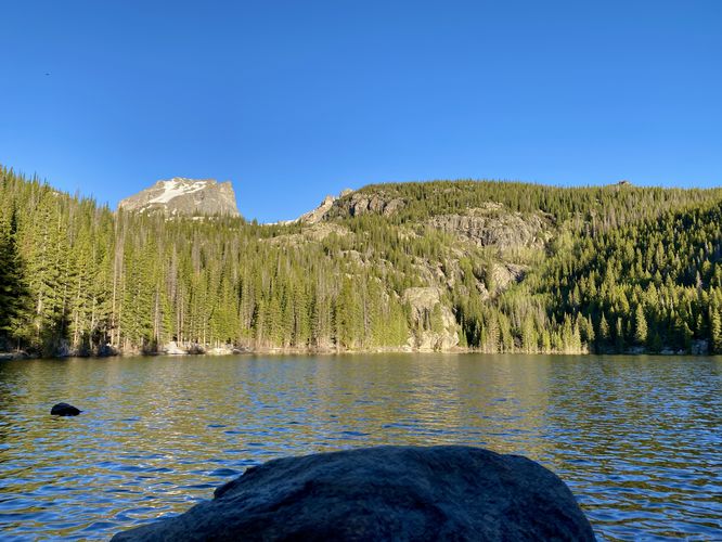
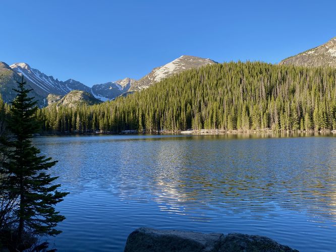
The Bear Lake Trail in Rocky Mountain National Park
near Estes Park, Colorado is an easy 0.8-mile loop trail that encompasses Bear Lake and features stunning views of the surrounding mountains.
Semi-Universally Accessible
Note that a portion of this trail is universally accessible from the parking lot and along the north shore. The trail is not accessible beyond ~0.4-miles. The southern section of the trail is not accessible.
Hike
This is less of a hike and more of a short walk with scenic views. The Bear Lake Trail is one of the most popular trails at the park as it's located at the very-end of Bear Lake Road which acts as a portal to the rest of the popular day hike lakes at the park. For hikers looking for a long day hike, consider hiking the Mills Lake - The Loch - Lake Haiyaha - Dream Lake - Nymph Lake Loop in addition to this trail to make for a long ~9.4-mile day hike.
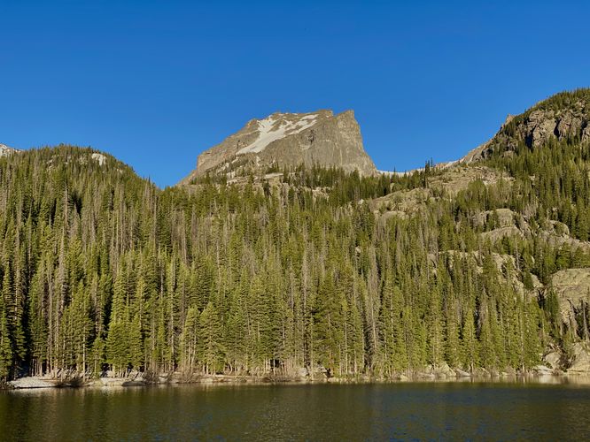
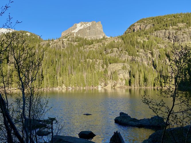
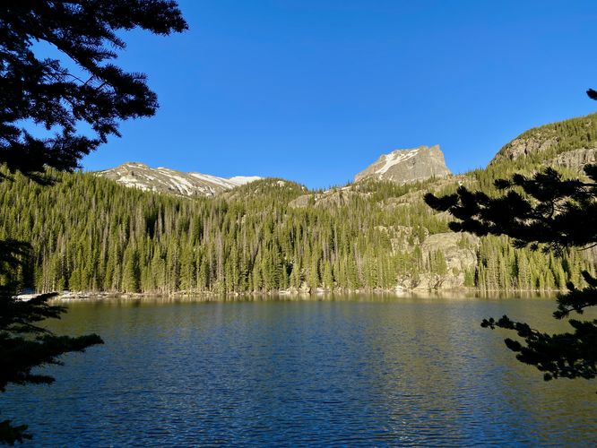
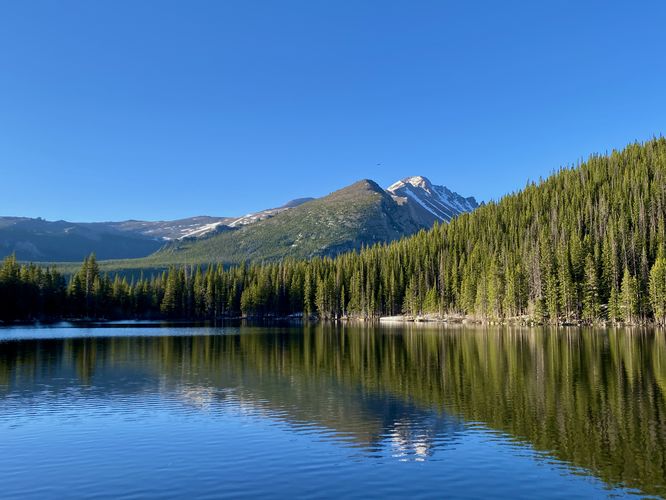
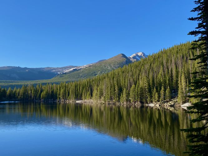
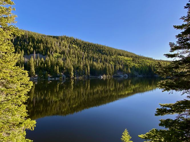
The main trailhead for the Bear Lake Trail can be found at the parking lot - head in and cross the footbridge, then keep-right at the trail junction to find the loop. This track heads along the north shore first, which is universally-accessible. The trail provides several views along the shore of Bear Lake and Hallett Peak. Once the trail makes it's way around the northwestern section, you'll begin to find more stunning views of different mountains within the park like Half Mountain and Storm Peak. The southern section of the trail ascends into the hills slightly and provides some less-stunning views of Bear Lake. The trail then ends around mile 0.8 at the main trailhead.
Pets
Dogs are not allowed on this trail.
Parking
Hikers will find a massive parking lot at the coordinates provided, located at the end of Bear Lake Road. The lot is large enough to fit many dozens of vehicles as of June 2024.
Wildlife Viewing
This trail is great for viewing wildlife, especially deer, elk, and moose due to the lake's water source for drinking. If you wish to spot wildlife, your best chances are in the early morning or in the early evening. Always keep a safe distance while viewing - approx. 75-feet for elk and longhorn sheep; 120-feet for bear and moose.
Timed-Entry Reservations
Between the months of late May through early October you must purchase a timed-entry pass to visit Rocky Mountain National Park. If you wish to visitor and hike anything off of the Bear Lake Road, you must purchase a dedicated Bear Lake timed-entry pass. You can find more information about timed entry on the park's website.
Warnings
Elevation sickness: This trail sits at about 9,500 feet above sea level. Around the 7,000-foot mark above sea level, hikers may start to experience symptoms of elevation sickness including headache, muscle aches, shortness of breath, among other warning signs. In order to avoid elevation sickness it's recommended to ascend to higher elevations and take short walks to acclimate over the course of several days before taking a long or physically-demanding hike. At any time you feel elevation sickness kicking in, that's the time to turn back and head for lower altitude.
Wild animals: While rare, hikers may encounter bears or mountain lion along the trail. Again, this is rare due to the insane amount of people who hike these trails each day; however, it's smart to know that these wild animals could be on-trail. Please read-up on how to properly handle a bear or mountain lion encounter before hitting the trails.
Semi-Universally Accessible
Note that a portion of this trail is universally accessible from the parking lot and along the north shore. The trail is not accessible beyond ~0.4-miles. The southern section of the trail is not accessible.
Hike
This is less of a hike and more of a short walk with scenic views. The Bear Lake Trail is one of the most popular trails at the park as it's located at the very-end of Bear Lake Road which acts as a portal to the rest of the popular day hike lakes at the park. For hikers looking for a long day hike, consider hiking the Mills Lake - The Loch - Lake Haiyaha - Dream Lake - Nymph Lake Loop in addition to this trail to make for a long ~9.4-mile day hike.
The main trailhead for the Bear Lake Trail can be found at the parking lot - head in and cross the footbridge, then keep-right at the trail junction to find the loop. This track heads along the north shore first, which is universally-accessible. The trail provides several views along the shore of Bear Lake and Hallett Peak. Once the trail makes it's way around the northwestern section, you'll begin to find more stunning views of different mountains within the park like Half Mountain and Storm Peak. The southern section of the trail ascends into the hills slightly and provides some less-stunning views of Bear Lake. The trail then ends around mile 0.8 at the main trailhead.
Pets
Dogs are not allowed on this trail.
Parking
Hikers will find a massive parking lot at the coordinates provided, located at the end of Bear Lake Road. The lot is large enough to fit many dozens of vehicles as of June 2024.
Wildlife Viewing
This trail is great for viewing wildlife, especially deer, elk, and moose due to the lake's water source for drinking. If you wish to spot wildlife, your best chances are in the early morning or in the early evening. Always keep a safe distance while viewing - approx. 75-feet for elk and longhorn sheep; 120-feet for bear and moose.
Timed-Entry Reservations
Between the months of late May through early October you must purchase a timed-entry pass to visit Rocky Mountain National Park. If you wish to visitor and hike anything off of the Bear Lake Road, you must purchase a dedicated Bear Lake timed-entry pass. You can find more information about timed entry on the park's website.
Warnings
Elevation sickness: This trail sits at about 9,500 feet above sea level. Around the 7,000-foot mark above sea level, hikers may start to experience symptoms of elevation sickness including headache, muscle aches, shortness of breath, among other warning signs. In order to avoid elevation sickness it's recommended to ascend to higher elevations and take short walks to acclimate over the course of several days before taking a long or physically-demanding hike. At any time you feel elevation sickness kicking in, that's the time to turn back and head for lower altitude.
Wild animals: While rare, hikers may encounter bears or mountain lion along the trail. Again, this is rare due to the insane amount of people who hike these trails each day; however, it's smart to know that these wild animals could be on-trail. Please read-up on how to properly handle a bear or mountain lion encounter before hitting the trails.