The Mid-Falls Trail at Boyce Mayview Park in Upper St. Clair, Pennsylvania is an easy 0.2-mile out-and-back trail that leads to a 10-foot tall waterfall named Upper St. Clair Falls or Mid-Falls.
Hike Description
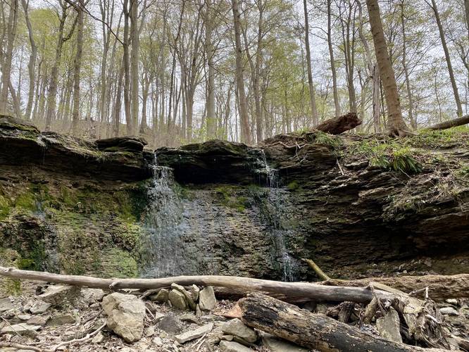
This very short trail follows both the bank of a creek and crosses the creek to reach a 10-foot tall waterfall that cascades down a small shale gorge. The trail is not difficult, but hikers may need to get their feet wet if the water is rushing during very early Spring or after a heavy rainfall. We tracked this trail during mid-to-late late April 2021 and unfortunately the waterfall was mostly dried up with just enough water falling to make the hike worth it, so hikers should show up earlier in the Spring to enjoy it.
Upper St. Clair Falls / Upper Saint Clair Falls / Mid-Falls
This trail leads to the waterfall unofficially named Upper St. Clair Falls, Upper Saint Clair Falls, or "Mid-Falls". The waterfall is about 10-feet tall and cascades into a small shale gorge.
Pets
Dogs are not allowed on this trail.
Parking
Hikers will find parking at the coordinates provided, right off of Morton Road in Upper St. Clair.
Biking
Biking is not allowed along this trail.
Wildflowers
During the Spring (approx. mid-April) this trail usually has some nice wildflowers like Trout Lily and Trillium.
Connecting Trails
This trail connects with Curved Bridge Trail, Trillium Trail, Switchback Trail.
Hike Description
This very short trail follows both the bank of a creek and crosses the creek to reach a 10-foot tall waterfall that cascades down a small shale gorge. The trail is not difficult, but hikers may need to get their feet wet if the water is rushing during very early Spring or after a heavy rainfall. We tracked this trail during mid-to-late late April 2021 and unfortunately the waterfall was mostly dried up with just enough water falling to make the hike worth it, so hikers should show up earlier in the Spring to enjoy it.
Upper St. Clair Falls / Upper Saint Clair Falls / Mid-Falls
This trail leads to the waterfall unofficially named Upper St. Clair Falls, Upper Saint Clair Falls, or "Mid-Falls". The waterfall is about 10-feet tall and cascades into a small shale gorge.
Pets
Dogs are not allowed on this trail.
Parking
Hikers will find parking at the coordinates provided, right off of Morton Road in Upper St. Clair.
Biking
Biking is not allowed along this trail.
Wildflowers
During the Spring (approx. mid-April) this trail usually has some nice wildflowers like Trout Lily and Trillium.
Connecting Trails
This trail connects with Curved Bridge Trail, Trillium Trail, Switchback Trail.