Loading...

WINTER SALE! 50% OFF Supporter Accounts — now through January 31st. Learn More.

Beaver Trail

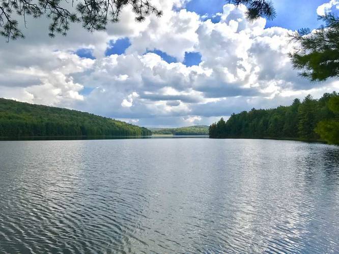
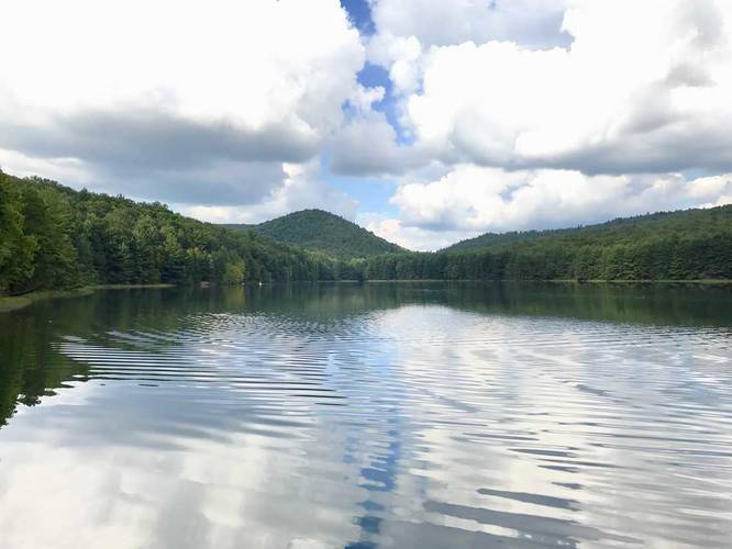
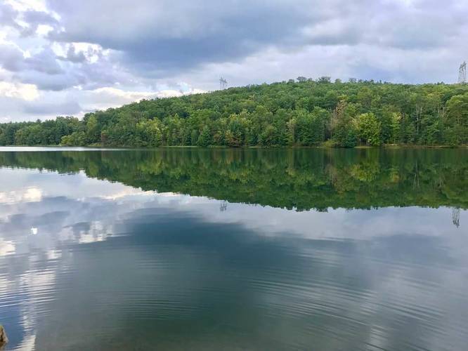
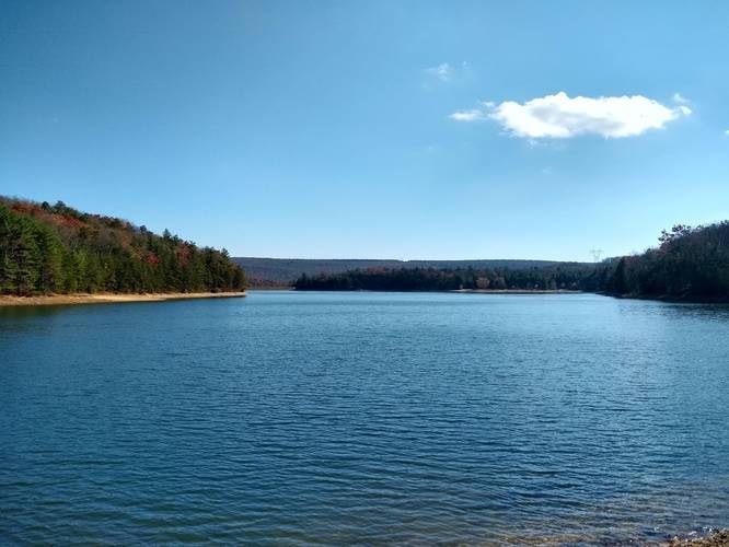
The Beaver Trail at Michaux State Forest in Pennsylvania is a 2.5 mile out-and-back hike along the Long Pine Run Reservoir in central Michaux with amazing views of the reservoir and the surrounding hills. To the north of the reservoir, you'll find Rocky Knob towering above - with the Rocky Knob Trail ascending alongside it.

No biking, horses, or camping along this trail.

The trail has 3 different trailheads, depending on where you want to park. The GPS data provided does not include all trailhead connections, so keep this in mind when navigating to the trail.

Note: we did not complete the entire hike to Birch Run rd due to sunset approaching, but it's not much further than 0.25 - 0.3 miles from where the GPS data ends to get to the road.

Parking: Your best bet for parking is at the coordinates provided (under Get Directions), along Birch Run Rd on the southern end of the reservoir. You can also park at the intersection of Birch Run Rd and Milesburns Rd and extend the hike further to about 3 miles out-and-back. The trailhead, in the GPS data, starts along Birch Run Rd to the north of the reservoir; however, there is no viable parking lot here. This trailhead is useful if you're hiking down from the Rocky Knob Trail.
Explore 17 trails near Fayetteville, PA

Know Before You Go

  • The Beaver Trail is a 2.5-mile out-and-back hike in Michaux State Forest (Fayetteville, PA) offering scenic views of Long Pine Run Reservoir and surrounding hills.
  • The trail does not allow biking, horses, or camping.
  • Optimal parking is on Birch Run Rd on the reservoir's southern end; note that GPS data may not include all trailhead connections.
Interactive topographic map for Beaver Trail located in Fayetteville, PA. Click the "View Map" button to load GPS coordinates and trail markers.
Get directions
Distance
2.5 mi
Difficulty
Easy
Type
Out-and-Back
Est. Time
1.3 hrs
Elev. Gain
167'
Rating
0.0
Added
September 18, 2017
Updated
February 19, 2019

Weather Forecast

Loading...
Total Change
54'
Ascent
167'
Descent
172'
Loading...

Download the GPX Data for Offline Use

Supporters get exclusive access to download trail routes to the MyHikes app for offline use. Stay prepared on your adventure, even without an internet connection! Become a Supporter today to unlock this feature and hike with confidence.

Download Beaver Trail GPX Data to the MyHikes Mobile App

Features

Vista / Lookout Point
Dogs
Water Source

Points of interest

  1. Parking

    39.942854, -77.455334
  2. Main Trailhead

    39.95043, -77.444819
  3. View of Long Pine Run Reservoir

    39.947942, -77.446756
    View of Long Pine Run Reservoir
  4. View of Rocky Knob

    39.945314, -77.447297
    View of Rocky Knob

Safety information

For your own safety: plan ahead, let someone know where you'll be, and hike at your own risk.

Markers

Blaze Color

Yellow

Availability

All seasons

Surface type

Dirt

Trip Reports (Reviews)

Your opinion matters! Be the first to rate this trail.

Ready to help fellow hikers? Add a trip report to share your experience and provide valuable insights for other hikers!

8.9 miles / 14.3 km
June 04, 2023
Already wrote a trip report that included this trail and a full loop around Long Pine Reservoir, plus a loop around Rocky Knob. Such a peaceful hike around the lake with lots of Pines!
Hiking
2.5 miles / 4.0 km
November 02, 2019
Hiking

Explore other routes for this Trail guide, added by the MyHikes' community via Trip Reports (Reviews). To add your own hike as a Community Route for this Trail guide, leave a Trip Report and attached your GPX file!

Popular categories

Scenic mountain view representing vista trails
Vista trails
Scenic gorge of cascades representing waterfall trails
Waterfall hikes
Rugged mountain terrain representing summit trails
Summit trails
Scenic mountain view representing dog-friendly trails
Dog-friendly
Scenic campsite with a view representing camping trails
Camping trails
Appalachian Trail logo representing A.T. hikes
A.T. hikes

You May Also Like

New York's Best Waterfalls - Whether you're planning a day hike, roadside stop, or a leisurely short walk, this guide provides hikers, travelers, and locals alike with 63 different locations to over 100 scenic waterfalls to help plan your next adventure!
Explore

New York's Best Waterfalls

Whether you're planning a day hike, roadside stop, or a leisurely short walk, this guide provides hikers, travelers, and locals alike with 63 different locations to over 100 scenic waterfalls to help plan your next adventure!

Read
🍪 We use cookies to learn about site usage and to serve map tiles. You may block cookies manually in the browser. By continuing you agree. Learn more