Section 5 of the Metacomet - Monadnock Trail is a moderate 5-mile one-way trail located in Holyoke, Massachusetts and features beautiful views of the surrounding mountains and farmlands.
Parking
The trail can be accessed at the parking lot on Old Easthampton Rd of route 141 in Holyoke (at the parking coordinates provided). Hikers can also park on the side of route 202 across McLean Reservoir at: 42.184351, -72.670469.
Section 5
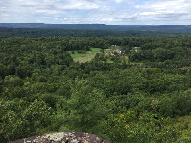
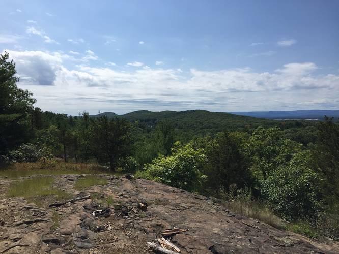
This trail should be rated easy/moderate since there is only one notable strenuous climb located just after the Holyoke Revolver Club - located roughly 1.5-miles south of the northern trailhead. The first mile of the trail is a gentle but rocky hike through the woods. There are several other trails crossing and heading in all directions, but none appear to be marked. After the first mile is complete, hikers will arrive at the first overlook gazing out to Easthampton, Massachusetts and Barnes Airport just to the south. The trail then descends towards the Revolver Club and immediately back up to the next peak. After ascending back up the ridge, the trail undulates along the ridge providing many beautiful views of lower farmlands and the Berkshires in the distance. The trail continues on in this fashion until the 3.5 mile mark.
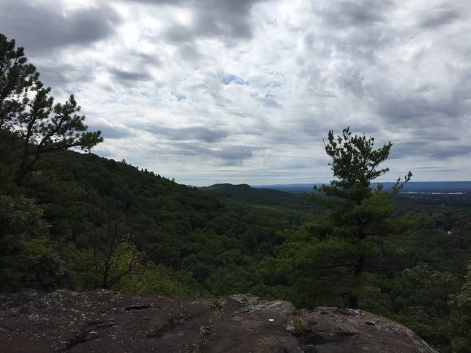
The trail then leads up a rather thin ridge - nothing to worry about in terms of cliffs or falling, but its notably thinner. There are lookouts and cliffs to the west much like the rest of the hike, but there is also a fair gap to the east where another smaller ridge appears. Here, hikers will be treated to the only eastern-facing view of this hike. While the smaller ridge blocks the potential for a better views, you are still able to see a portion of the Mount Holyoke Range, Quabbin Tower and Westover AFB. This is also the best southern view as well, looking south you can see the radio towers of Provin Mountain and in the distance Heublein Tower on Talcott Mountain. From here the trail dips down and loops back a little to the smaller ridge to the east. There is a smaller lookout here but the view is only of the ridge you just came from. This is the last view along this section of trail, 202 is an easy 1-mile walk away.
Trailhead Notes
The trail signs at each end are for the New England Trail rather than the Metacomet - Monadnock Trail. These trails are one in the same, historically this trail has been called the Metacomet - Monadnock Trail, but in 2009 it received designation as a national trail and incorporated into the National Trail System.
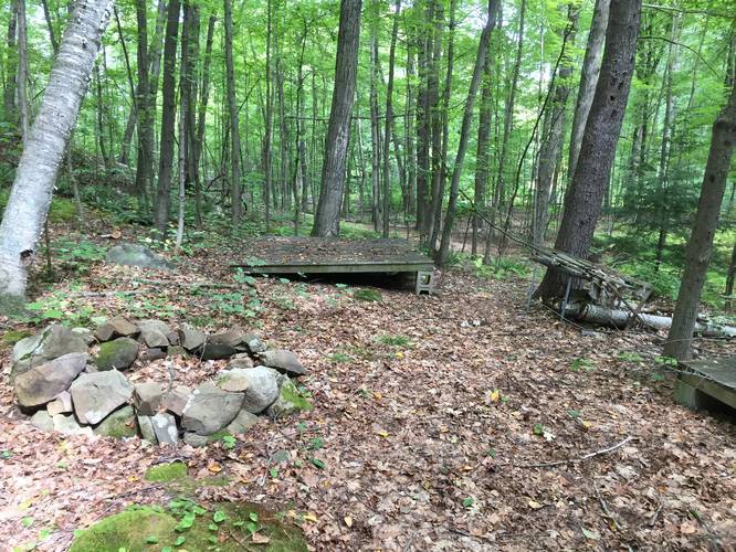
Near the southern trailhead there are two signs for other trails - Salad Gremilin and White Lightning. White Lightning signs can be seen in some places across Section 4, but there seems to be no official trail data on this.
Warnings
Much like on the Mt Tom Range, this area is part of the original range of the Timber Rattlesnake. While very rare, hikers should still be wary and on the lookout for Timber Rattlers just in case.
Parking
The trail can be accessed at the parking lot on Old Easthampton Rd of route 141 in Holyoke (at the parking coordinates provided). Hikers can also park on the side of route 202 across McLean Reservoir at: 42.184351, -72.670469.
Section 5
This trail should be rated easy/moderate since there is only one notable strenuous climb located just after the Holyoke Revolver Club - located roughly 1.5-miles south of the northern trailhead. The first mile of the trail is a gentle but rocky hike through the woods. There are several other trails crossing and heading in all directions, but none appear to be marked. After the first mile is complete, hikers will arrive at the first overlook gazing out to Easthampton, Massachusetts and Barnes Airport just to the south. The trail then descends towards the Revolver Club and immediately back up to the next peak. After ascending back up the ridge, the trail undulates along the ridge providing many beautiful views of lower farmlands and the Berkshires in the distance. The trail continues on in this fashion until the 3.5 mile mark.
The trail then leads up a rather thin ridge - nothing to worry about in terms of cliffs or falling, but its notably thinner. There are lookouts and cliffs to the west much like the rest of the hike, but there is also a fair gap to the east where another smaller ridge appears. Here, hikers will be treated to the only eastern-facing view of this hike. While the smaller ridge blocks the potential for a better views, you are still able to see a portion of the Mount Holyoke Range, Quabbin Tower and Westover AFB. This is also the best southern view as well, looking south you can see the radio towers of Provin Mountain and in the distance Heublein Tower on Talcott Mountain. From here the trail dips down and loops back a little to the smaller ridge to the east. There is a smaller lookout here but the view is only of the ridge you just came from. This is the last view along this section of trail, 202 is an easy 1-mile walk away.
Trailhead Notes
The trail signs at each end are for the New England Trail rather than the Metacomet - Monadnock Trail. These trails are one in the same, historically this trail has been called the Metacomet - Monadnock Trail, but in 2009 it received designation as a national trail and incorporated into the National Trail System.
Near the southern trailhead there are two signs for other trails - Salad Gremilin and White Lightning. White Lightning signs can be seen in some places across Section 4, but there seems to be no official trail data on this.
Warnings
Much like on the Mt Tom Range, this area is part of the original range of the Timber Rattlesnake. While very rare, hikers should still be wary and on the lookout for Timber Rattlers just in case.