The Mesa Village Loop Trail at Chimney Rock National Monument near Pagosa Springs, Colorado is an easy universally-accessible 0.3-mile loop trail that features ancient an Puebloan kiva and pithouse along with scenic views of the Pierda River from the mesa.
Walk
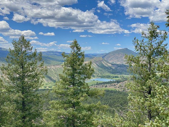
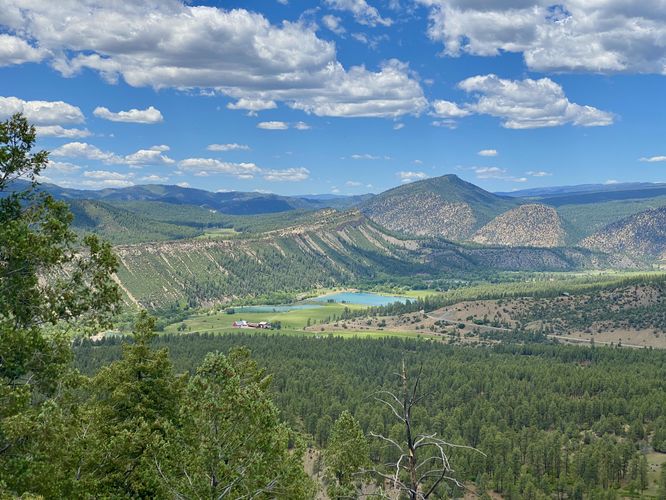
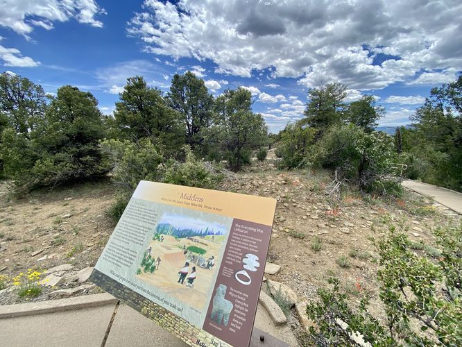
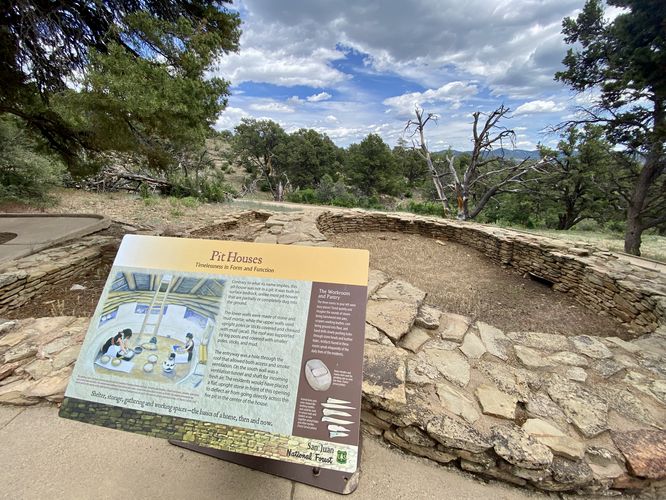
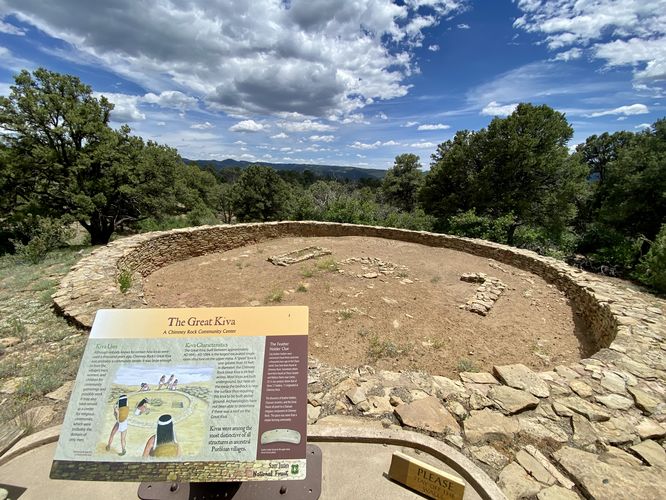
This short walk begins at the main parking lot located at the very end of Chimney Rock Road within the park. Visitors will find a smooth universally accessible pathway as it meanders along the top of the mesa to viewpoints and ancient Puebloan structures. Along the north side of the loop, visitors will find views of the Pierda River and the bluffs and mountains surrounding the valley below. You'll also find an ancient midden -- a refuse or trash pile that was once used by ancient Puebloans to discard items that they declared as junk or useless. The trail loops around to reach a pithouse and kiva on the south side of the trail. After exploring the ancient structures, you'll follow the paved pathway back up to parking by following easy-graded switchbacks.
Hours of Operation
Chimney Rock is open to visitors between the hours of 9AM and 4:30PM as of June 2024. The park is closed annually from ~mid-October to mid-May each year.
Parking & Fees
Hikers will find a large parking lot at the coordinates provided, located at the very end of Chimney Rock Road at the park. The lot is large enough to fit a few dozen vehicles as of June 2024. Like other national parks, there's a $25 vehicle entry fee as of June 2024. You can also use your annual National Parks Pass to enter without additional charge.
Warning
Sun exposure: This trail has very-little no shade, so bring plenty of water and sun protection depending on the time of day.
Elevation sickness: This trail leads hikers up to about 7,400 feet above sea level. Around the 7,000-foot mark above sea level, hikers may start to experience symptoms of elevation sickness including headache, muscle aches, shortness of breath, among other warning signs. In order to avoid elevation sickness it's recommended to ascend to higher elevations and take short walks to acclimate over the course of several days before taking a long or physically-demanding hike. At any time you feel elevation sickness kicking in, that's the time to turn back and head for lower altitude or the parking lot.
Walk
This short walk begins at the main parking lot located at the very end of Chimney Rock Road within the park. Visitors will find a smooth universally accessible pathway as it meanders along the top of the mesa to viewpoints and ancient Puebloan structures. Along the north side of the loop, visitors will find views of the Pierda River and the bluffs and mountains surrounding the valley below. You'll also find an ancient midden -- a refuse or trash pile that was once used by ancient Puebloans to discard items that they declared as junk or useless. The trail loops around to reach a pithouse and kiva on the south side of the trail. After exploring the ancient structures, you'll follow the paved pathway back up to parking by following easy-graded switchbacks.
Hours of Operation
Chimney Rock is open to visitors between the hours of 9AM and 4:30PM as of June 2024. The park is closed annually from ~mid-October to mid-May each year.
Parking & Fees
Hikers will find a large parking lot at the coordinates provided, located at the very end of Chimney Rock Road at the park. The lot is large enough to fit a few dozen vehicles as of June 2024. Like other national parks, there's a $25 vehicle entry fee as of June 2024. You can also use your annual National Parks Pass to enter without additional charge.
Warning
Sun exposure: This trail has very-little no shade, so bring plenty of water and sun protection depending on the time of day.
Elevation sickness: This trail leads hikers up to about 7,400 feet above sea level. Around the 7,000-foot mark above sea level, hikers may start to experience symptoms of elevation sickness including headache, muscle aches, shortness of breath, among other warning signs. In order to avoid elevation sickness it's recommended to ascend to higher elevations and take short walks to acclimate over the course of several days before taking a long or physically-demanding hike. At any time you feel elevation sickness kicking in, that's the time to turn back and head for lower altitude or the parking lot.