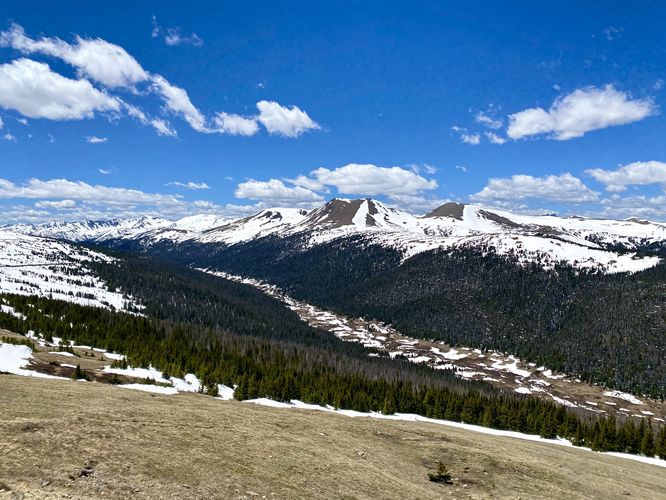
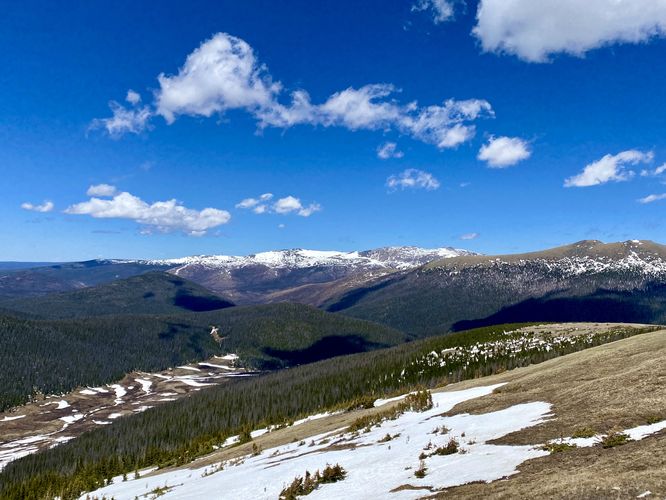
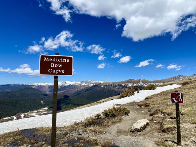
Medicine Bow Curve at Rocky Mountain National Park
near Estes Park, Colorado is a universally-accessible roadside view
that features panoramic sweeping views of the park and its surrounding
snow-capped mountains including Mount Specimen.
This is not a hike and just barely a walk, but Medicine Bow Curve deserves its own write-up on MyHikes for visitors who want to explore Rocky Mountain National Park's beauty from the parking lot or sidewalks. You can walk as far or as little as you'd like, as most of the views from Medicine Bow Curve are essentially the same. Visitors will find mountain peaks like Mount Specimen and Mount Lulu in the distance.
Due to this overlook's altitude at 11,600-feet above sea level, it's a great place for visitors to take-in the natural beauty while also taking short walks to acclimatize.
Paved Path & Universal Access
This short parking lot viewpoint is universally accessible via pavement and a sidewalk.
Pets
Dogs are only allowed at the parking lot and must be cleaned-up after.
Parking
Hikers will find a medium-sized parking turnout at the coordinates provided along Trail Ridge Road. The lot is large enough to fit less than a dozen vehicles as of June 2024.
Timed-Entry Reservations
Between the months of late May through early October you must purchase a timed-entry pass to visit Rocky Mountain National Park. If you wish to visitor and hike anything off of the Bear Lake Road, you must purchase a dedicated Bear Lake timed-entry pass. You can find more information about timed entry on the park's website.
Warnings
Elevation sickness: This trail brings hikers through terrain at 11,600-feet above sea level. Around the 7,000-foot mark above sea level, hikers may start to experience symptoms of elevation sickness including headache, muscle aches, shortness of breath, among other warning signs. In order to avoid elevation sickness it's recommended to ascend to higher elevations and take short walks to acclimate over the course of several days before taking a long or physically-demanding hike. At any time you feel elevation sickness kicking in, that's the time to turn back and head for lower altitude or the parking lot.