The McGee Meadow Trail at Glacier National Park near West Glacier, Montana is an easy 0.1-mile walk that leads into the middle of a wetland fen known as McGee Meadow and features scenic mountain views.
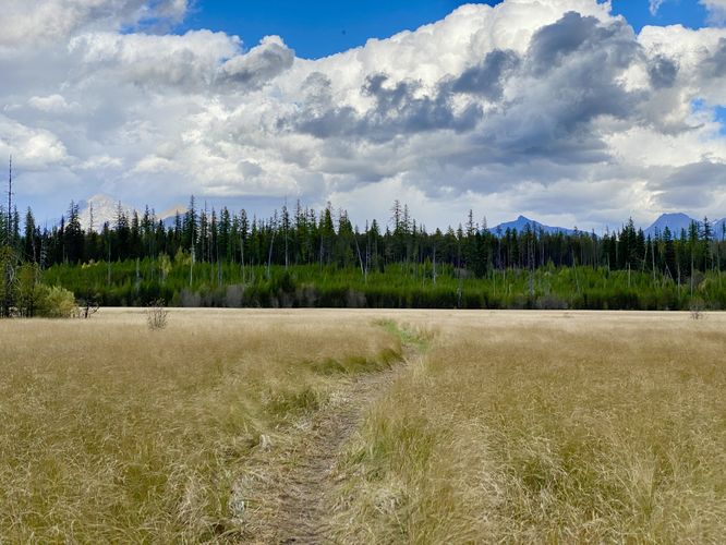
You can choose to hike as far as you wish or just head out into McGee Meadow for a short walk to take-in the views. During our visit here in September 2024, the park employees appeared to have cut a path across the fen; however it's unclear how far that path went or where it lead to. In the map tile data provided, the path did not clearly follow any of the "defined" routes drawn in yellow, so the park may pick and choose where to send hikers through McGee Meadow each year or season based on the depth of the water below all of this amazing plant life.
Walking McGee Meadow
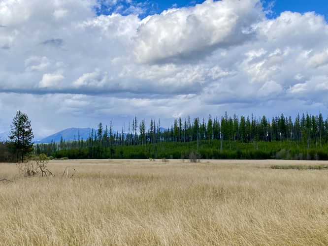
This very short walk begins at the main overlook for McGee Meadow. Visitors will find a trailhead located on the south side of the parking lot, adjacent to the info kiosk about the area. McGee Meadow is in fact not a real meadow but rather a wetland fen. The middle of the fen is full of water with plants that thrive in an always-wet environment. The "grass" you see growing in the fen is actually not grass either, but rather sedges. Sedges have edges and are not hollow, while grasses do not have edges and are hollow. Due to the wetland environment, exploring the fen and the entire length of the trail can be a bit dicey without the proper footwear. This very short out-and-back route leads into the fen where the water seeps through the plants on the trail just a bit too much for low-cut shoes, but provides beautiful views of the surrounding mountains in the distance, the fen's plant life, and the evergreen spruce trees that line the outer edge of the open space.You can choose to hike as far as you wish or just head out into McGee Meadow for a short walk to take-in the views. During our visit here in September 2024, the park employees appeared to have cut a path across the fen; however it's unclear how far that path went or where it lead to. In the map tile data provided, the path did not clearly follow any of the "defined" routes drawn in yellow, so the park may pick and choose where to send hikers through McGee Meadow each year or season based on the depth of the water below all of this amazing plant life.