The Marshview Trail at the East Sandwich Game Farm in Sandwich, Massachusetts is an easy 0.9-mile loop hike that features views of Scorton Creek and marshes.
Hike Description
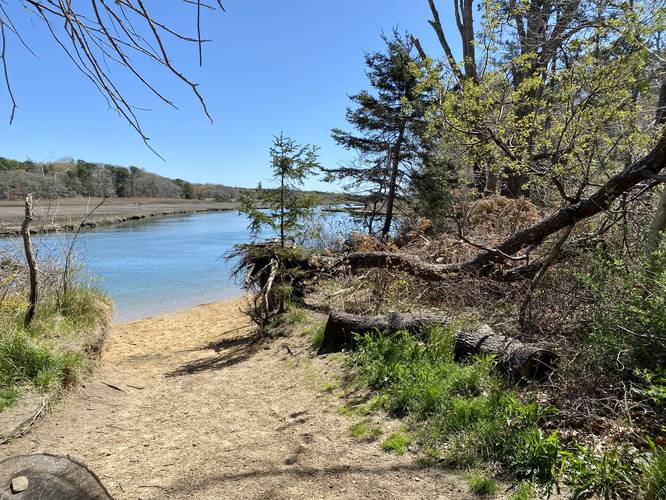
This hike begins at the main parking lot located at the dead-end road for the East Sandwich Game Farm at the coordinates provided and heads in along the main trail, stopping first at the Scorton Creek view at the trailhead.
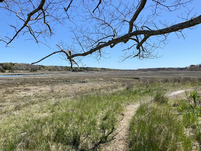
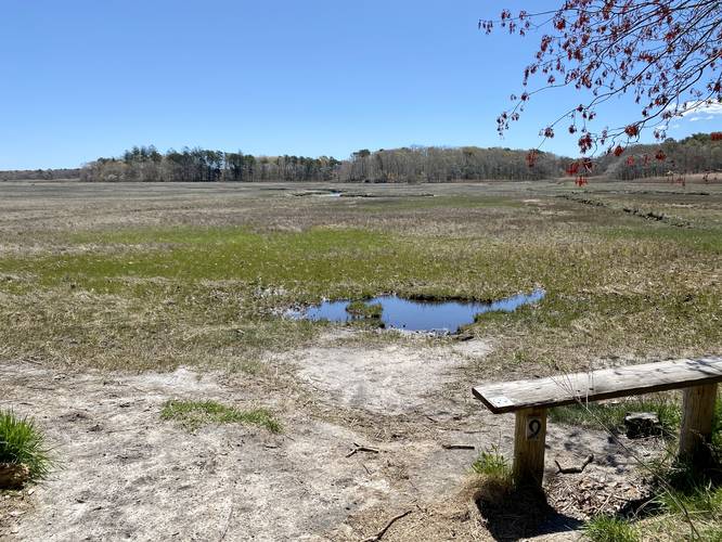
The trail will head south before reaching a kiosk with a trail map. From here, hikers will head east to stay along the Marshview Trail as it twists and winds its way out to the shores of Scorton Creek once more. Once along the creek, the trail will follow the edge of the marshland for quite a while before it heads back into the woods. Along the way, hikes get nice views of Scorton Creek, Mill Creek, and the surrounding marshes. Once back in the woods, it's a confusing free-for-all on where you want to hike, but hikers can easily meander around the woods before reaching the main entrance trail once again. Once back on the entrance trail, hikers will head north to reach the parking lot.
Parking
Hikers will find a medium-sized parking lot at the coordinates provided, located at the end of a dead-end dirt road.
Pets
Dogs are allowed only if leashed and if cleaned up after.
Warning
Hunting: Hunting is permitted here. Please be aware of the season and wear blaze orange when applicable.
Hike Description
This hike begins at the main parking lot located at the dead-end road for the East Sandwich Game Farm at the coordinates provided and heads in along the main trail, stopping first at the Scorton Creek view at the trailhead.
The trail will head south before reaching a kiosk with a trail map. From here, hikers will head east to stay along the Marshview Trail as it twists and winds its way out to the shores of Scorton Creek once more. Once along the creek, the trail will follow the edge of the marshland for quite a while before it heads back into the woods. Along the way, hikes get nice views of Scorton Creek, Mill Creek, and the surrounding marshes. Once back in the woods, it's a confusing free-for-all on where you want to hike, but hikers can easily meander around the woods before reaching the main entrance trail once again. Once back on the entrance trail, hikers will head north to reach the parking lot.
Parking
Hikers will find a medium-sized parking lot at the coordinates provided, located at the end of a dead-end dirt road.
Pets
Dogs are allowed only if leashed and if cleaned up after.
Warning
Hunting: Hunting is permitted here. Please be aware of the season and wear blaze orange when applicable.