The Maple Falls Hike at South Mountain Reservation in Millburn, New Jersey is a moderate 1.4-mile out-and-back hike that features the Maple Falls Cascades, including Maple Falls (30-feet).
Trails
This hike follows two named trails (from the park's trail map): Quarry Trail, Sunset Trail, Lenape Trail (yellow blazes).
Hike Description
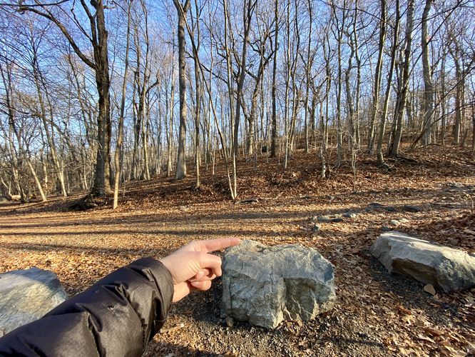
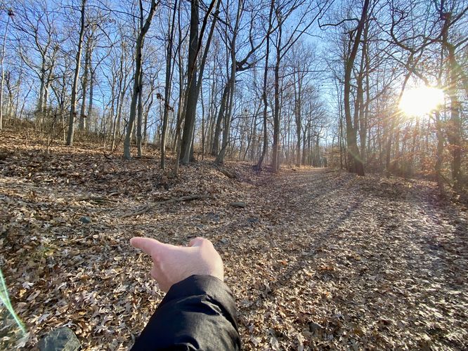
This hike begins at the main trailhead for the Quarry Trail (also depicted on some maps as the Sunset Trail) and heads-in along the rocky path as it makes its way slowly uphill. On the way up, hikers will pass an old quarry on their right-hand side -- during cold months, you can easily see the steep rock walls of the quarry, but during warm months it's likely hidden by the leaves on the trees.
Right-Hand Turn (Sunset Trail) - Mile 0.27
Around mile 0.27, hikers will reach a right-hand turn at the Sunset Trail. Take this turn to head uphill to reach the Lenape Trail.
Left-Hand Turn (Lenape Trail) - Mile 0.32
Just a few-hundred feet up the Sunset Trail is a left-hand turn for the Lenape Trail (yellow blazes). Hikers will hope on the Lenape Trail and follow this trail as it heads back downhill, slowly, to reach the Maple Falls Cascades.
Upper Maple Falls Cascades - Mile 0.63
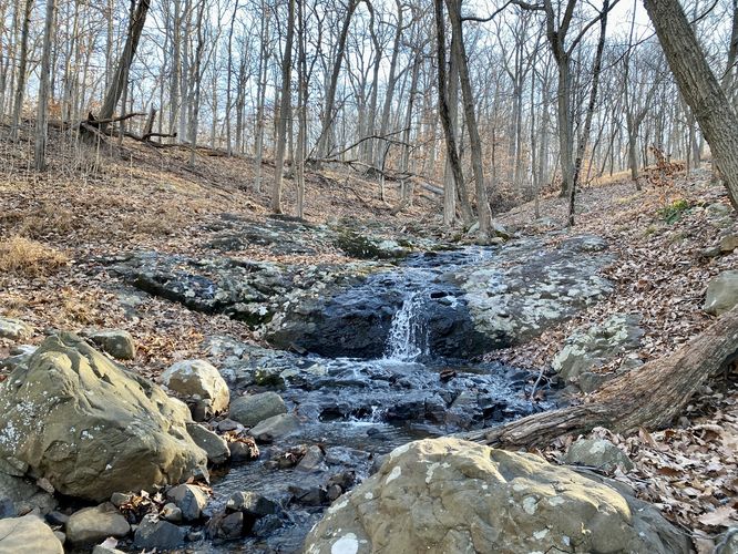
Around mile 0.63, hikers will finally reach Maple Creek which includes the Maple Falls Cascades. Some of the cascades are located upstream, but most of them are very short. This track brings hikers to the Upper Maple Falls Cascade which can be found just off-trail. The cascade is ~3-feet tall but is scenic nonetheless. If you noticed the loud rush of water hiking in, fear not, you can explore the larger ~30-foot tall Maple Falls on this hike too. Hike back along the Lenape Trail to reach an open, rocky, downhill section of forest.
Off-Trail to Maple Falls (30-feet tall) - Mile 0.67 to 0.7
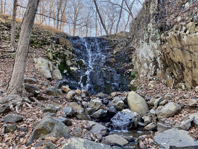
Hikers will head off-trail after backtracking from the small upper cascade to reach a rocky forest along a steep hillside. This off-trail hike to reach the bottom of Maple Falls can be a bit tricky, so watch your footing and grab onto trees to help stabilize -- sometimes the rocks can slip here causing a small rockfall which could also lead to injury. Finally, at the bottom of the hill, hikers can walk carefully upstream to reach the base of the ~30-foot tall Maple Falls. This waterfall is the largest cascade along the Maple Falls Cascades (Maple Creek), so take in the scenery while you can. Unfortunately the surrounding ground is a bit difficult to sit on or enjoy due to the large number of jagged rocks. So hikers likely won't spend too much time at the base of Maple Falls.
Hiking Out
Obviously the hike out follows the same trails that you hiked-in on. Make sure to take the proper turns on your way out to reach parking.
Parking
Hikers will find a large parking lot at the coordinates provided, located at the Locust Grove Parking Area. As of December 2023, the lot is large enough to fit a couple dozen vehicles.
Restrooms
As of December 2023, there are non-flush portable-toilets at the trailhead -- not ideal, but in an emergency, they can be handy.
Pets
Dogs are allowed only if leashed and must be cleaned up after.
Trails
This hike follows two named trails (from the park's trail map): Quarry Trail, Sunset Trail, Lenape Trail (yellow blazes).
Hike Description
This hike begins at the main trailhead for the Quarry Trail (also depicted on some maps as the Sunset Trail) and heads-in along the rocky path as it makes its way slowly uphill. On the way up, hikers will pass an old quarry on their right-hand side -- during cold months, you can easily see the steep rock walls of the quarry, but during warm months it's likely hidden by the leaves on the trees.
Right-Hand Turn (Sunset Trail) - Mile 0.27
Around mile 0.27, hikers will reach a right-hand turn at the Sunset Trail. Take this turn to head uphill to reach the Lenape Trail.
Left-Hand Turn (Lenape Trail) - Mile 0.32
Just a few-hundred feet up the Sunset Trail is a left-hand turn for the Lenape Trail (yellow blazes). Hikers will hope on the Lenape Trail and follow this trail as it heads back downhill, slowly, to reach the Maple Falls Cascades.
Upper Maple Falls Cascades - Mile 0.63
Around mile 0.63, hikers will finally reach Maple Creek which includes the Maple Falls Cascades. Some of the cascades are located upstream, but most of them are very short. This track brings hikers to the Upper Maple Falls Cascade which can be found just off-trail. The cascade is ~3-feet tall but is scenic nonetheless. If you noticed the loud rush of water hiking in, fear not, you can explore the larger ~30-foot tall Maple Falls on this hike too. Hike back along the Lenape Trail to reach an open, rocky, downhill section of forest.
Off-Trail to Maple Falls (30-feet tall) - Mile 0.67 to 0.7
Hikers will head off-trail after backtracking from the small upper cascade to reach a rocky forest along a steep hillside. This off-trail hike to reach the bottom of Maple Falls can be a bit tricky, so watch your footing and grab onto trees to help stabilize -- sometimes the rocks can slip here causing a small rockfall which could also lead to injury. Finally, at the bottom of the hill, hikers can walk carefully upstream to reach the base of the ~30-foot tall Maple Falls. This waterfall is the largest cascade along the Maple Falls Cascades (Maple Creek), so take in the scenery while you can. Unfortunately the surrounding ground is a bit difficult to sit on or enjoy due to the large number of jagged rocks. So hikers likely won't spend too much time at the base of Maple Falls.
Hiking Out
Obviously the hike out follows the same trails that you hiked-in on. Make sure to take the proper turns on your way out to reach parking.
Parking
Hikers will find a large parking lot at the coordinates provided, located at the Locust Grove Parking Area. As of December 2023, the lot is large enough to fit a couple dozen vehicles.
Restrooms
As of December 2023, there are non-flush portable-toilets at the trailhead -- not ideal, but in an emergency, they can be handy.
Pets
Dogs are allowed only if leashed and must be cleaned up after.