Loading...

📌 Love our trails? Set MyHikes as your preferred Google source. Add Now ⛰️

Manitoga Loop Hike

Located in the heart of the Hudson Valley near Garrison, New York sits Manitoga–the historic, modernist house that was once owned by Russel Wright (1904–1976) and his wife Mary Small Einstein Wright (1904–1952).

While touring and exploring the outside of Manitoga is strictly for paid tour groups only, the property has plenty of free-access trails that the public can use to escape into nature. This short hike through the Manitoga forest follows several named trails to make-up a short and easy 0.9-mile loop hike.

Note: Again, you cannot explore the outside of the modernist home, Manitoga, without paying for a guided tour. To learn more, visit their official website.

Trails

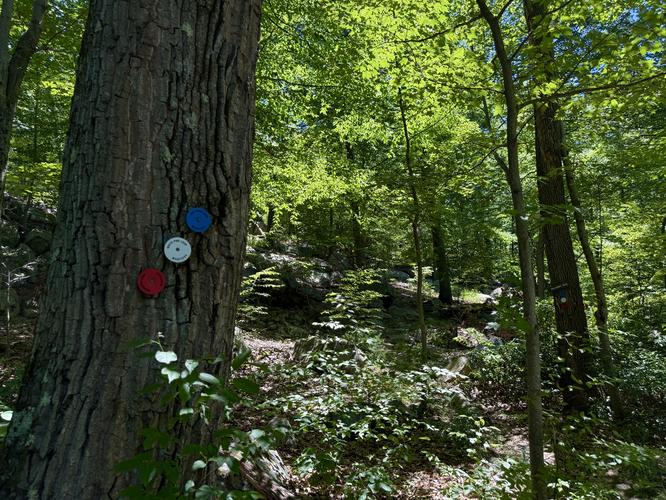
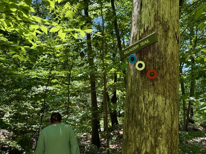
This hike follows the Killalemy Trail, Deer Run, Upper Laurel Field Trail, Wickopee Trail, and the Morning Path.

Hiking the Manitoga Loop

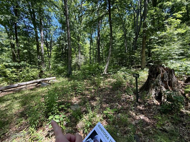
This hike begins at the main parking lot located near the Visitor Guide House on the property and heads into the forest by following the Killalemy Trail to reach the Deer Run Trail, passing through Mary's Meadow.

Mary's Meadow to Four Corners - Mile 0 to 0.37

Starting at the trailhead kiosk, the hike leads up the stone steps to reach Mary's Meadow. Hike through the meadow via the Killalemy Trail to find its continuation, located on your left-hand side, that leads into the forest. Here, you'll have two choices once you reach a fork in the Killalemy Trail - either take a left or right-hand turn. This route takes a right-hand turn to follow a counter-clockwise loop. Hike up through the forest as it follows an easy grade to reach Four Corners trail junction near mile 0.37.

Four Corners to Sunset Osio - Mile 0.37 to 0.56

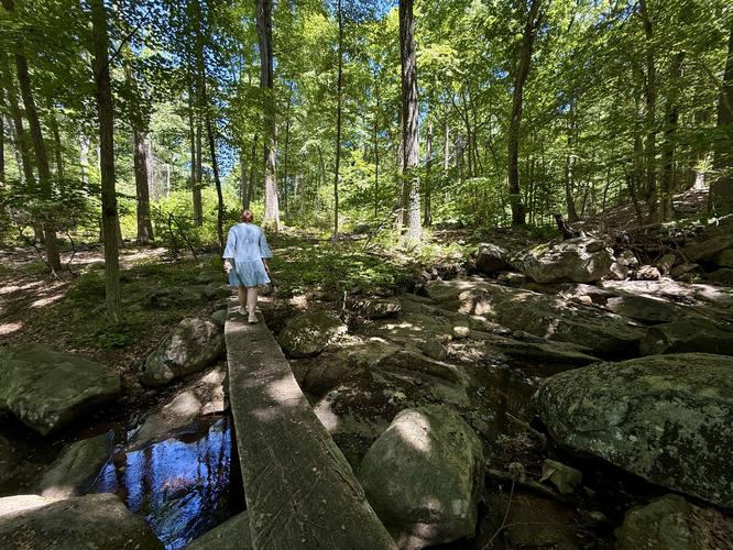
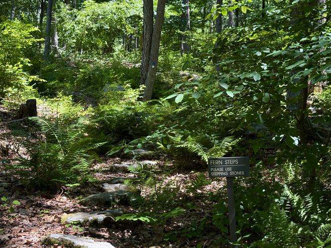
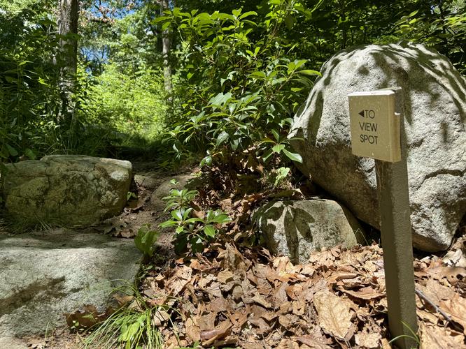
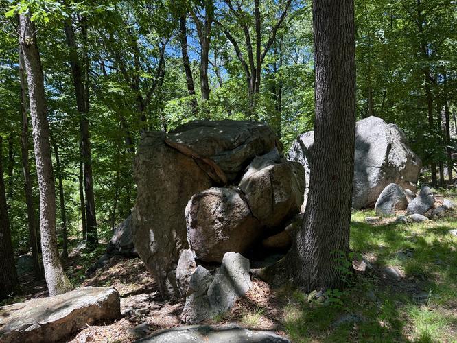
At Four Corners, take a right-hand turn onto the Wickopee Trail and follow the Wickopee Trail downhill. The trail eventually crosses a creek by way of a halved tree. On the far side of the creek crossing sits the Fern Steps, a small pathway that leads through a fern-filled section of forest, near mile 0.48. Following the Morning Path westward from the Fern Steps leads hikers to an offshoot path that leads to the Sunset Osio - a viewpoint that sits on the edge of the Manitoga property. Here, during warmer months, hikers will find large boulders enclosed in a shaded forest. During colder months, when no leaves are on the trees, you'll find an obstructed view of the Hudson Valley area.

Sunset Osio to Parking - Mile 0.56 to 0.9

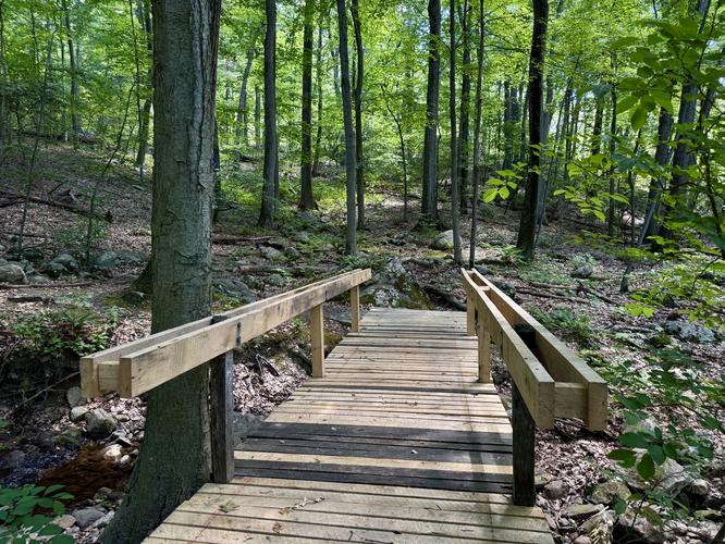
From the Sunset Osio path, hikers will head back to the Morning Path where you'll find the opposite end of the Killalemy Trail that you started on. Take the left-hand turn (almost immediately across from the Sunset Osio trail terminus) to follow the Killalemy Trail back to parking. The trail crosses the same creek one last time by following a wooden footbridge before it winds slightly uphill through the forest. Pass the first trail junction you initially came across before walking through Mary's Meadow to end the hike back at the trailhead at mile 0.9.

Hours

Trails at Manitoga, via their public parking lot, are open from Dawn to Dusk. The property has a gate at the public entrance and as such, the gate may be closed outside of these hours.

Pets

Dogs are not allowed on the Manitoga Trails.

Warning

Poison ivy: This route passes sections of poison ivy, mainly in Mary's Meadow. Hikers should be aware of what poison ivy looks like in its various stages of growth to avoid stepping on or touching the plant.
Explore 8 trails near Garrison, NY

Know Before You Go

  • The 0.9-mile Manitoga forest loop is entirely free to hike and open to the public. However, exploring the historic modernist home or its immediate grounds is strictly restricted to paid guided tours.
  • Dogs and other pets are completely prohibited on all Manitoga trails to protect the surrounding wildlife and native flora. Plan ahead and leave your furry friends at home for this specific hike.
  • Keep a sharp eye out for poison ivy, which grows abundantly in sections of the trail, particularly around Mary's Meadow. Staying on the designated path and knowing how to identify the plant will keep your hike itch-free.
Interactive topographic map for Manitoga Loop Hike located in Garrison, NY. Click the "View Map" button to load GPS coordinates and trail markers.
Get directions
Distance
0.9 mi
Difficulty
Easy
Type
Loop
Est. Time
27 min
Elev. Gain
205'
Rating
0.0
Added
June 13, 2026
Updated
July 02, 2026

Weather Forecast

Don't let Google decide who you trust.

Loading...
Total Change
184 ft.
56 m
Ascent
205 ft.
62 m
Descent
199 ft.
61 m
Loading...

Download the GPX Data for Offline Use

Supporters get exclusive access to download trail routes to the MyHikes app for offline use. Stay prepared on your adventure, even without an internet connection! Become a Supporter today to unlock this feature and hike with confidence.

Download Manitoga Loop Hike GPX Data to the MyHikes Mobile App

Features

Water Source

Points of interest

  1. Parking

    41.348464, -73.952727
  2. Main Trailhead

    41.348464, -73.952727
  3. Turn

    41.348042, -73.951819
    Turn
  4. Turn at Four Corners

    41.347436, -73.949281
    Turn at Four Corners

Safety information

For your own safety: plan ahead, let someone know where you'll be, and hike at your own risk.

Hazards

Poison Ivy or Poison Oak

Availability

All seasons

Surface type

Dirt

Trip Reports (Reviews)

Your opinion matters! Be the first to rate this trail.

Ready to help fellow hikers? Add a trip report to share your experience!

No community routes found. To add your own hike as a Community Route for this Trail guide, leave a Trip Report with an attached GPX file.

You may also like

Colorado's Million Dollar Highway - Plan a day's drive adventure along the iconic Million Dollar Highway in Colorado. Explore the best short trails, roadside stops, waterfalls, vistas, ghost towns, and hot springs within a ~6 hour road trip.
Explore

Colorado's Million Dollar Highway

Plan a day's drive adventure along the iconic Million Dollar Highway in Colorado. Explore the best short trails, roadside stops, waterfalls, vistas, ghost towns, and hot springs within a ~6 hour road trip.

Read
Glacier's Going-to-the-Sun Road - Discover the breathtaking beauty of Glacier National Park along the iconic Going-to-the-Sun Road. From stunning roadside stops to picturesque waterfalls and vistas, this engineering marvel offers endless opportunities for exploration.
Explore

Glacier's Going-to-the-Sun Road

Discover the breathtaking beauty of Glacier National Park along the iconic Going-to-the-Sun Road. From stunning roadside stops to picturesque waterfalls and vistas, this engineering marvel offers endless opportunities for exploration.

Read
🍪 We use cookies to learn about site usage and to serve map tiles. You may block cookies manually in the browser. By continuing you agree. Learn more