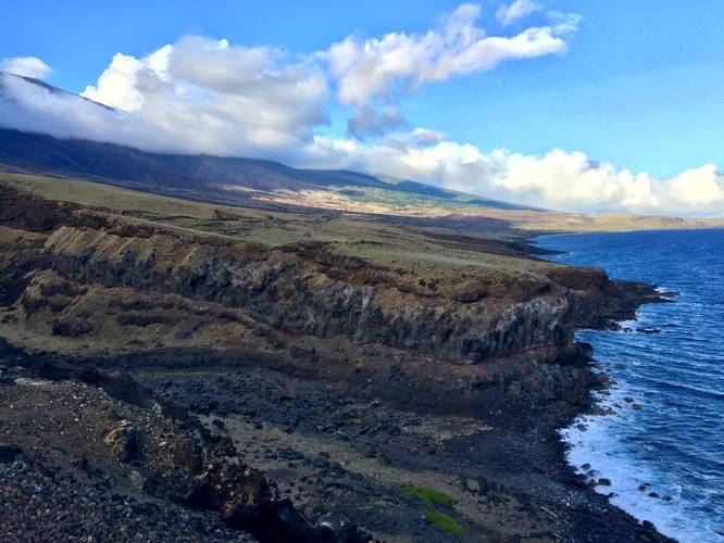
The Manawainui Gulch Trail is a short and easy 0.1 mile out-and-back walk to viewpoints along Maui's southern cliff sides where Haleakala's waters have carved out a deep chasm into the earth. The Manawainui Gulch is often dry unless there's heavy rainfall, but the views of the southern slopes of Haleakala alongside the massive chasm are stunning.
This tiny trail can be very windy and it's dangerous to get too close to any of the cliff edges along this trail, so stay back and keep on the trail. Parking can be found on the western side of Manawainui Gulch with a large turnout for plenty of vehicles.
Do not attempt to drive to this trail during heavy rainfall on this part of Maui since there are many flash flood warning signs along dry creek crossings on this road. You could get stuck or washed out easily.
Respecting the Land
Hawaiian land is considered sacred to native Hawaiians and many locals, so please stay on-trail, take nothing but photos, and leave nothing but footprints. Respect the locals - don't stay for long and have a backup hike planned in case the parking lot is full.