Loading...

Distance:
3.2 Miles / 5.1 km
Type:
Out-and-Back
Difficulty:
Moderate
Time to Hike:
1 hour, ~36 minutes
Features:
Surface Type:
Dirt
Park:
New River Gorge National Park
Town:
Fayetteville, West Virginia
Directions:
38.04153, -81.077988
Added:
September 06, 2017
Updated:
January 09, 2021
Loading...
Loading...
264 '

Total Change
460 '

Ascent
457 '

Descent

The Long Point Trail at New River Gorge National Park is a moderate 3.2 mile out-and-back hike to one of the best overlook views of the New River Gorge Bridge and New River that West Virginia has to offer.

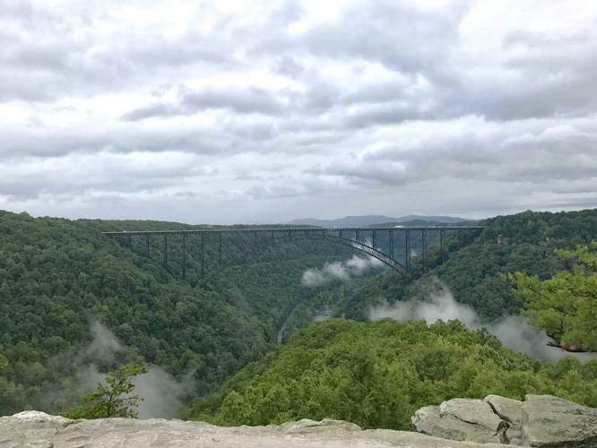
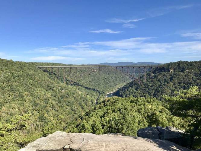
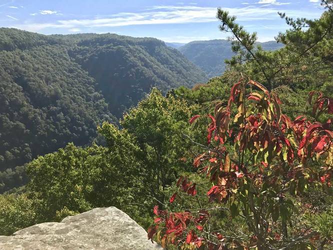
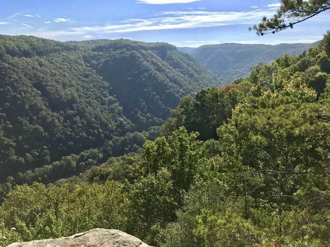
The overlook, at the end of the trail, is a three-sided cliff that juts out from the mountains and into the valley formed by the New River. Straight ahead is the iconic New River Bridge, the longest steel span bridge in the western hemisphere.

The hike itself is moderate only for the way back. The hike starts out easy. Follow the signs that point toward the Long Point Trail and Long Point Overlook. Once you reach a sign that states "no bikes beyond this point", you know you're getting close. From there, the hike is downhill to the lookout point.

GPS data note: the GPS data provided here was tracked during early September 2017, during the same time that the trail was getting new routes blazed. The GPS data may be slightly off after Sept 2017, but will still get you to the overlook regardless.

Explore 1 trail near Fayetteville, WV
  1. Parking

    38.04153, -81.077988
  2. Main Trailhead

    38.041769, -81.078089
  3. View of the New River Gorge Bridge

    38.059656, -81.077392
    View of the New River Gorge Bridge
  4. New River Gorge Bridge

    38.059628, -81.077369
    New River Gorge Bridge
  5. View to the southeast of the New River Gorge Bridge

    38.059456, -81.077147
    View to the southeast of the New River Gorge Bridge
  6. View to the southeast of the New River Gorge Bridge

    38.0596, -81.077256
    View to the southeast of the New River Gorge Bridge
No community routes found. To add your own hike as a Community Route for this Trail guide, leave a Trip Report with an attached GPX file.

Hazards

Ticks - Lyme Disease More Info (CDC)

Season

Summer

Photo Albums

3 Trip Reports

No Star-Ratings
Trail Guide By:
Admin user profile picture
3.2 miles / 5.1 km
Trail added
September 06, 2017
Hiked on
September 01, 2017
Updated on
January 09, 2021
3.2 miles / 5.1 km
September 24, 2017
Hiking
3.2 miles / 5.1 km
September 01, 2017
Hiking

Weather Forecast

In Fayetteville, WV

Explore Hiking Trails

New Hikes

Boulder Falls Trail
0.2 Miles
0.3 km
Moderate
Out-and-Back
Conklin's Gully Loop
2.4 Miles
3.9 km
Hard
Loop
Many Parks Curve Trail
0.4 Miles
0.6 km
Easy
Out-and-Back
Alluvial Fan (East) Waterfall
0.4 Miles
0.6 km
Easy
Out-and-Back

Before you boogie...

Find our trail guides useful? Consider becoming a Supporter to unlock perks!

MyHikes is an indie platform that makes exploring public trails easier for everyone. The platform has no investors, runs no ads, and is owned and operated by one person, Dave Miller. Dave has personally mapped and written over 1,600 trail guides on MyHikes for the public to explore. As of 2024, MyHikes has helped over 1,300,000 outdoor enthusiasts plan their next adventure.

But it takes a lot of time 🕦, money 💰, and work, and espresso shots ☕ to run MyHikes, including hiking , mapping , writing , and publishing new trails with high-quality (accurate) information... along with software engineering (coding) the platform like building new features, site and mobile app development for iOS and Android, site maintainance . and much much more.

Supporters unlock website and mobile app perks with an annual one-time payment of $25 (you renew) 😎👍. Or you can simply make a Donation of your choice. Otherwise, you can support us by telling your friends about MyHikes - both quick and free 🎉

Admin user profile picture

Dave Miller
MyHikes Founder