Little Pine Dam Trail
This track follows the officially-named Lake Shore Trail along the entire length of the Little Pine dam before turning back to parking for a quit stroll at the park.
Pets
Dogs are allowed if leashed and their waste must be carried out by the hiker.
Parking
There's a small parking turnout by the gate at the coordinates provided that's large enough for a few vehicles. Do not block the gate.
Know Before You Go
Interactive topographic map for Little Pine Dam Trail located in Waterville, PA. Click the "View Map" button to load GPS coordinates and trail markers.
View map
Get directions
- Distance
- 0.4 mi
- Difficulty
- Easy
- Type
- Out-and-Back
- Est. Time
- 12 min
- Elev. Gain
- 0'
- Rating
- 0.0
- Added
- January 27, 2022
- Updated
- January 27, 2022
Weather Forecast
Don't let Google decide who you trust.


Loading...
<strong>Trail map and elevation chart not rendering in print mode?</strong> Simply scroll to the trail map section, then try printing again!
Total Change
0 ft.
0 m
0 m
Ascent
0 ft.
0 m
0 m
Descent
0 ft.
0 m
0 m
Loading...
Features
- Vista / Lookout Point
- Dogs
- Biking
-
 PA Wilds
Points of interest
-
Parking
41.354986, -77.356838 -
Main Trailhead
41.355005, -77.356779 -
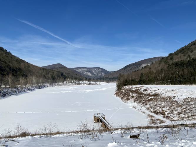
View of Little Pine Lake from the dam with surrounding mountains
41.355275, -77.355142
Safety information
For your own safety: plan ahead, let someone know where you'll be, and hike at your own risk.
Availability
All seasons
Surface type
Dirt
Trip Reports (Reviews)
Ready to help fellow hikers? Add a trip report to share your experience!
10.76
miles
/ 17.3 km
October 19, 2023
Hiking
Explore other routes for this Trail guide, added by the MyHikes' community via Trip Reports (Reviews). To add your own hike as a Community Route for this Trail guide, leave a Trip Report and attached your GPX file!
-
View Trail Map
Hiker: CoreyBHiked on: October 19, 2023Distance: 10.76 miles / 17.3 km


You may also like

Explore
Pennsylvania's Grand Canyon
Explore Pennsylvania's Grand Canyon, officially named Pine Creek Gorge, including hiking trails, vistas, overlooks, waterfalls, backcountry campsites, backpacking trails.

Explore
New York's Best Waterfalls
Whether you're planning a day hike, roadside stop, or a leisurely short walk, this guide provides hikers, travelers, and locals alike with 63 different locations to over 100 scenic waterfalls to help plan your next adventure!

Explore
25 Best Day Hikes in West Virginia
Discover 25 of the best day hikes in West Virginia, from scenic overlooks to wilderness trails—perfect for every level of hiker.

Explore
Best of the Alps: Hiking, Adventure & Scenery
Plan your ultimate European Alps adventure! Discover the best hiking trails, epic scenery, and villages in the Swiss Alps, Dolomites, Chamonix, and Lake Como.
little pine state park

