Lick Brook Falls via Finger Lakes Trail at Sweedler Preserve near Ithaca, New York is a moderate 1.9-mile out-and-back hike that leads up Lick Brook Gorge with views of the large waterfalls below, including the massive Upper Lick Brook Falls.
This trail guide is an alternative to the Lick Brook Falls Loop hike, which does not include any creek crossings but is a longer hike.Warning
Steep drop-offs / ledges: This hike leads to many steep
drop-offs, ledges, and gorges. Please stay back at all times for your
own safety. Note that these shale ledges are not very stable near the
edge as the rock is generally very loose and can give away at any time
without warning or notice.
Steep terrain: This hike leads along areas of steep terrain. If hiking when there's snow and/or ice, it's smart to use microspikes/ice spikes when hiking this loop.
This trail guide is an alternative to the Lick Brook Falls Loop hike, which does not include any creek crossings but is a longer hike.
Hiking to Lick Brook Falls
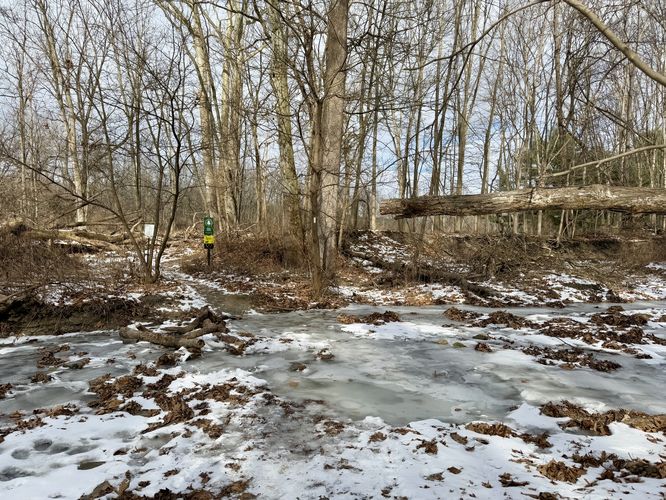
This hike begins along the east side of NY-13 at the main parking lot for the Finger Lakes Trail at the coordinates provided. Hikers will find the Finger Lakes Trail trailhead and an information kiosk for the Sweedler Preserve on the north side of the parking lot, where your adventure begins. Follow the Finger Lakes Trail as it leads east toward Cayuga Inlet Creek and railroad tracks.Crossing Cayuga Inlet Creek - Mile 0.2
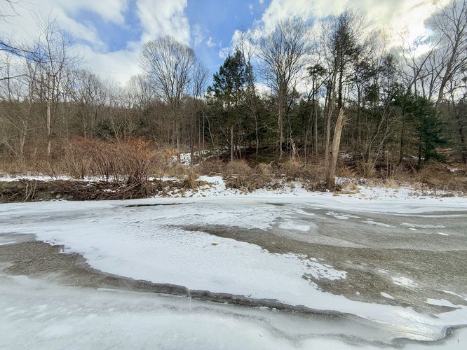
The trickiest part about this hike is at mile 0.2 from the parking lot where you'll be faced with a creek crossing. We hiked this during the winter after a very-long deep freeze, which froze Cayuga Inlet Creek over almost in-full, so we hiked across the frozen creek. During other times of the year, the creek may be high. There's a live train track that crosses the creek via a bridge, which most hikers take. I do not encourage train track bridge crossing, but if you need to cross there you technically can, albeit the legality of doing so is iffy so cross at your own risk.Entering Sweedler Preserve - Mile 0.45
At mile 0.45, hikers will officially enter the Sweedler Preserve. Also note there's another shallow creek crossing here.Lower Lick Brook Falls - Mile 0.55
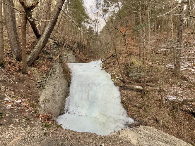
The Finger Lakes Trail will curve around Lick Brook where you'll find beautiful views of Lower Lick Brook Falls. During our hike here during the winter, we found a large group of weekend ice climbers. After passing the view of Lower Lick Brook Falls, hikers will hike up the blue-blazed trail, Jim's Trail.Middle Lick Brook Falls - Mile 0.65
Once on Jim's Trail (blue blazes), you'll begin hiking uphill along switchbacks that weave in and out toward Lick Brook Gorge. This section of the hike includes two views of waterfalls. First up is Middle Lick Brook Falls, located around mile 0.65, and is about 30-feet tall.Upper Lick Brook Falls Overlook - Mile 0.9
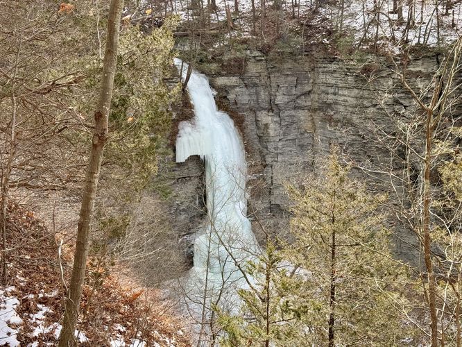
The turn-around on this route is located near the top of Lick Brook Gorge, at a view of Upper Lick Brook Falls. Upper Lick Brook Falls plummets down Lick Brook Gorge at about 90-feet tall (or slightly taller). During our hike here in the winter, the waterfall was almost fully frozen over from top-to-bottom and made for quite the ice climbing objective for folks who can/have climbed up to that waterfall.Hiking Out - Mile 0.9 to 1.9
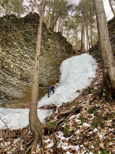
After exploring Lick Brook Gorge, this route heads back to parking, but first it heads over to another waterfall located in a tributary gully just north of Lick Brook Gorge. My original goal was to do some ice climbing on Lower Lick Brook Falls that day, but too many people were there and instead I did some novice ice climbing around this off-trail waterfall. The hike back to parking follows the same route and thus you'll need to cross two creeks to reach the parking lot.Warning
Steep drop-offs / ledges: This hike leads to many steep
drop-offs, ledges, and gorges. Please stay back at all times for your
own safety. Note that these shale ledges are not very stable near the
edge as the rock is generally very loose and can give away at any time
without warning or notice.Steep terrain: This hike leads along areas of steep terrain. If hiking when there's snow and/or ice, it's smart to use microspikes/ice spikes when hiking this loop.