The Lick Brook Falls Loop at Sweedler Preserve at Lick Brook in Ithaca, New York is a difficult 1.8-mile loop hike that leads to several large waterfalls including Lower (~50-feet) and Middle (~30-feet) Lick Brook Falls. During the winter or when leaves are off of the trees, the trail provides views of the ~90-foot tall Upper Lick Brook Falls as well.
Small Waterfalls - Mile 0.3 to 0.37
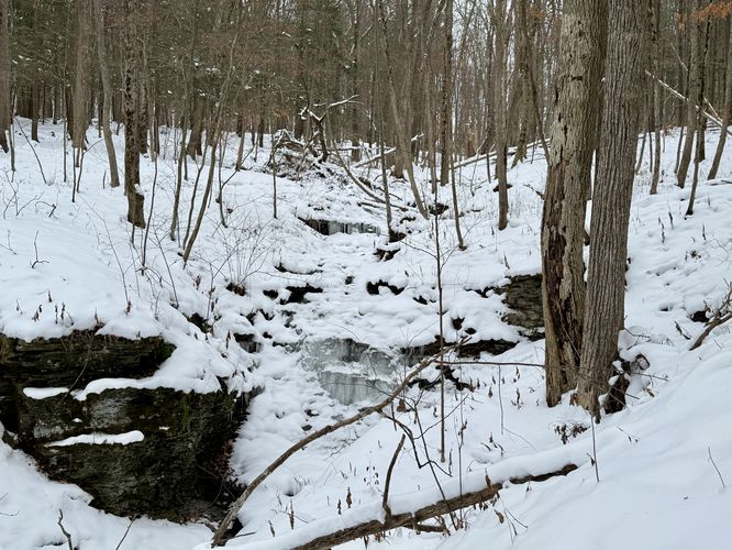
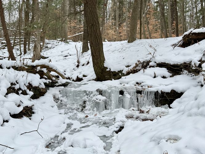
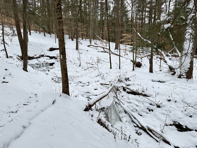
Just down the Finger Lakes Trail, around mile 0.3 from the trailhead, sits a ~5-foot tall waterfall. While nothing special, it certainly adds to the forest scenery. Just down the trail, around mile 0.37 is a creek crossing where you'll find a small 3-foot cascade upstream and a ~5-foot cascade downstream.
After the 40-foot unnamed waterfall, the trail traverses a steep ridge before it descends to the valley below. Once in the valley, the hiking becomes a lot easier as the trail heads south to reach Lick Brook.
After exploring the last view of Lick Brook Falls, the hike leads back up the Finger Lakes Trail, passing a couple of small waterfalls, before reaching the parking lot for a relatively difficult 1.8-mile loop hike.
Steep terrain: This hike leads along areas of steep terrain. If hiking when there's snow and/or ice, it's smart to use microspikes/ice spikes when hiking this loop.
Trails
This hike follows two names trails in a counter-clockwise order: Finger Lakes Trail / FLT (white blazes), Jim's Trail (blue blazes).Hiking to Lick Brook Falls
This hike follows the most-difficult way to explore the Lick Brook waterfalls, but the hike leads to several smaller upstream and side stream cascades that hikers miss if they only take the Finger Lakes Trail from NY-13. This hike begins at the top of the hill, located on Townline Road. The trail leads into the forest along the north side of the road where you'll begin your downhill walk, passing waterfalls along the way like a short waterfall, located around mile 0.2.Gorge View & Loop Junction - Mile 0.27
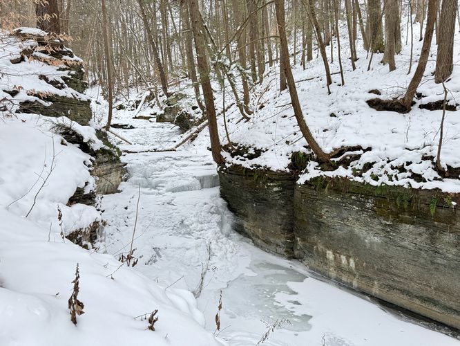
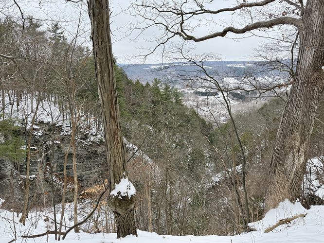
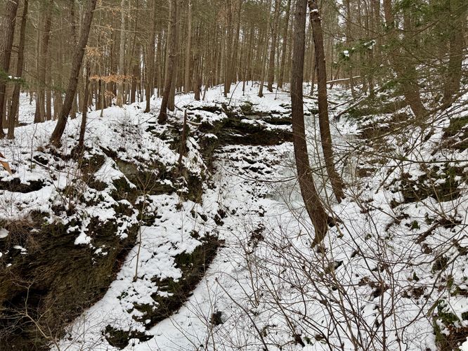
Hikers will reach a split in the trail around mile 0.27 -- this route leads to the right, following the Finger Lakes Trail (white blazes) downhill. During cold months, you'll also find a view high above the Lick Brook Gorge where you'll find the steep ~90-foot tall rock ledges plummeting down to the bedrock creek below. Save the best for last where you can hear Upper Lick Brook Falls 90-foot cascade, but instead hike down the Finger Lakes Trail.Small Waterfalls - Mile 0.3 to 0.37
Just down the Finger Lakes Trail, around mile 0.3 from the trailhead, sits a ~5-foot tall waterfall. While nothing special, it certainly adds to the forest scenery. Just down the trail, around mile 0.37 is a creek crossing where you'll find a small 3-foot cascade upstream and a ~5-foot cascade downstream. 40-foot Waterfall - Mile 0.5
Just before the trail leads down a steeper ridge, you'll reach a bend in the trail where it leads out to a very steep and dangerous cliff drop-off. Here, you'll find a ~40-foot tall waterfall that cascades down the bedrock of an unnamed creek. This waterfall is difficult to photograph but can be enjoyed in-person without much hassle. Just watch your step as the best view is close to the edge of the shale-laden gorge. Stay back from the ledge for your own safety.After the 40-foot unnamed waterfall, the trail traverses a steep ridge before it descends to the valley below. Once in the valley, the hiking becomes a lot easier as the trail heads south to reach Lick Brook.
Old-Growth Tree - Mile 0.87
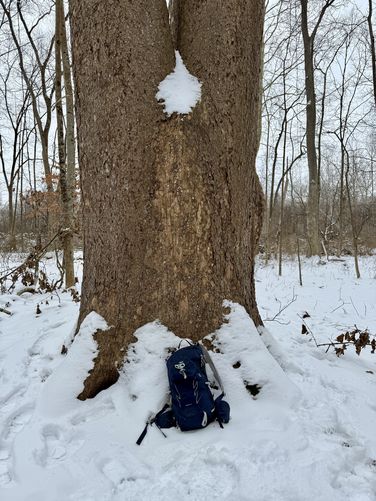
Around mile 0.87 from the trailhead sits an old-growth tree directly on-trail. This tree appears to have been logged at one point in history and now has splintered into 3 trees. The remaining trunk from the old-growth still stands and is fairly impressive in size.Off-Trail 30-foot Waterfall - Mile 0.95
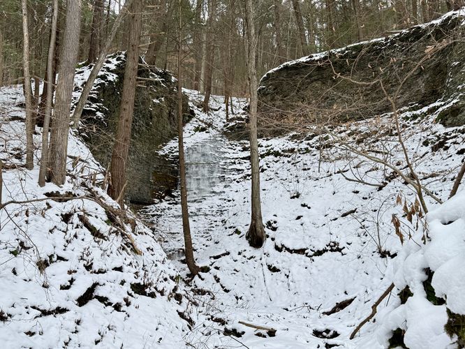
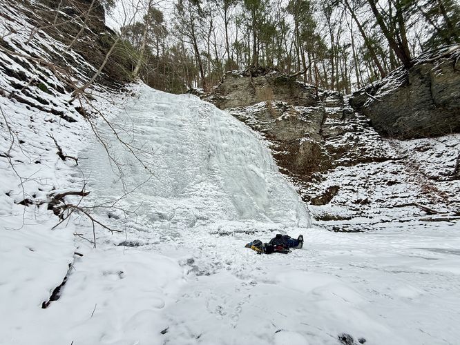
Just beyond the old-growth tree lies an off-trail waterfall that plummets down the bedrock of an entirely different unnamed creek. This waterfall is about 30-feet tall from the base of the creek but can only be reached with some off-trail exploration. The walk to/from the waterfall is very easy.Lower Lick Brook Falls (50-feet tall) - Mile 1.1
After exploring the off-trail waterfall, the official route leads to a viewpoint downstream of Lick Brook Falls. First, take a right-hand turn near the "Jim's Trail" sign and follow the creek's bluff out to a viewpoint of Lower Falls (Lower Lick Brook Falls). If you choose, you can easily hike off-trail to the base of Lower Lick Brook Falls as this route includes in the data. I ended up hiking to the base of the frozen waterfall and found ice climber's gear that they left behind for a return climb. I was a bit jealous I didn't bring my own ice climbing gear to play around on this massive frozen wall, but took in the beauty regardless.Jim's Trail to Middle Lick Brook Falls (30-feet) - Mile 1.13 to 1.25
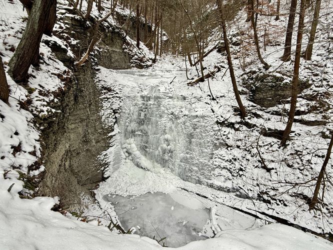
After exploring Lower Falls, this route leads up the steep hill that sits alongside Lick Brook Gorge via Jim's Trail. Jim's Trail follows blue blazes and switchbacks as it heads back up toward parking and the FLT. Along the way up, you'll find a perch of a view sitting high above Middle Lick Brook Falls. This waterfall is about 30-feet tall and is another beautiful ice climb, if you can climb up from Lower Falls. Here is where I ran into the climbers and asked about their day climbing in Lick Brook Gorge.Upper Lick Brook Falls (90-feet) - Mile 1.44 to 1.47
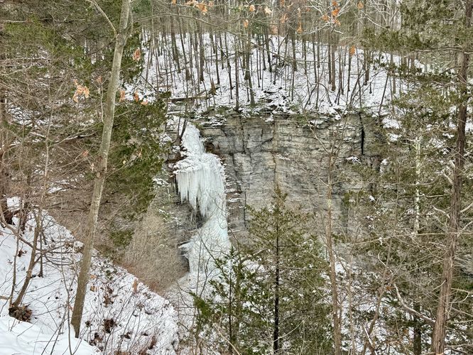
The last stop along this hike is a view of the 90-foot tall Upper Lick Brook Falls (aka Lick Brook Falls). The view from the trail is the best you'll get (without ice climbing or rappelling); however, the view from the trail is pretty decent. You can find views, when the leaves are off of the trees, between mile 1.44 and 1.47. At mile 1.47 is a small bench where you'll find the least-obstructed view of the 90-foot waterfall's plummet. During this winter hike I found the waterfall was mostly frozen over but had a steady stream of water that almost broke the cascade into two separate pieces. Remember to stay back from the ledges for your own safety.After exploring the last view of Lick Brook Falls, the hike leads back up the Finger Lakes Trail, passing a couple of small waterfalls, before reaching the parking lot for a relatively difficult 1.8-mile loop hike.
Parking
Hikers will find a small parking turnout located along Townline Road in Ithaca near the coordinates provided. The turnout is large enough to fit less than 10 vehicles as of December 2024.Pets
Dogs are allowed only if leashed and must be cleaned up after.Warning
Steep drop-offs / ledges: This hike leads to many steep drop-offs, ledges, and gorges. Please stay back at all times for your own safety. Note that these shale ledges are not very stable near the edge as the rock is generally very loose and can give away at any time without warning or notice.Steep terrain: This hike leads along areas of steep terrain. If hiking when there's snow and/or ice, it's smart to use microspikes/ice spikes when hiking this loop.