Loading...

WINTER SALE! 50% OFF Supporter Accounts — now through January 31st. Learn More.

Liberty Trail

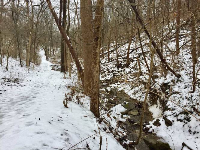
The Liberty Trail at Kane Woods Nature Area in Scott Township, Pennsylvania is an easy 0.4 mile one-way trail that leads from the western edge of the park back over to parking. You can also hike this in the opposite direction from the parking lot and the Whiskey Boys Trail over to the west to make a loop with Neville's Trail or Tom Tinker Trail.

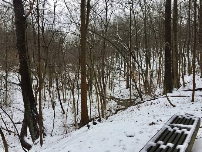
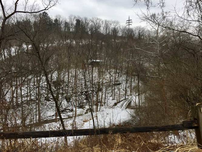
This trail runs directly above a creek and features a small 2 to 3 foot waterfall just next to the trailhead for the Tom Tinker Trail. Dogs are allowed but no biking.
Explore 213 trails near Scott Township, PA

Know Before You Go

  • Liberty Trail is a short, easy 0.4-mile trail in Kane Woods Nature Area, Scott Township, PA.
  • It connects the park's western edge to parking or can be used as part of a loop with other trails like Neville's or Tom Tinker.
  • The trail features a small waterfall near the Tom Tinker Trail trailhead; dogs are permitted, but biking is not.
Interactive topographic map for Liberty Trail located in Scott Township, PA. Click the "View Map" button to load GPS coordinates and trail markers.
Get directions
Distance
0.4 mi
Difficulty
Easy
Type
One-Way
Est. Time
12 min
Elev. Gain
1'
Rating
0.0
Added
February 10, 2018
Updated
January 21, 2020

Weather Forecast

Loading...
Total Change
94'
Ascent
1'
Descent
89'
Loading...

Download the GPX Data for Offline Use

Supporters get exclusive access to download trail routes to the MyHikes app for offline use. Stay prepared on your adventure, even without an internet connection! Become a Supporter today to unlock this feature and hike with confidence.

Download Liberty Trail GPX Data to the MyHikes Mobile App

Features

Dogs
Water Source

Points of interest

  1. Parking

    40.380221, -80.085512
  2. Main Trailhead

    40.374483, -80.084116
  3. Creek adjacent to the trail

    40.375653, -80.084319
    Creek adjacent to the trail
  4. Bench

    40.377758, -80.084564
    Bench

Safety information

For your own safety: plan ahead, let someone know where you'll be, and hike at your own risk.

Availability

All seasons

Surface type

Dirt

Trip Reports (Reviews)

Your opinion matters! Be the first to rate this trail.

Ready to help fellow hikers? Add a trip report to share your experience and provide valuable insights for other hikers!

0.4 miles / 0.6 km
February 19, 2021
Hiking
No community routes found. To add your own hike as a Community Route for this Trail guide, leave a Trip Report with an attached GPX file.

Popular categories

Scenic mountain view representing vista trails
Vista trails
Scenic gorge of cascades representing waterfall trails
Waterfall hikes
Rugged mountain terrain representing summit trails
Summit trails
Scenic mountain view representing dog-friendly trails
Dog-friendly
Scenic campsite with a view representing camping trails
Camping trails
Appalachian Trail logo representing A.T. hikes
A.T. hikes

You May Also Like

New York's Best Waterfalls - Whether you're planning a day hike, roadside stop, or a leisurely short walk, this guide provides hikers, travelers, and locals alike with 63 different locations to over 100 scenic waterfalls to help plan your next adventure!
Explore

New York's Best Waterfalls

Whether you're planning a day hike, roadside stop, or a leisurely short walk, this guide provides hikers, travelers, and locals alike with 63 different locations to over 100 scenic waterfalls to help plan your next adventure!

Read
🍪 We use cookies to learn about site usage and to serve map tiles. You may block cookies manually in the browser. By continuing you agree. Learn more