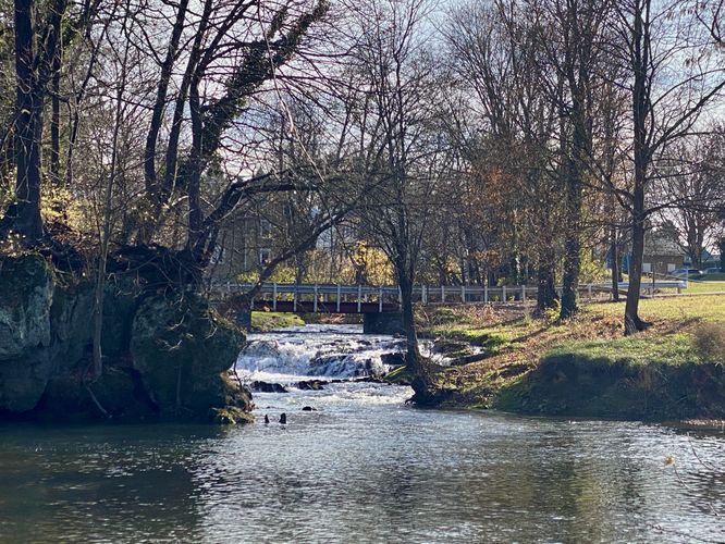
LeTort Falls at LeTort Falls Park in Carlisle, Pennsylvania is an easy 0.1-mile out-and-back walk that leads to a viewpoint of the 7-foot tall waterfall, LeTort Falls.
This is not a hike but rather a very short walk through LeTort Falls Park to reach the edge of Conodoguinet Creek. From the edge of the creek, visitors will get a view of the 7-foot tall LeTort Falls across the creek located due-South. The waterfall sits several-hundred feet away; however, this is the closest public viewing area of the waterfall, as viewed from downstream.
Only Public Access for LeTort Falls
Please note that despite the bare and empty grass lot that sit alongside LeTort Falls, according to property maps (and the no trespassing signs) that lot is private property. This means that LeTort Falls Park (or driving on the adjacent road) are the only public locations that visitors can appreciate and enjoy the waterfall.
Parking
Visitors will find a large parking lot at the coordinates provided at LeTort Falls Park. The lot is large enough to fit a couple dozen vehicles.
Pets
Dogs are allowed only if leashed and must be cleaned up after.