This section of the Laurel Highlands Hiking Trail in Confluence, Pennsylvania is a strenuous 10.2-mile one-way trail that runs from Jersey Hollow Rd over to the end of the trail in Ohiopyle State Park and State Game Lands 111.
This trail technically has two trailheads - one located along Jersey Hollow Rd in State Game Lands 111 and the other is located in Ohiopyle, here. While this trail is listed as being in Ohiopyle State Park, it's really split between State Game Lands 111 and Ohiopyle State Park. The eastern side is located in the State Game Lands and the western side is located in Ohiopyle State Park, so it's smart to wear blaze-orange when hiking this trail just in case there are hunters present.
While the entire Laurel Highlands Hiking Trail about 70-miles long, this 10.2-mile section can be completed in a single day and a perk of the hike is that there's a shuttle service that'll bring you directly to the eastern terminus.
The elevation profile of this section of the LHHT is strenuous, but the difficulty lies mostly in the downhill portions. If you plan to hike this trail from east to west, the hike will still be strenuous; however, the elevation gain is far greater than if you hike east to west.
Ohiopyle is where you get a shuttle to the eastern trailhead via Wilderness Voyageurs and hike back to Ohiopyle, PA. Ohiopyle State Park has great facilities, lots of less difficult trails and waterfalls compared to this section of the LHHT.
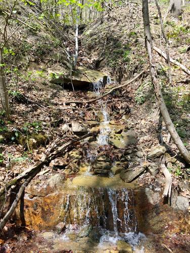
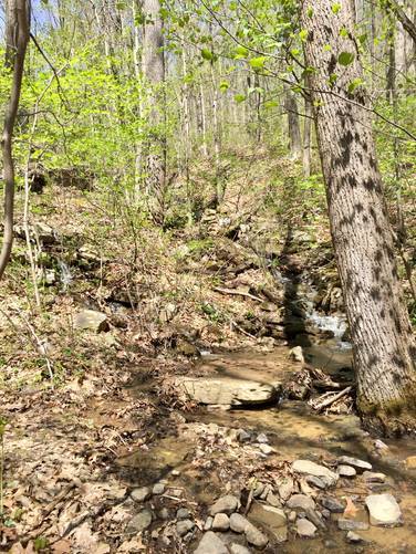
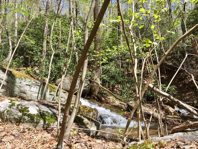
Waterfalls: There are various small waterfalls during the rainy months along the trail, especially closer to Ohiopyle. Most of these waterfalls sit in the small creeks that run down the side of the mountains and eventually run into the Youghiogheny River.
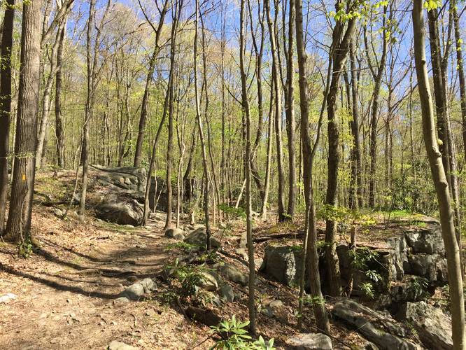
Bouldering: Within the first mile or two of the trail, on the Ohiopyle end, is a very popular bouldering area with large rock formations.
Parking: Parking for the western trailhead in Ohiopyle, click here. If you plan to drive directly to the eastern terminus along Jersey Hollow Rd, go to the Get Directions section below.
This trail technically has two trailheads - one located along Jersey Hollow Rd in State Game Lands 111 and the other is located in Ohiopyle, here. While this trail is listed as being in Ohiopyle State Park, it's really split between State Game Lands 111 and Ohiopyle State Park. The eastern side is located in the State Game Lands and the western side is located in Ohiopyle State Park, so it's smart to wear blaze-orange when hiking this trail just in case there are hunters present.
While the entire Laurel Highlands Hiking Trail about 70-miles long, this 10.2-mile section can be completed in a single day and a perk of the hike is that there's a shuttle service that'll bring you directly to the eastern terminus.
The elevation profile of this section of the LHHT is strenuous, but the difficulty lies mostly in the downhill portions. If you plan to hike this trail from east to west, the hike will still be strenuous; however, the elevation gain is far greater than if you hike east to west.
Ohiopyle is where you get a shuttle to the eastern trailhead via Wilderness Voyageurs and hike back to Ohiopyle, PA. Ohiopyle State Park has great facilities, lots of less difficult trails and waterfalls compared to this section of the LHHT.
Waterfalls: There are various small waterfalls during the rainy months along the trail, especially closer to Ohiopyle. Most of these waterfalls sit in the small creeks that run down the side of the mountains and eventually run into the Youghiogheny River.
Bouldering: Within the first mile or two of the trail, on the Ohiopyle end, is a very popular bouldering area with large rock formations.
Parking: Parking for the western trailhead in Ohiopyle, click here. If you plan to drive directly to the eastern terminus along Jersey Hollow Rd, go to the Get Directions section below.