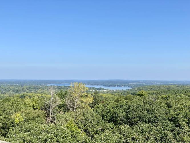
Lapham Peak Tower via Ice Age Trail at Kettle Moraine State Forest in Delafield, Wisconsin is a moderate 0.9-mile loop hike that leads to the top of Lapham Peak Tower and provides panoramic views of the surrounding area like Pewaukee Lake.
Trails
This hike follows two named trails: Ice Age Trail (yellow blazes), Kettle View Trail (blue blazes), and one connector trail from the parking lot to the tower.
Hike Description
This hike begins at the main parking lot just below Lapham Peak Tower and follows the stairs and the paved trail up to the base of the tower. Here, hikers can explore the tower by climbing its stairs to the top to enjoy panoramic views. The tower is 45-feet tall with an observation platform that sits above the canopy, providing visitors with views for vast distances.
Ice Age Trail - Kettle View Trail Loop - Mile 0.11 to 0.8
After visiting the Lapham Peak Tower, visitors may want to explore the woods a bit. This track provided includes a loop of the Ice Age Trail (yellow blazes) and the Kettle View Trail (blue blazes) by heading east from the tower, down from Lapham Peak. After walking for about 0.3 miles, hikers will reach a junction with the blue blazes of the Kettle View Trail - take a right-hand turn here.
Turn to Parking - Mile 0.75
Around mile 0.75, after passing Lapham Peak Tower below the summit, hikers will reach a junction with a connecting trail that leads to the parking lot. Take this right-hand turn to return to parking, passing the Ice Age Trail along the way.
Prohibited
No pets, beverages, or food on the tower. No biking.
Fees & Parking
Parking can be found at the coordinates provided and there's a fee to enter the park. For out-of-state plates, this was $10 in September 2022. Please check their main site for more updated info.
Pets
Dogs are allowed on trails if leashed and their waste must be carried out by the hiker. Note that dogs are not allowed on Lapham Peak Tower.
Trail Type
This trail follows a paved path to the tower. After that, the loop follows a dirt path. The connecting trail that leads back to parking is mostly grass and dirt.
Lapham Unit Map PDF
Please find the official Lapham Unit Trail Map PDF for more route details.