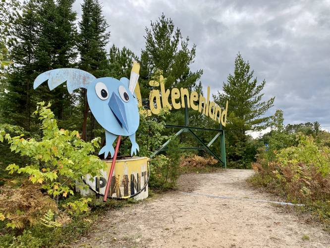
The Lakenenland Bog Walk at Lakenenland in Marquette, Michigan is an easy 0.3-mile loop walk that leads through a beautiful wetland area following wooden planks for most of the trail.
The trail first begins along a gravel and sandy path as it leads through an evergreen forest to reach the wooden planks. Once on the wooden planks, hikers will find several written words on the planks like "snow owl", "bear cub" - look for hidden painted wooden cutouts of the animals at each stop. The bog walk includes an ecosystem that most people don't venture through, due to the murky water of the wetlands, so the scenery along the way brings you out of your element a bit and feels kind of magical.
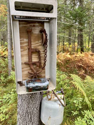
There are a couple of geocache spots along the way. On this walk we found a geocache at the "gas phone". The trail eventually loops back to the start. Before heading out, if you already explored the Lakenen Sculpture Trail, you should consider walking around the ponds to enjoy the remaining sculpture and artwork by Tom Lakenen.
Bog Walk Construction
According to the signage along the trail, the wooden planks were made from the old ore dock and telephone poles.
Rules
Hours: Open 24/7 to the public.
Summer: walking / hiking, ATVs, and cars allowed on the trail.
Winter: Absolutely NO wheeled vehicles during the winter. Walking / hiking, cross country skiing, and snowmobiles are allowed on the trail.
90-Minute Parking.
Parking
If you choose to walk the trail as we did, you can park in the parking lot just before the trail's entrance.
Pets
Dog are allowed if the owner is on a leash (per the official website rules).
Trail Type
This hike follows a sandy path that leads to a very skinny wooden plank trail (aka a very skinny and literal "boardwalk").
The trail first begins along a gravel and sandy path as it leads through an evergreen forest to reach the wooden planks. Once on the wooden planks, hikers will find several written words on the planks like "snow owl", "bear cub" - look for hidden painted wooden cutouts of the animals at each stop. The bog walk includes an ecosystem that most people don't venture through, due to the murky water of the wetlands, so the scenery along the way brings you out of your element a bit and feels kind of magical.
There are a couple of geocache spots along the way. On this walk we found a geocache at the "gas phone". The trail eventually loops back to the start. Before heading out, if you already explored the Lakenen Sculpture Trail, you should consider walking around the ponds to enjoy the remaining sculpture and artwork by Tom Lakenen.
Bog Walk Construction
According to the signage along the trail, the wooden planks were made from the old ore dock and telephone poles.
Rules
Hours: Open 24/7 to the public.
Summer: walking / hiking, ATVs, and cars allowed on the trail.
Winter: Absolutely NO wheeled vehicles during the winter. Walking / hiking, cross country skiing, and snowmobiles are allowed on the trail.
90-Minute Parking.
Parking
If you choose to walk the trail as we did, you can park in the parking lot just before the trail's entrance.
Pets
Dog are allowed if the owner is on a leash (per the official website rules).
Trail Type
This hike follows a sandy path that leads to a very skinny wooden plank trail (aka a very skinny and literal "boardwalk").