The Lake Windwing-Bennetts Pond-Pine Mountain Loop hike at Bennett's Pond State Park near Ridgefield, Connecticut is a difficult 6.8-mile loop trail that features beautiful views.
This hike follows several trails through Bennett's Pond State Park and the surrounding public lands just west of the state park, where the hike begins.
This track begins alongside Lake Windwing and heads north while the trail straddles the base of a large hill. The trail will quickly bend to the east as it begins ascending this hill before the trail heads back downhill slightly. Just after the downhill section, around mile 1.3, the trail will head up a very steep mountain side along Pine Mountain.
Pine Mountain Overlook
Around mile 1.7, hikers will reach the top of Pine Mountain, which features a beautiful overlook of the neighboring hills and mountains. The vista can be found just after finishing the ascent up Pine Mountain from the west.
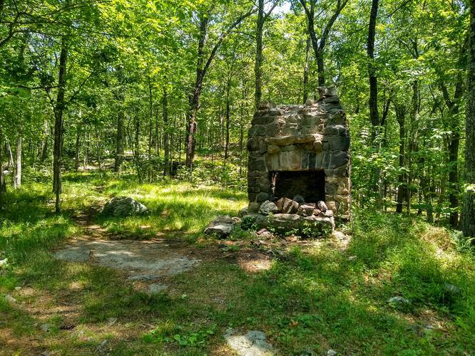
Continuing onward from the Pine Mountain Overlook hikers will reach an old stone chimney, around mile 1.9, that once belonged to a house.
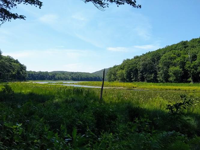
After passing the old stone chimney, the trail will head downhill for approximately 1.5-miles before the trail enters the state park. Here, hikers will head back to parking while following some of the Bennett's Pond State Park trails -- mostly the green and white-blazed trails before the hike leaves the state park once again. Hikers will find a nice view of the Bennett Ponds / Bennett Lake around mile 4.1.
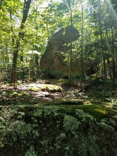
Bouldering Rock
The last noteworthy section of this trail is a massive boulder that lies just outside of the state park boundaries, closer to the parking area on the hike out. This large boulder can be found around mile 5.45 and is a great spot for bouldering.
Difficulty
This loop, for the majority of the hike, should be considered moderate. There are several steep climbs throughout the hike that make this hike difficult, especially for those who do not hike often.
Parking
Hikers will find a small parking turnout at the coordinates provided, located along N Shore Drive next to Lake Windwing.
Pets
Dogs are allowed if leashed and their waste must be carried out by the hiker.
This hike follows several trails through Bennett's Pond State Park and the surrounding public lands just west of the state park, where the hike begins.
This track begins alongside Lake Windwing and heads north while the trail straddles the base of a large hill. The trail will quickly bend to the east as it begins ascending this hill before the trail heads back downhill slightly. Just after the downhill section, around mile 1.3, the trail will head up a very steep mountain side along Pine Mountain.
Pine Mountain Overlook
Around mile 1.7, hikers will reach the top of Pine Mountain, which features a beautiful overlook of the neighboring hills and mountains. The vista can be found just after finishing the ascent up Pine Mountain from the west.
Continuing onward from the Pine Mountain Overlook hikers will reach an old stone chimney, around mile 1.9, that once belonged to a house.
After passing the old stone chimney, the trail will head downhill for approximately 1.5-miles before the trail enters the state park. Here, hikers will head back to parking while following some of the Bennett's Pond State Park trails -- mostly the green and white-blazed trails before the hike leaves the state park once again. Hikers will find a nice view of the Bennett Ponds / Bennett Lake around mile 4.1.
Bouldering Rock
The last noteworthy section of this trail is a massive boulder that lies just outside of the state park boundaries, closer to the parking area on the hike out. This large boulder can be found around mile 5.45 and is a great spot for bouldering.
Difficulty
This loop, for the majority of the hike, should be considered moderate. There are several steep climbs throughout the hike that make this hike difficult, especially for those who do not hike often.
Parking
Hikers will find a small parking turnout at the coordinates provided, located along N Shore Drive next to Lake Windwing.
Pets
Dogs are allowed if leashed and their waste must be carried out by the hiker.