Located just south of Rocky Mountain National Park within the Indian Peaks Wilderness of Colorado sits the Four Lakes Backcountry area where hikers will find several day hikes that lead to stunning views of alpine peaks, subalpine lakes, and even glaciers if you're up for the challenge.
This difficult 10.3-mile out-and-back shuttle hike leads hikers along the Pawnee Pass Trail and Isabelle Glacier Trail to reach Long Lake, the stunning Lake Isabelle, and eventually the Isabelle Glacier.
The trail follows an easy-to-moderate grade as it makes its way along Long Lake before it ascends up to Lake Isabelle. Once you reach the ascent to Lake Isabelle, hikers will find distant views of the large waterfall that pours out from Lake Isabelle before following switchbacks to reach a scenic subalpine wildflower meadow and a small footbridge alongside a small waterfall.
Just beyond the scenic subalpine meadow and waterfall sits a sign for the Pawnee Pass Trail and Isabelle Glacier Trail - here, keep left at the sign to reach the edge of Lake Isabelle by following the Isabelle Glacier Trail.
Just before the trail reaches the side of Isabelle Glacier, hikers will be faced with one last creek crossing. During mid-summer, the creek is relatively low, making the crossing easy with rocks scattered along the way. On the opposite side of the creek, however, sits a rock scramble where hikers will need to climb up ~5 feet of rock to reach the trail - again, not too difficult but be careful.
Near mile 5.2, you'll reach the lower slopes of the Isabelle Glacier where you'll find turquoise water below, ice chunks floating and melting in the glacial lake, along with the large sloping snow and icefield of the glacier to the southwest. Overhead are 1,000-foot tall alpine slopes that were formed over millennia from the Isabelle Glacier slowly carving out the mountains at its stopping point (arete). Stick around a while, listen for rockfall and enjoy the glimmering turquoise glacial water in the sunlight before you head out.
Shuttle hours: Daily 8AM - 5PM as of 2026. If you miss the 5PM shuttle back, you must add ~5 miles to get back to parking for a ~16.3-mile hike.
For hikers who do not have a day entry pass, as of summer 2026, you can hop on the Brainard Lake shuttle at the parking coordinates provided: 40.080074, -105.533983. The total fee for the shuttle is $5 for a round trip - remember to keep your receipt for your ride back.
Due to the shuttle service, this route begins near Brainard Lake at the shuttle drop-off.
Day-pass Parking Reservations: For hikers that have a day pass to park directly at the trailhead, the length of the hike is shortened from 10.3 miles out-and-back to just ~8.3 miles out-and-back. You can grab a day-pass for parking at the recreation.gov website for the Long Lake Trailhead - Day Use pass.
Altitude sickness: Some hikers may have issues with altitude sickness, which usually makes physical appearances in the form of headaches, muscle aches, and more above 7,500 feet. Please note that this hike leads up to ~12,000-feet in altitude. While not all hikers can succumb to altitude sickness, be on the lookout for signs. If you begin experiencing issues due to the altitude, turning back to lower elevation will eventually cure the symptoms.
Light scrambling: This route passes through areas of light rock scrambling, mostly located on the last push uphill to reach the Isabelle Glacier. 99% of the hikers to Lake Isabelle will skip hiking to the Isabelle Glacier, so please note that there are no rock scrambles to reach Lake Isabelle!
Rockfall: On the last push to reach Isabelle Glacier, if you choose to visit the glacier, you'll find very steep terrain that passes through boulder fields where rockfall can be present especially if there are hikers above you on the steep trail. Due to this, if you have a rock climbing helmet, it might be smart to bring it (like I did). While standing at the Isabelle Glacier, you can listen to random instances of rockfall along the sides and slopes of the 1,000-foot tall glacial cirque!
Creek crossings: West of Lake Isabelle are several creek crossings that provide no footbridges but rather require hikers to get their feet wet or rock hop. None of the creek crossings are difficult, but they might pose larger challenges in the Spring or early Summer when the snow melt levels make the South Saint Vrain Creek deeper.
Trail finding: West of Lake Isabelle is where the Isabelle Glacier Trail becomes more wild and a bit harder to find, especially within the wetland area of South Saint Vrain Creek. Here, the trail can be hard to spot as it winds through the low-growing brush.
This difficult 10.3-mile out-and-back shuttle hike leads hikers along the Pawnee Pass Trail and Isabelle Glacier Trail to reach Long Lake, the stunning Lake Isabelle, and eventually the Isabelle Glacier.
Hiking to Lake Isabelle
Important Note: This route begins at Brainard Lake and uses a brand new pilot shuttle service provided by the national forest (as of summer 2026).Brainard Lake to Long Lake Trailhead - Mile 0 to 0.9
This hike begins at the shuttle drop-off area next to Brainard Lake where hikers will follow Brainard Lake Road alongside Brainard Lake with views of the water and alpine peaks you'll be hiking up to - including Navajo Peak, the Navajo snowfield, and Isabelle Glacier. Follow Brainard Lake Road to reach Long Lake Road as it slowly ascends to reach the Long Lake Trailhead.Pawnee Pass Trail to Lake Isabelle - Mile 0.9 to 3
Once you reach the Long Lake Trailhead, the real hiking begins as you head into the Indian Peaks Wilderness boundary. The first lake you'll pass on the hike in is Long Lake which provides several views of the lake and surrounding alpine peaks if you walk down to the water's edge, located just beyond the Indian Peaks Wilderness boundary sign. Long Lake is scenic, but not as scenic as Lake Isabelle so hikers can get nice views of the water right from the trail - no real need to hike down to the water's edge if you want to keep trekking.The trail follows an easy-to-moderate grade as it makes its way along Long Lake before it ascends up to Lake Isabelle. Once you reach the ascent to Lake Isabelle, hikers will find distant views of the large waterfall that pours out from Lake Isabelle before following switchbacks to reach a scenic subalpine wildflower meadow and a small footbridge alongside a small waterfall.
Just beyond the scenic subalpine meadow and waterfall sits a sign for the Pawnee Pass Trail and Isabelle Glacier Trail - here, keep left at the sign to reach the edge of Lake Isabelle by following the Isabelle Glacier Trail.
Lake Isabelle and Alpine Views - Mile 3.1
Just beyond the trail junction for the Isabelle Glacier Trail sit stunning views of Lake Isabelle and the alpine peaks of the Indian Peaks Wilderness along with views of the Isabelle Glacier and Navajo snowfield that sit below Navajo Peak. Here, hikers will find ample opportunities for backcountry swimming in the glacier-chilled water of Lake Isabelle along with sweeping vistas of the rocky mountains. Enjoy your time, have a snack, and soak up the breathtaking alpine views from the shoreline of Lake Isabelle before continuing.Hiking to Isabelle Glacier
If you choose to hike up to Isabelle Glacier, the hike to reach it is not easy. Most hikers that reach Lake Isabelle skip Isabelle Glacier. During my hike in late July, I saw about 6 other hikers commit to hiking toward Isabelle Glacier and only 50% of those hikers even reached the glacier that day, so if you're looking for solitude and seclusion, the hike to Isabelle Glacier should be on your radar!Lake Isabelle to Upper Lake Isabelle Falls - Mile 3.1 to 3.9
After you spend plenty of time enjoying the alpine vistas from the eastern side of Lake Isabelle, the hike to reach the Isabelle Glacier includes several stops and ecosystem changes along the way. The Isabelle Glacier Trail runs along the north side of Lake Isabelle for just under 1 mile to reach the subalpine wetlands and meadows on the west side of the lake. Hikers will pass a couple of boulder fields where the trail meanders through before it heads uphill to reach a couple of short waterfalls within South Saint Vrain Creek, located near mile 3.9. At the base of each waterfall, you'll find wildflowers and eastward views of Lake Isabelle.Wetlands Traverse & Creek Crossing - Mile 3.9 to 4.5
Once you pass the Upper Lake Isabelle waterfalls, the trail begins to head deeper into the subalpine meadows and wetlands where hikers will be faced with several creek crossings. During mid-summer, the creek crossings are generally low water with some rock hopping and precarious footing to cross, but during Spring these crossings are likely much harder. The trail crosses South Saint Vrain Creek several times before traversing across hidden boulder fields with the creek flowing below - simply watch your step as you could puncture the soil through boulders, which could lead to a twisted ankle or fall. The trail also disappears slightly, so be on the lookout for the trail as it cuts through low-growing brush. Once you reach the south side of South Saint Vrain Creek, the trail picks back up again and is easy to follow.South Saint Vrain Creek Alpine Pond - Mile 4.7
After you climb the nearby hill from the south side of South Saint Vrain Creek, the trail spits you out at a small alpine pond which gets fed by the snow and ice melt from the Isabelle Glacier. This turquoise-tinted pond is the last stop before the hike to Isabelle Glacier becomes extremely difficult. Some of the traversing along this alpine pond can be annoying as you'll hop from rock to rock as well.Ascent to Isabelle Glacier - Mile 4.7 to 5.2
Once you leave the alpine pond, the climb to reach the Isabelle Glacier is not easy and should not be taken lightly. Hikers will first find a scenic 30-foot tall waterfall that plunges over the side of a cliff, located on-trail. During mid-summer this waterfall may be more of a trickle, depending on that winter's snowfall levels. After the waterfall, the trail follows many switchbacks and some light boulder scrambling to reach the glacier. Be on the lookout for rock cairns, take plenty of breaks along the way up, and keep your ears open for the squeaks of Pika hiding in the rocks! You may even hear random instances of rockfall from the steep alpine slopes and nearby glacial cirque.Just before the trail reaches the side of Isabelle Glacier, hikers will be faced with one last creek crossing. During mid-summer, the creek is relatively low, making the crossing easy with rocks scattered along the way. On the opposite side of the creek, however, sits a rock scramble where hikers will need to climb up ~5 feet of rock to reach the trail - again, not too difficult but be careful.
Near mile 5.2, you'll reach the lower slopes of the Isabelle Glacier where you'll find turquoise water below, ice chunks floating and melting in the glacial lake, along with the large sloping snow and icefield of the glacier to the southwest. Overhead are 1,000-foot tall alpine slopes that were formed over millennia from the Isabelle Glacier slowly carving out the mountains at its stopping point (arete). Stick around a while, listen for rockfall and enjoy the glimmering turquoise glacial water in the sunlight before you head out.
Hiking Out - Mile 5.2 to 10.3
After visiting the Isabelle Glacier and enjoying the scenery, the hike out is identical but opposite to the hike in and thankfully, is significantly easier as it's all downhill back to the trailhead. If you're completing this hike as a shuttle hike, then the hike out will lead to mile 10.3 to reach the shuttle pickup area just east of Brainard Lake. If you got lucky enough to secure a day pass for the Long Lake Trailhead, then the hike ends after ~8.3 miles instead.Pets
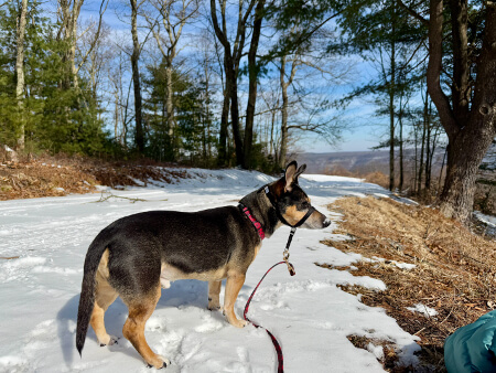
Dogs are allowed only if leashed and should be cleaned up after.Parking, Shuttle Hiking, Reservations and Fees
Shuttle hiking: The route description provided is meant for hikers that are using the brand new (as of 2026) pilot shuttle service provided by the national forest where parking is found in the overflow lot outside of the Brainard Lake Recreation Area gate entrance! Due to the nature of the pilot program, this shuttle service may not be available in the future.Shuttle hours: Daily 8AM - 5PM as of 2026. If you miss the 5PM shuttle back, you must add ~5 miles to get back to parking for a ~16.3-mile hike.
For hikers who do not have a day entry pass, as of summer 2026, you can hop on the Brainard Lake shuttle at the parking coordinates provided: 40.080074, -105.533983. The total fee for the shuttle is $5 for a round trip - remember to keep your receipt for your ride back.
Due to the shuttle service, this route begins near Brainard Lake at the shuttle drop-off.
Day-pass Parking Reservations: For hikers that have a day pass to park directly at the trailhead, the length of the hike is shortened from 10.3 miles out-and-back to just ~8.3 miles out-and-back. You can grab a day-pass for parking at the recreation.gov website for the Long Lake Trailhead - Day Use pass.
Restrooms
Hikers will find restrooms near the shuttle drop-off location near the Brainard Lake Recreation Area Campground. Pit toilets are available at the overflow parking area at the parking coordinates provided. Hikers will also find pit toilets at the Long Lake Trailhead.Restrictions (Camping/Backpacking)
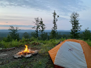
Please note that the Indian Peaks Wilderness has more restrictions than other backcountry wilderness areas in Colorado including, but not limited to restrictions for backpacking and camping. Backpacking and camping, between May 1 and November 30 is only allowed with backcountry permits and camping is not allowed within the Four Lakes Backcountry (i.e. Long Lake, Lake Isabelle, Mitchell Lake, Blue Lake, etc.). Please see this image for all restrictions as of July 2026.Warning
Wildlife: This hike passes through subalpine meadows and subalpine lakes that are visited by wild moose on a regular basis. Due to the nature of moose, they can be unpredictable, especially during rut season (autumn). Always give wild animals plenty of space. You may also find other wild animals on the trail like marmots and pika. Note that the rocky mountains of Colorado are also home to the mountain lion and brown bear, so be aware and make your presence known.Altitude sickness: Some hikers may have issues with altitude sickness, which usually makes physical appearances in the form of headaches, muscle aches, and more above 7,500 feet. Please note that this hike leads up to ~12,000-feet in altitude. While not all hikers can succumb to altitude sickness, be on the lookout for signs. If you begin experiencing issues due to the altitude, turning back to lower elevation will eventually cure the symptoms.
Light scrambling: This route passes through areas of light rock scrambling, mostly located on the last push uphill to reach the Isabelle Glacier. 99% of the hikers to Lake Isabelle will skip hiking to the Isabelle Glacier, so please note that there are no rock scrambles to reach Lake Isabelle!
Rockfall: On the last push to reach Isabelle Glacier, if you choose to visit the glacier, you'll find very steep terrain that passes through boulder fields where rockfall can be present especially if there are hikers above you on the steep trail. Due to this, if you have a rock climbing helmet, it might be smart to bring it (like I did). While standing at the Isabelle Glacier, you can listen to random instances of rockfall along the sides and slopes of the 1,000-foot tall glacial cirque!
Creek crossings: West of Lake Isabelle are several creek crossings that provide no footbridges but rather require hikers to get their feet wet or rock hop. None of the creek crossings are difficult, but they might pose larger challenges in the Spring or early Summer when the snow melt levels make the South Saint Vrain Creek deeper.
Trail finding: West of Lake Isabelle is where the Isabelle Glacier Trail becomes more wild and a bit harder to find, especially within the wetland area of South Saint Vrain Creek. Here, the trail can be hard to spot as it winds through the low-growing brush.