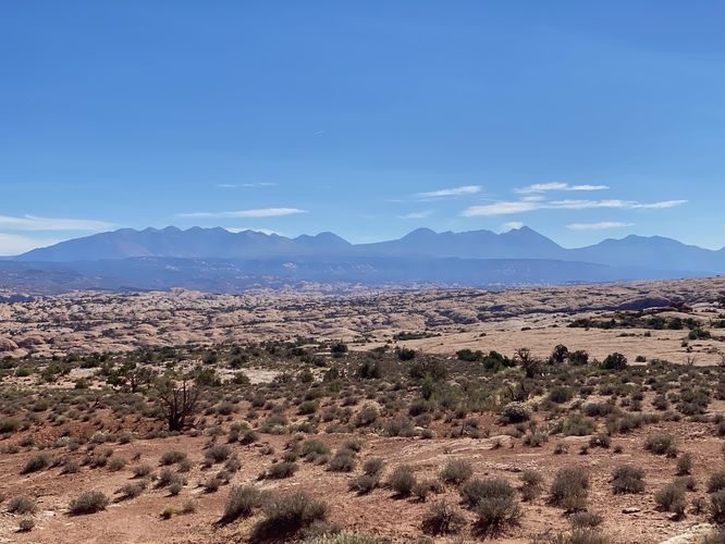
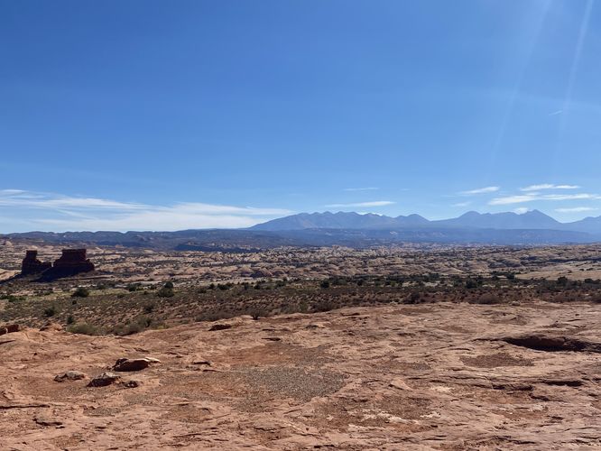
The La Sal Mountains Viewpoint at Arches National Park near Moab, Utah is an easy 0.1-mile out-and-back walk that features views of the distant La Sal Mountains in addition to Arches' massive rock formations.
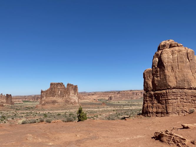
Visitors can follow the paved parking lot path as it curves its way around the lot, providing different views around Arches' landscape, including the La Sal Mountains to the southeast and the Tower of Babel to the north.
Universal Access
This viewpoint is considered universally-accessible since visitors can enjoy the same view from the parking lot's accessible sidewalk.
How to Get Into Arches National Park
Note that Arches National Park, as of September 2023 (and earlier) only allows vehicles to enter the park during scheduled time slots. You can read all about Arches' timed entry here and you can find reservation information here. Reservations are grabbed quickly, so be sure to log onto the reservation website when the date opens up to grab your timed entry ticket. Note that vehicles can enter the park outside of the timed entry slots (i.e. before 7AM or after 4PM each day, as of September 2023). If you do not have a timed entry ticket between 7AM and 4PM, do not wait in line to enter the park as you will be turned away and will slow everyone else down. The vehicle line to enter the park is very long and wait-times to enter can be a pain so show up prepared.
Parking
Hikers will find a large parking lot at the coordinates provided along Main Park Road in Arches National Park.
Pets
Dogs are not allowed on any trails or overlooks at Arches National Park. Please do not bring your dog here.
Fees
As of September 2023, there's a $30 fee per vehicle to enter Arches National Park.
Warnings
Sun exposure: This trail has very little shade and no water sources. Pack-in all water and wear sun screen and a hat to protect against sun exposure. It's smart to hike either in the early morning or late afternoon to avoid the intense desert sun.
No water: This trail has no water sources so you must pack-in all water. A general rule of thumb in the desert is 1 gallon of water per person per day.
Rattlesnakes: This is rattlesnake territory, so be on the lookout and give any rattlers you find plenty of space.